 SHOP
SHOP
 |
REPUBLIC OF THE PHILIPPINES
NATIONAL MAPPING AND RESOURCE INFORMATION AUTHORITY
Department of Environment and Natural Resources
|
 |
|
Order our printed maps and charts, and publications online that are available at our Map Sales Office.
|
|
Buy our products from one of our Map Sales Offices located throughout the country.
|
|
Access our maps in different scales, publications and other resources for FREE.
|
|
Know more about our agency, access our Transparency Seal and Citizen's Charter.
|
| You are here > Home > Resources |
| Hazards | 01 | 02 | 03 | 04 | 05 | 06 | 07 | 08 | 09 | 10 |
01. Abra |
 |
 |
 |
 |
 |
 |
||||
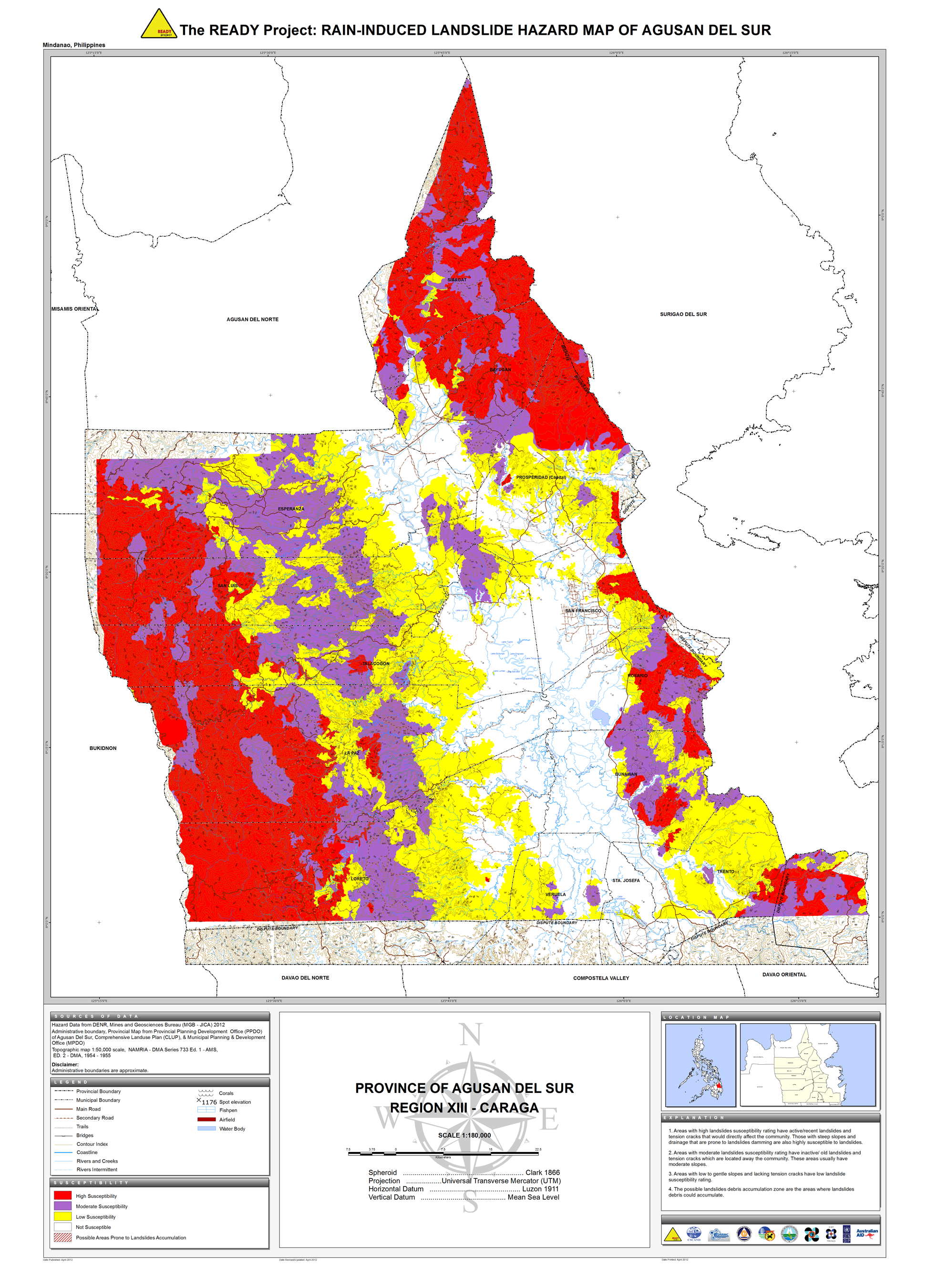
02. Agusan del Sur |
 |
 |
 |
|||||||
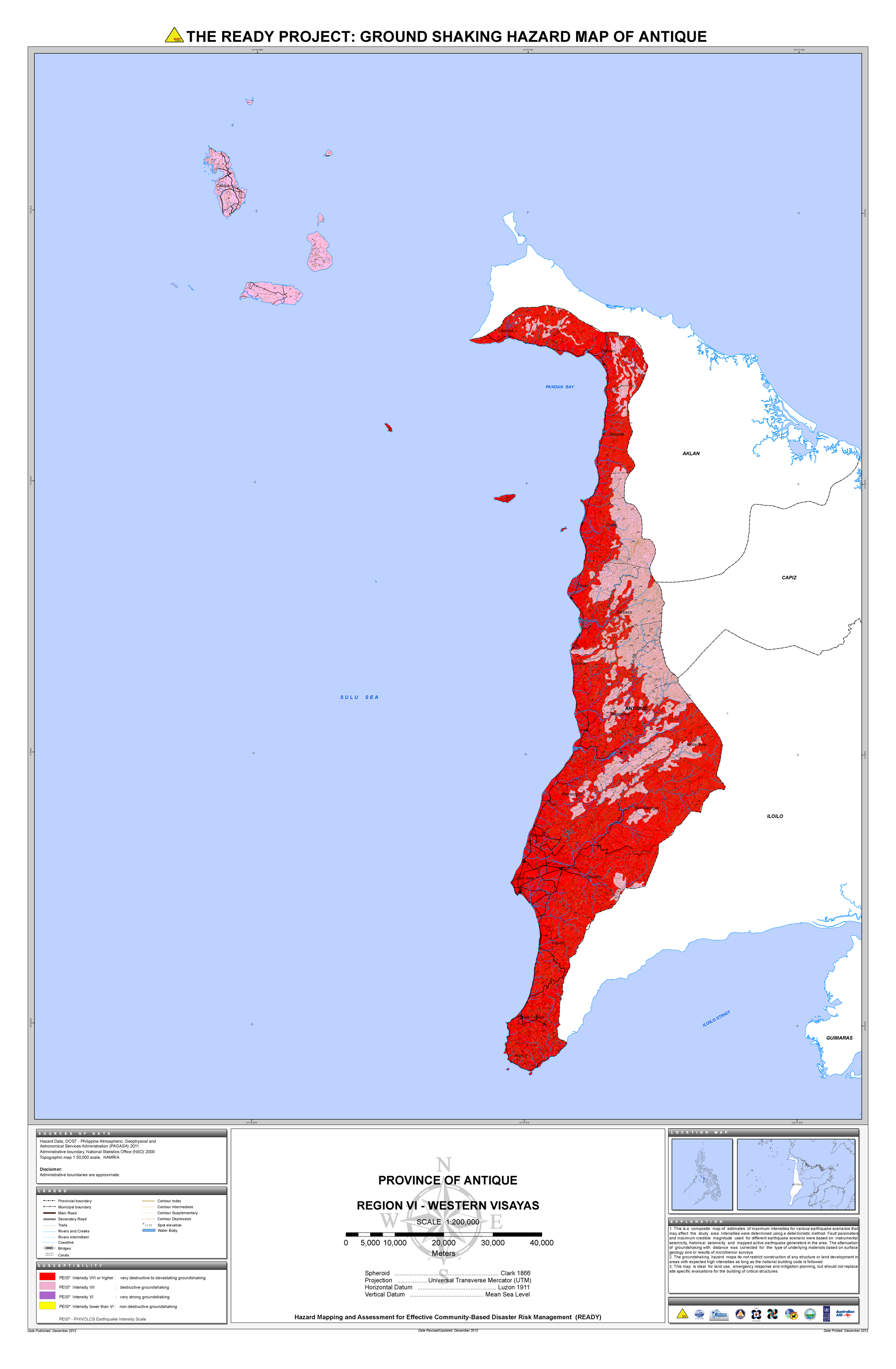
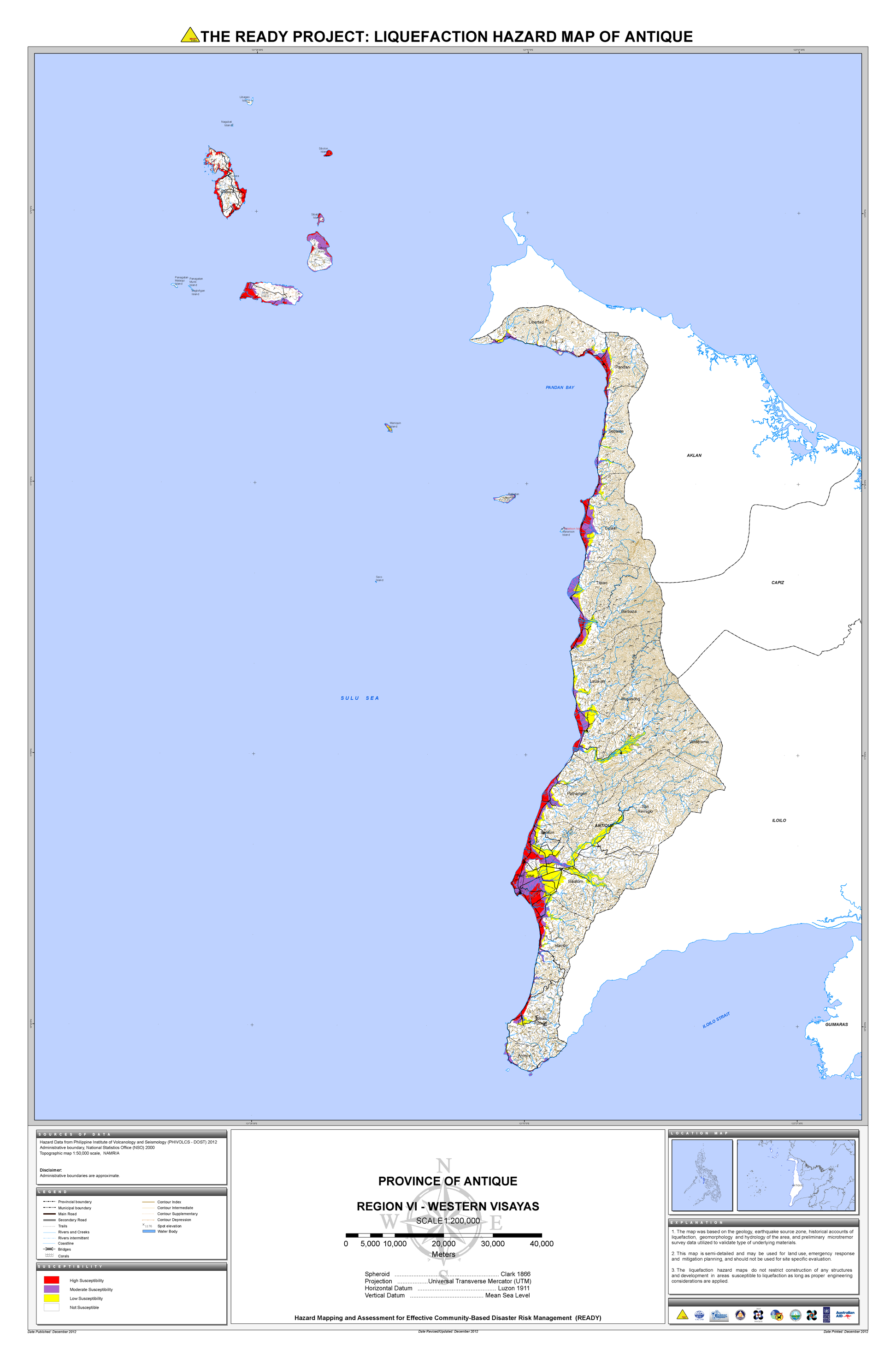
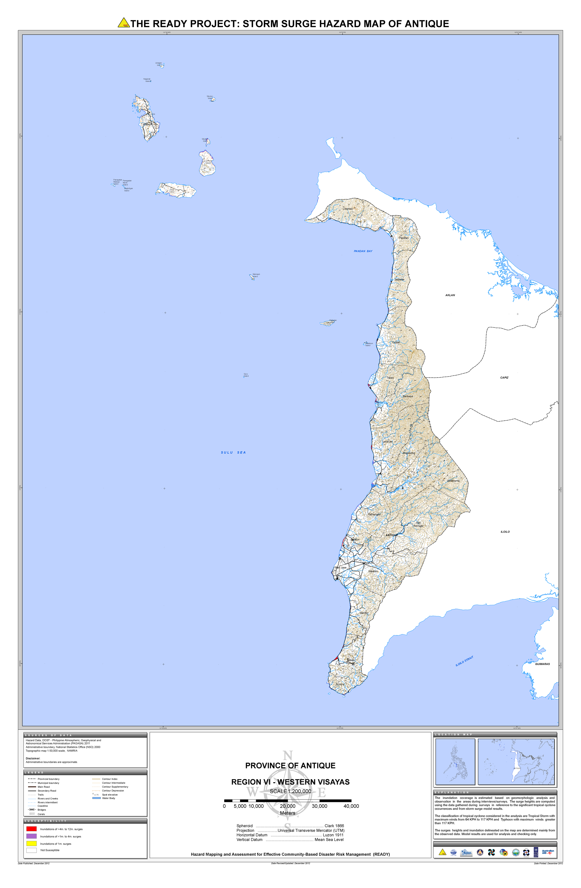
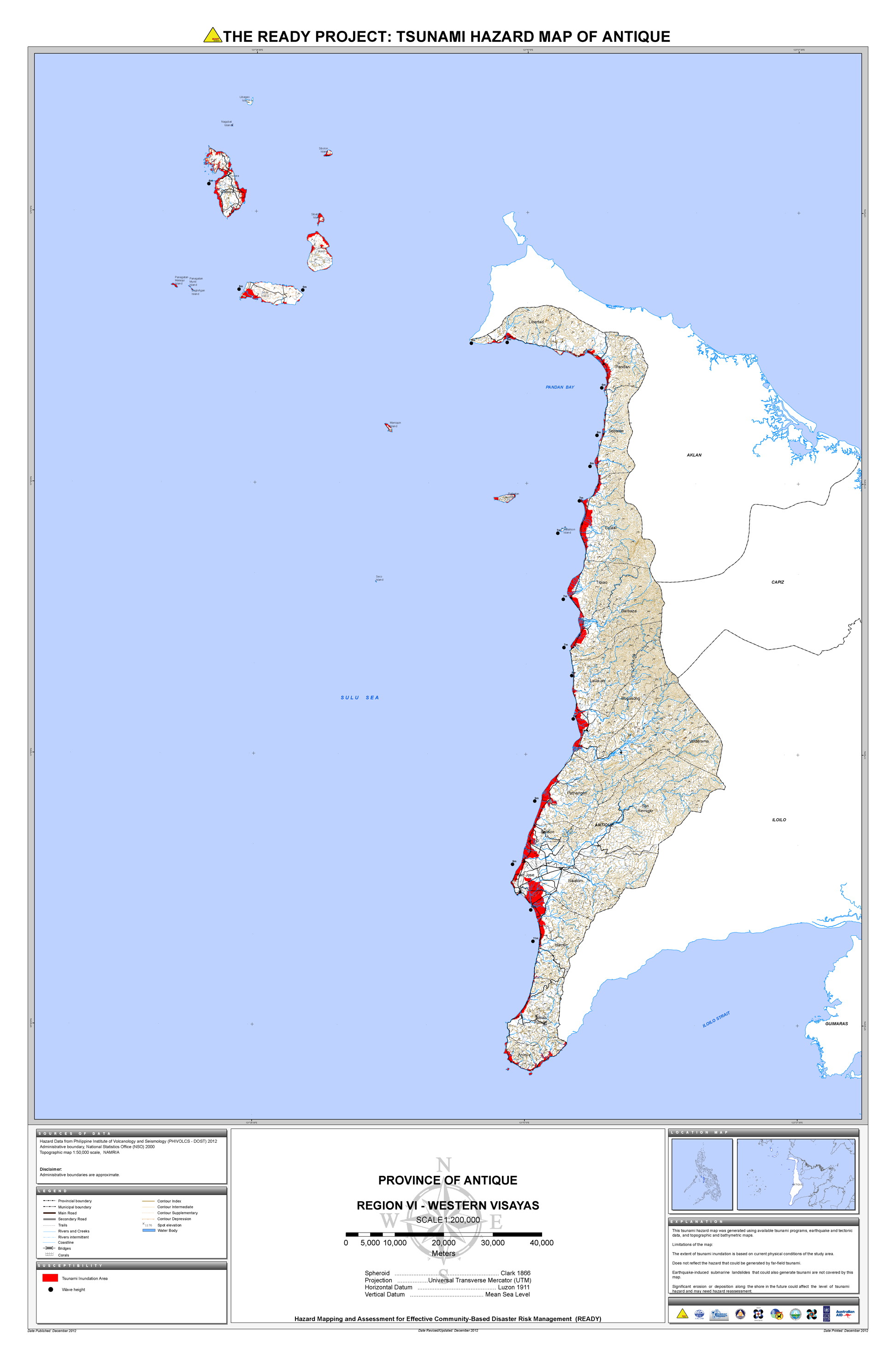
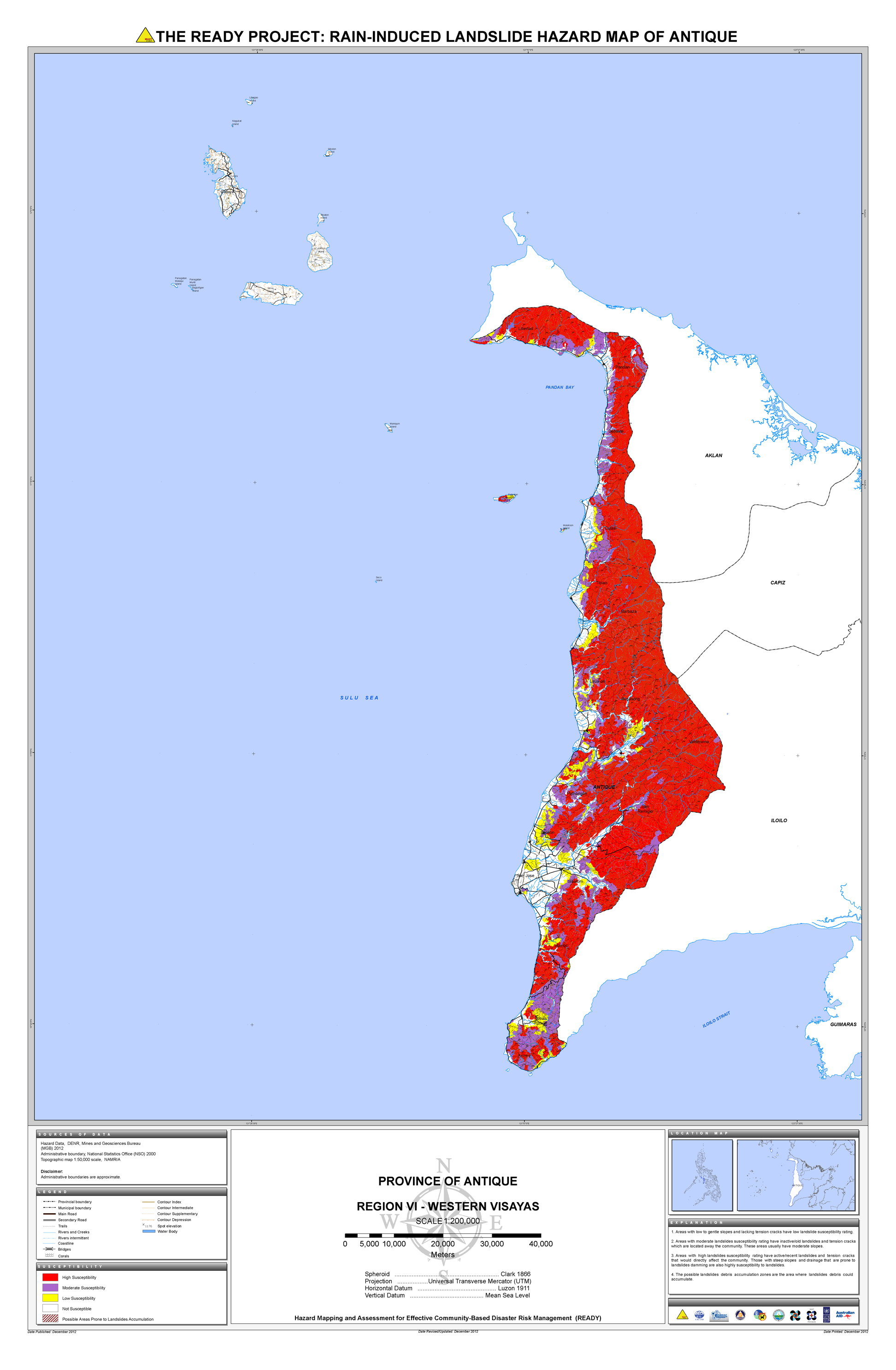
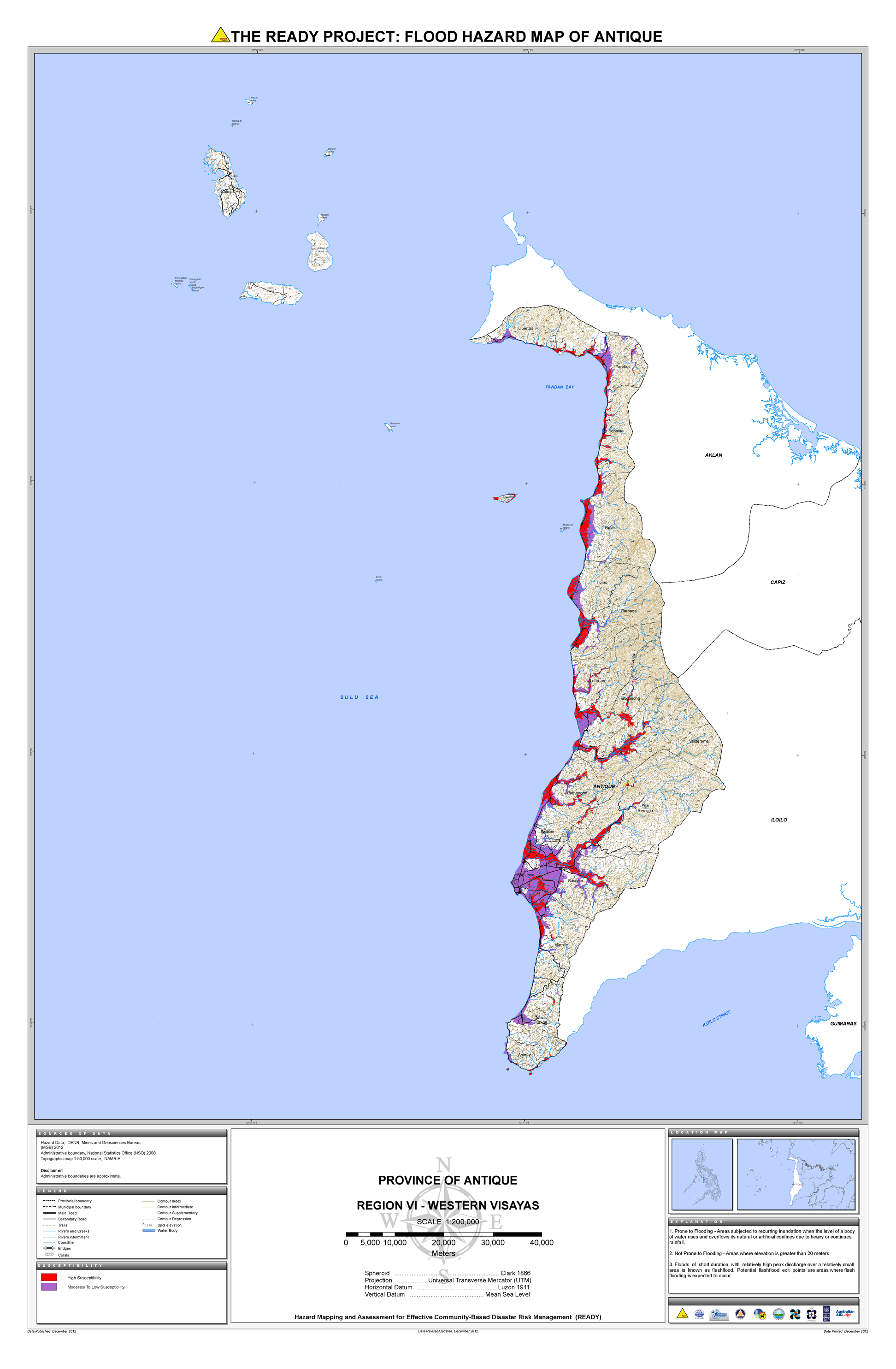
03. Antique |
 |
 |
 |
 |
 |
 |
 |
* |
||
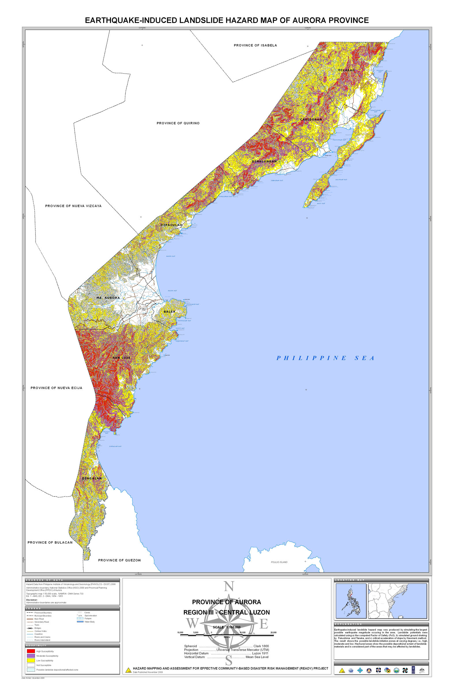
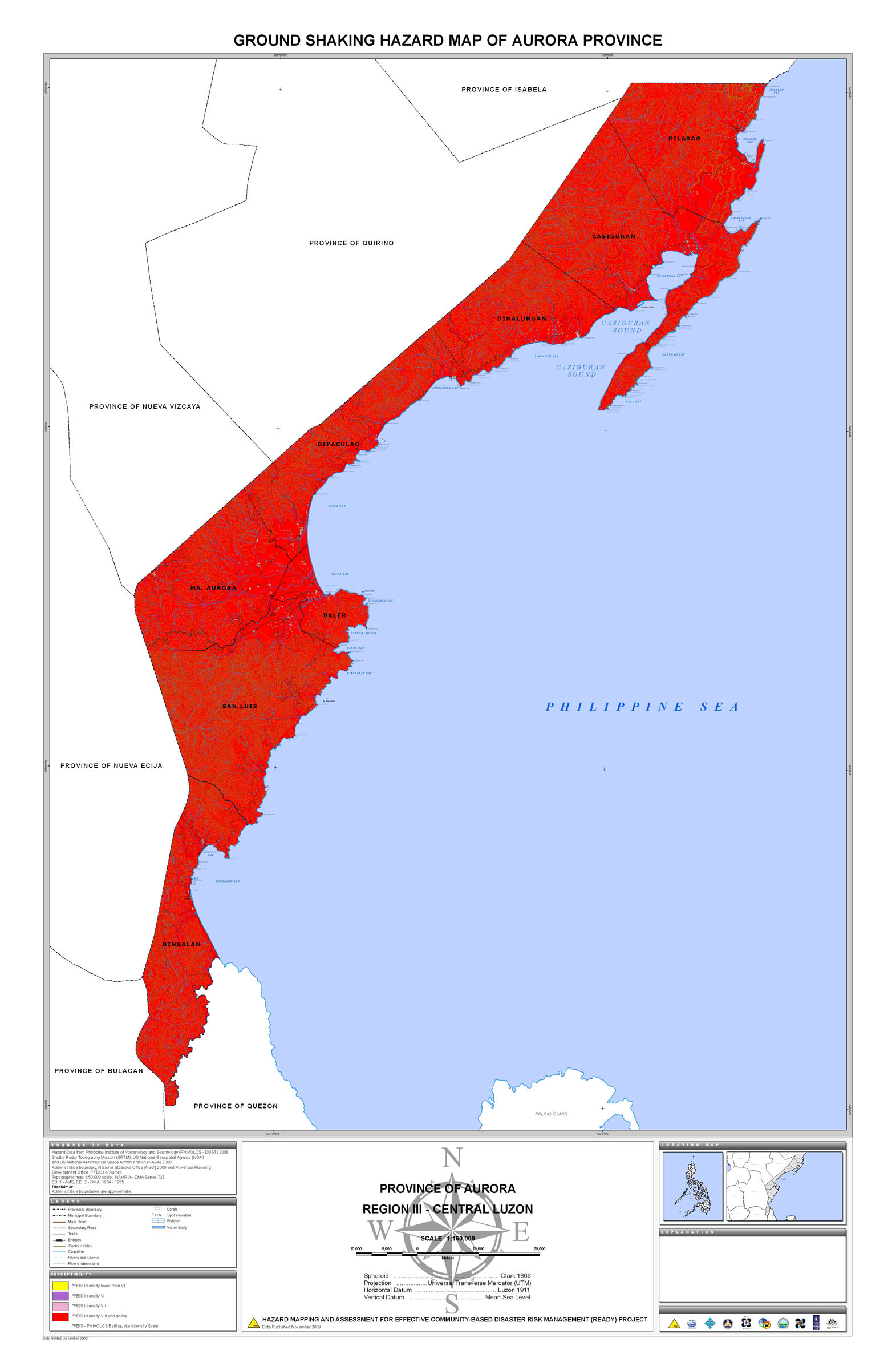
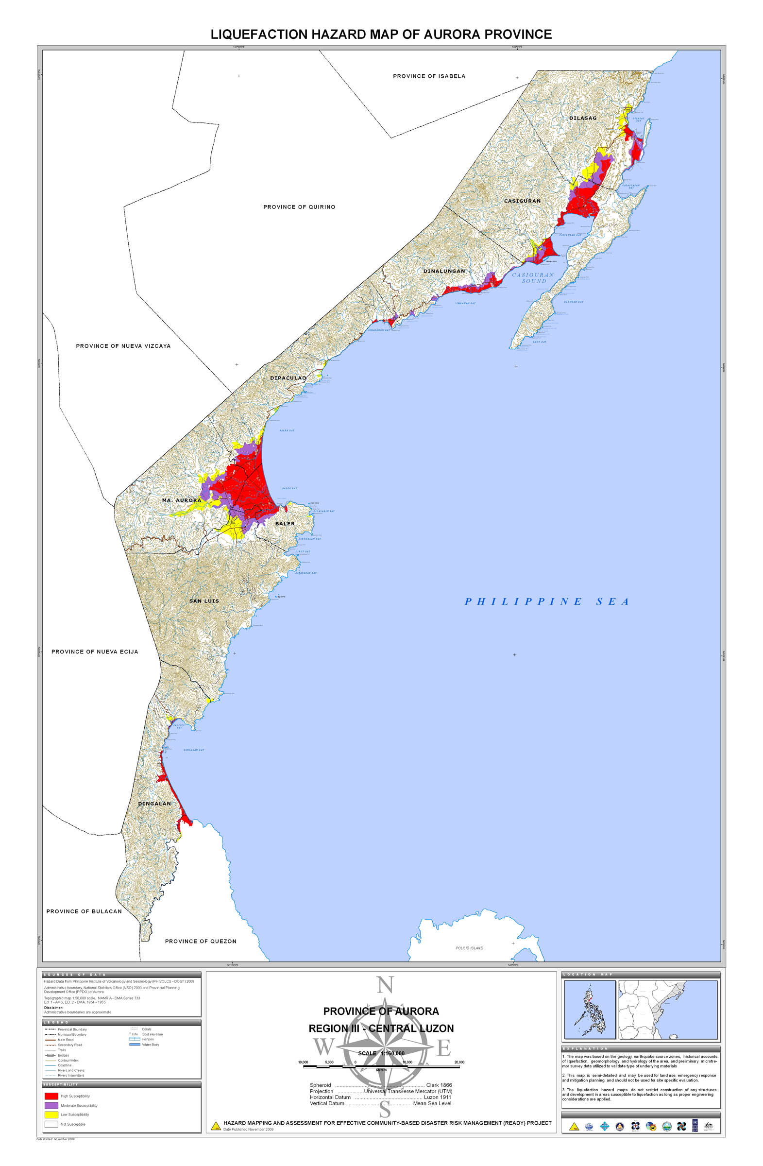
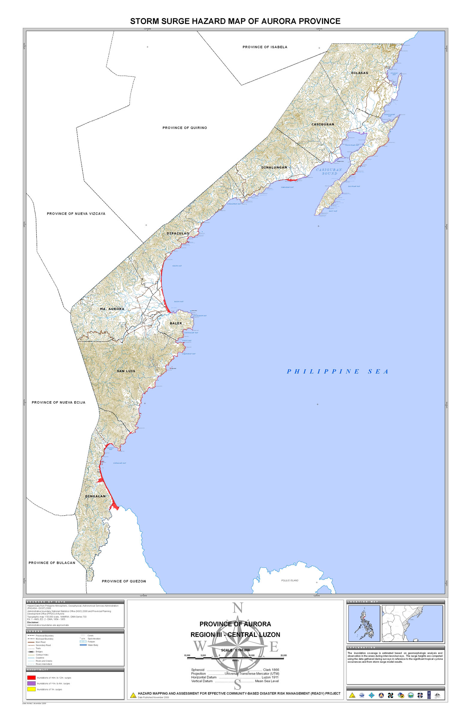
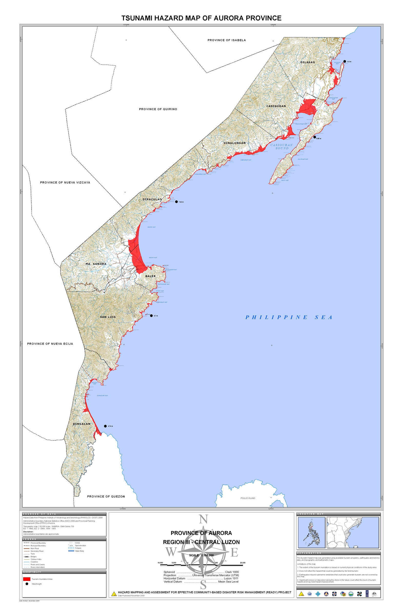
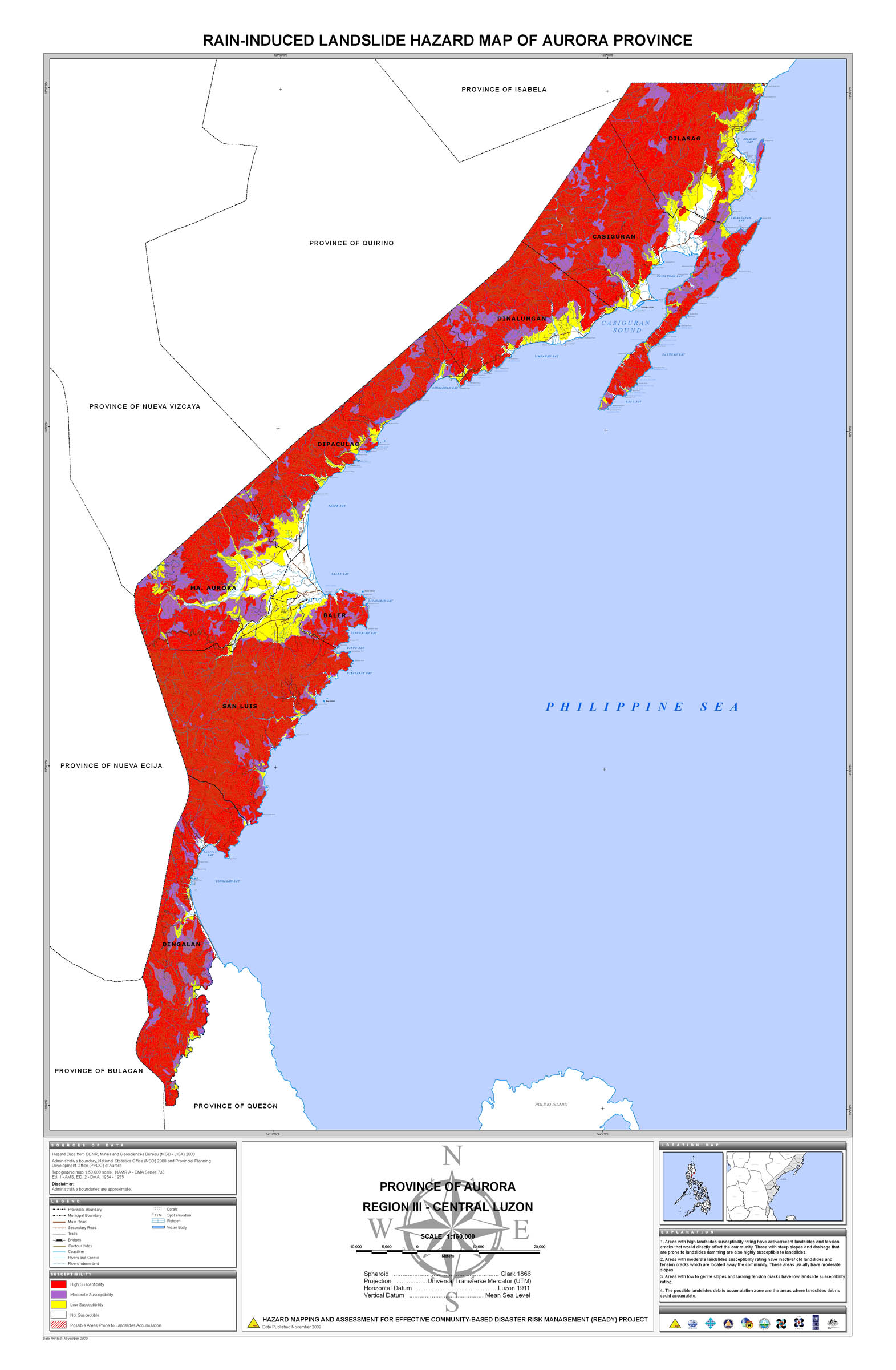
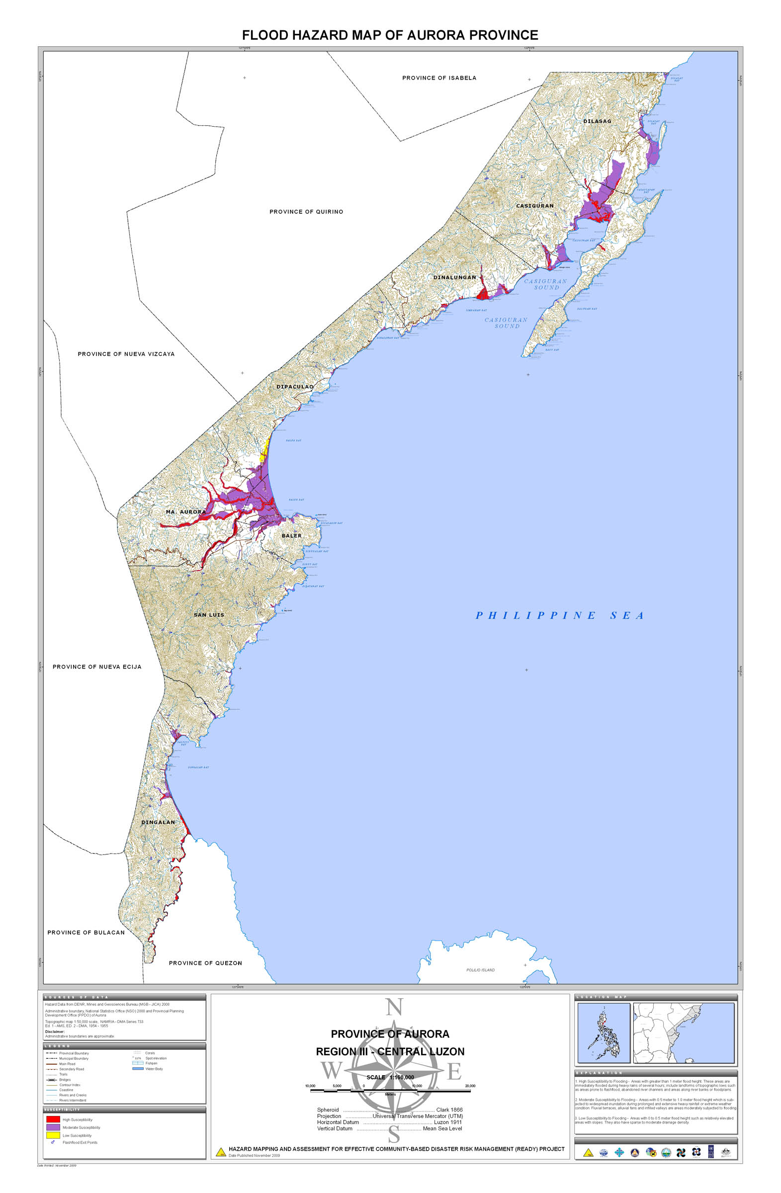
04. Aurora |
 |
 |
 |
 |
 |
 |
 |
 |
||
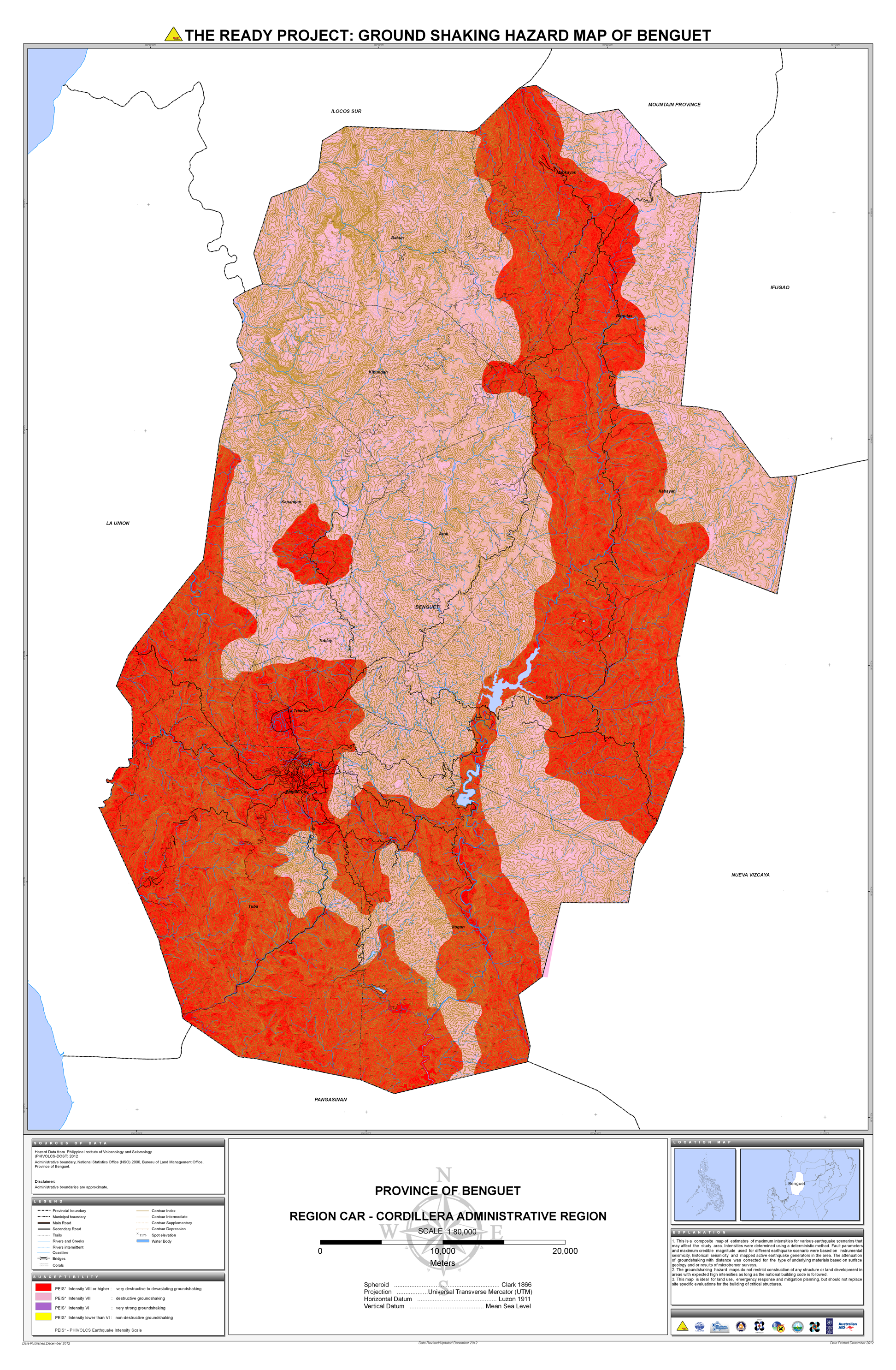
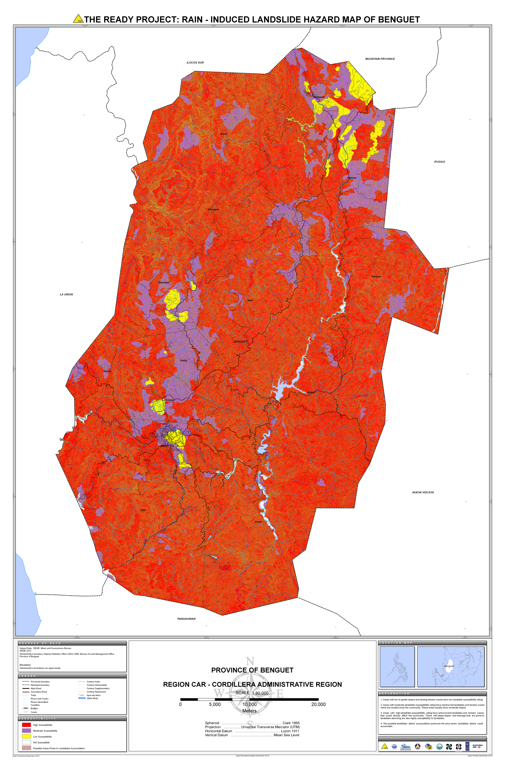
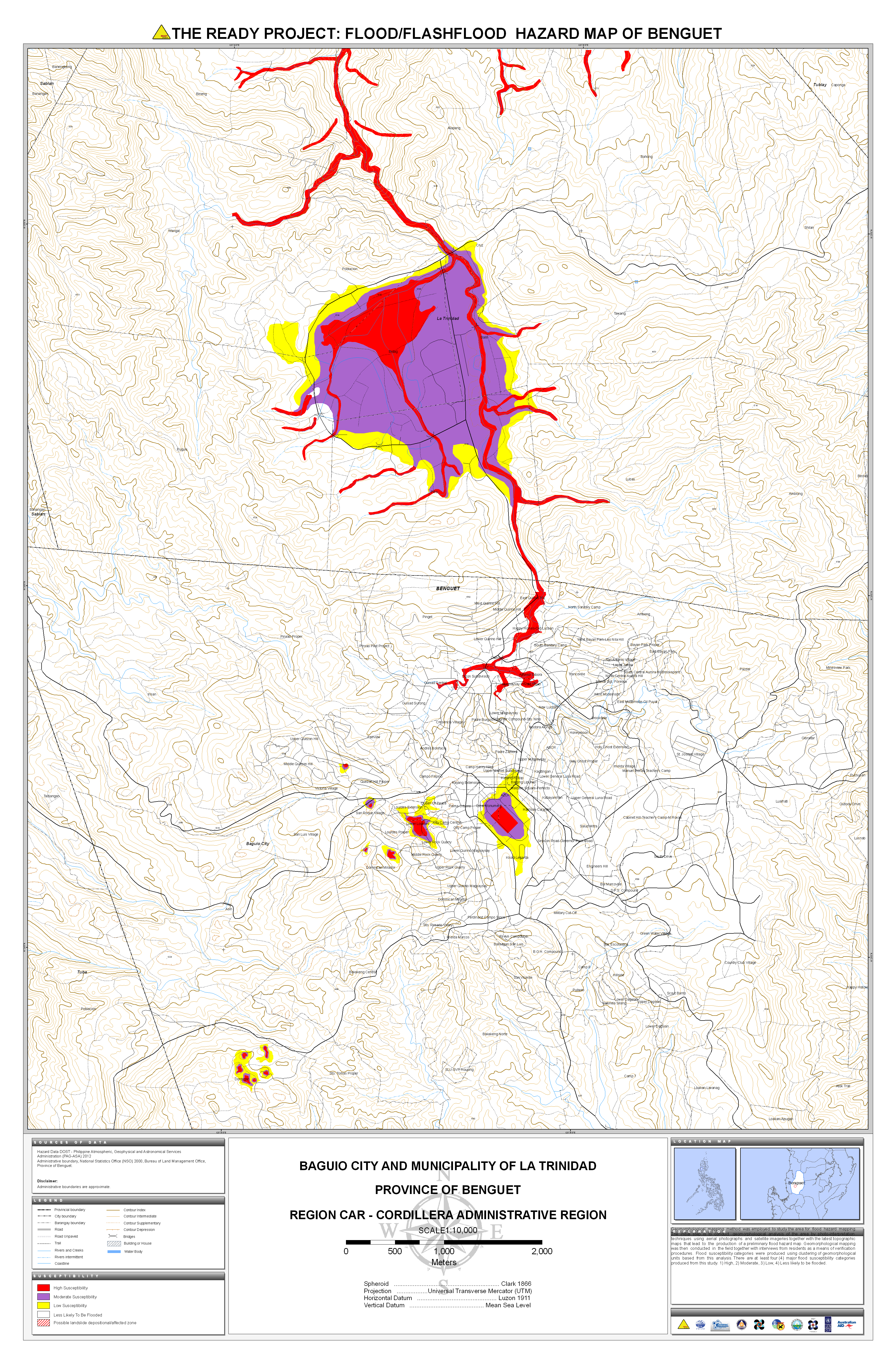
05. Benguet |
 |
 |
 |
 |
 |
 |
 |
|||
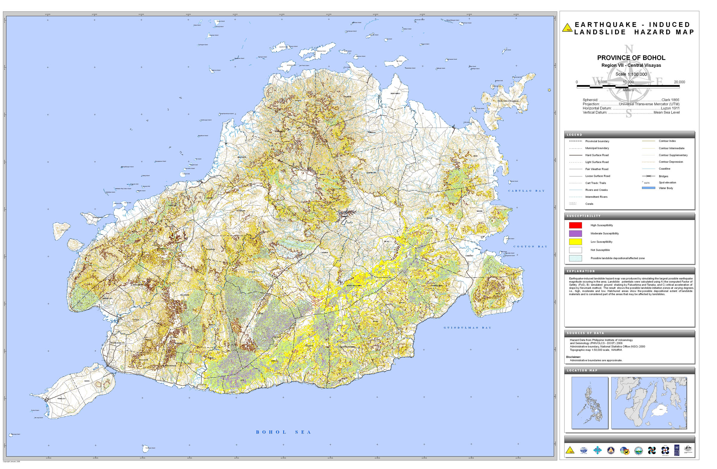
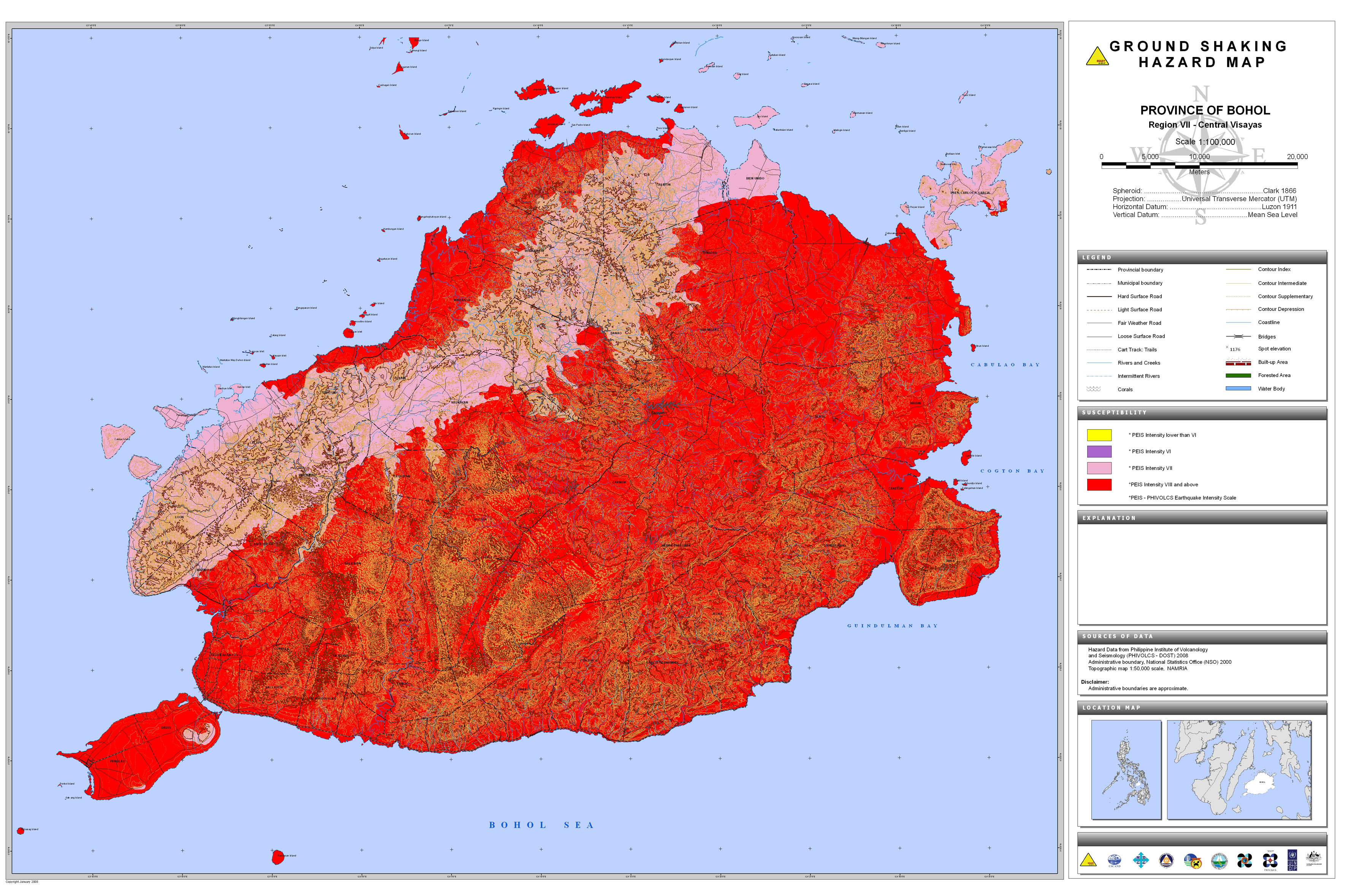
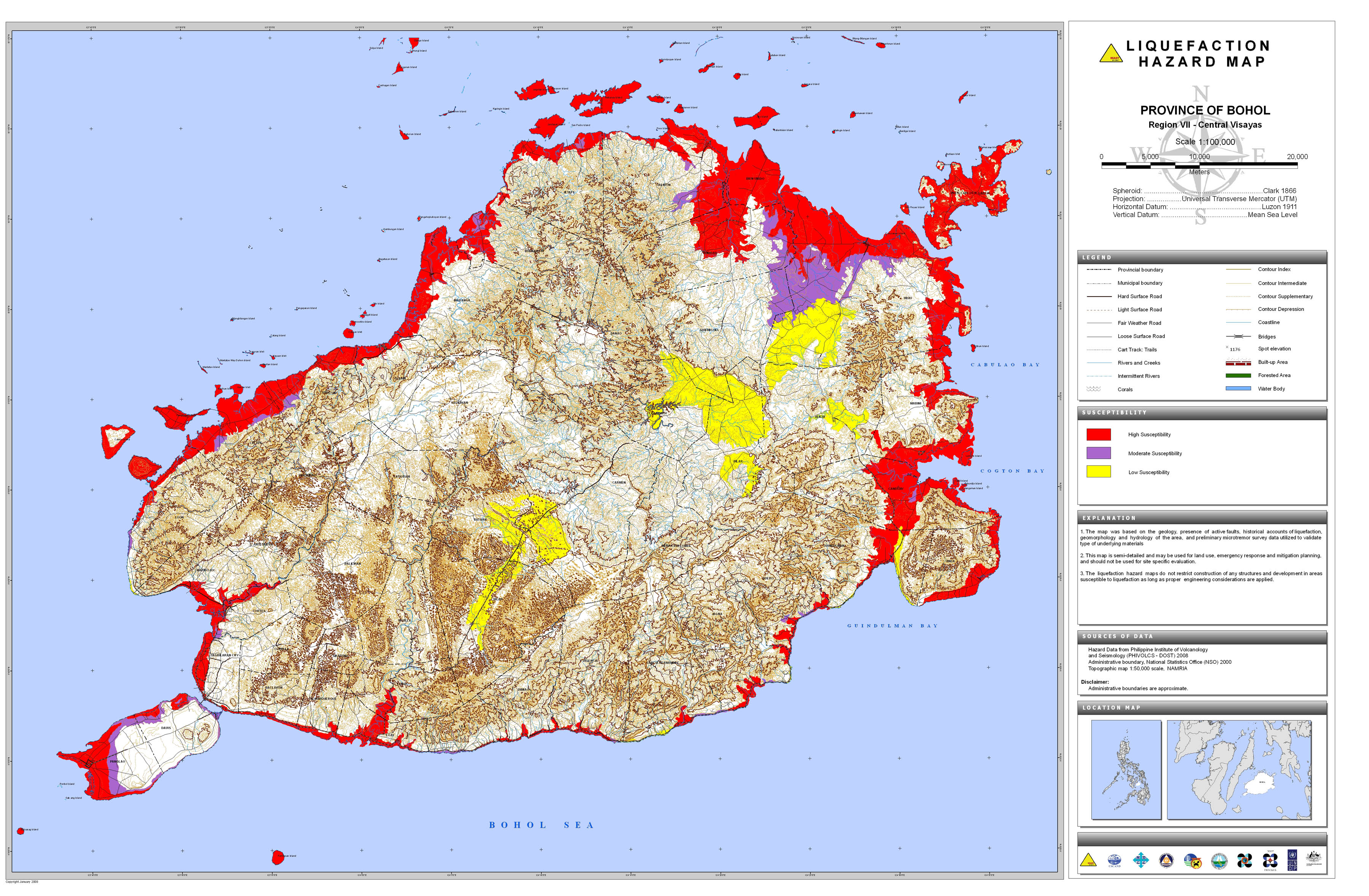
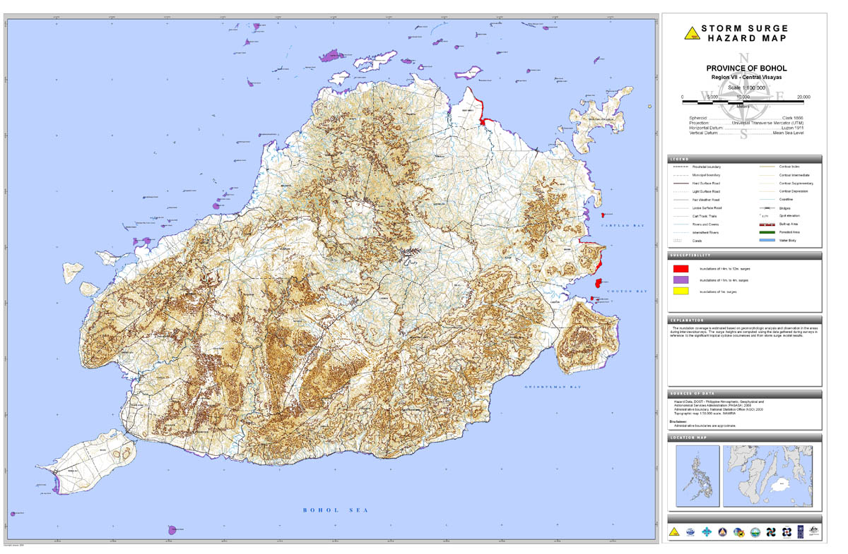
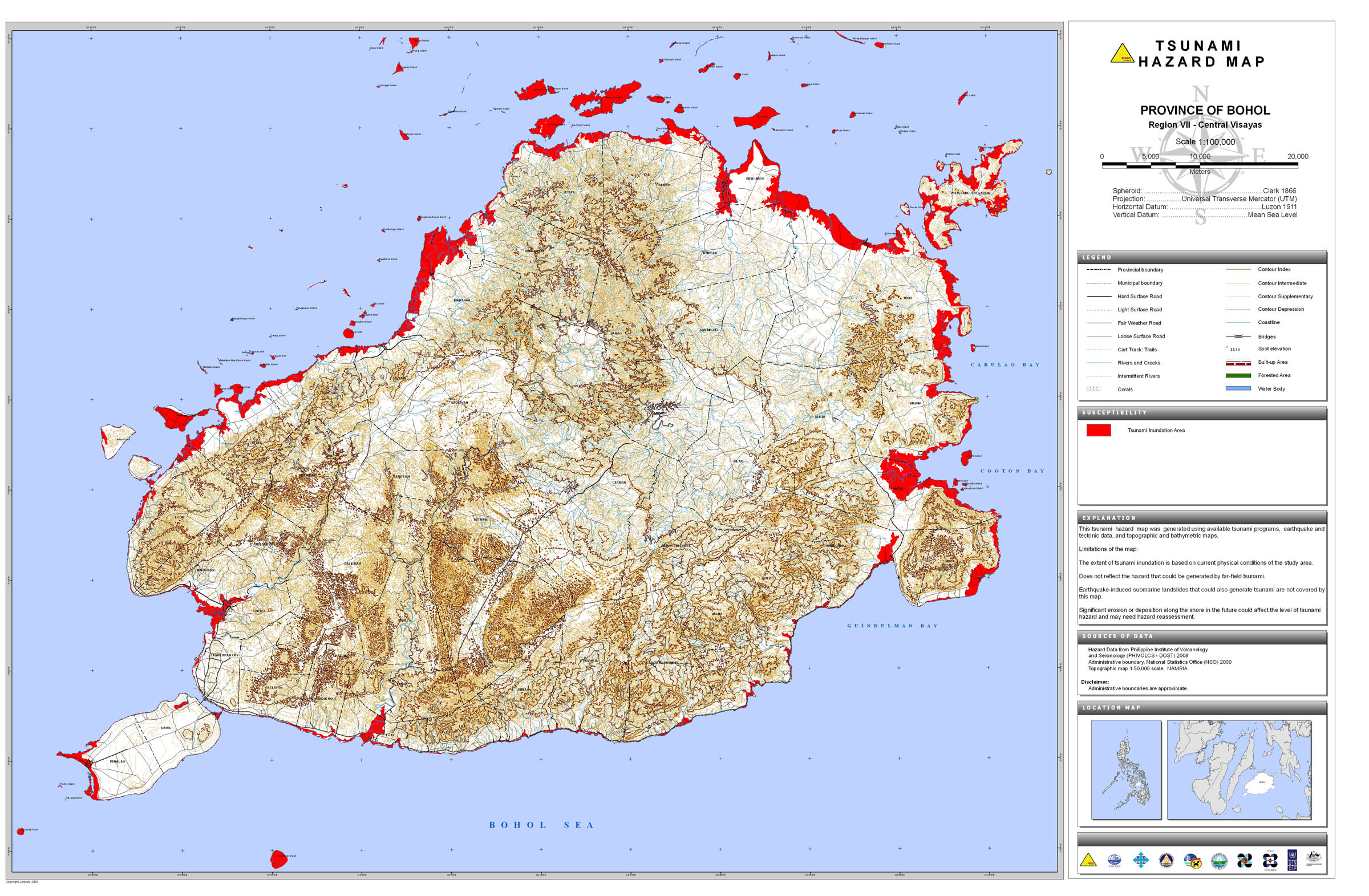
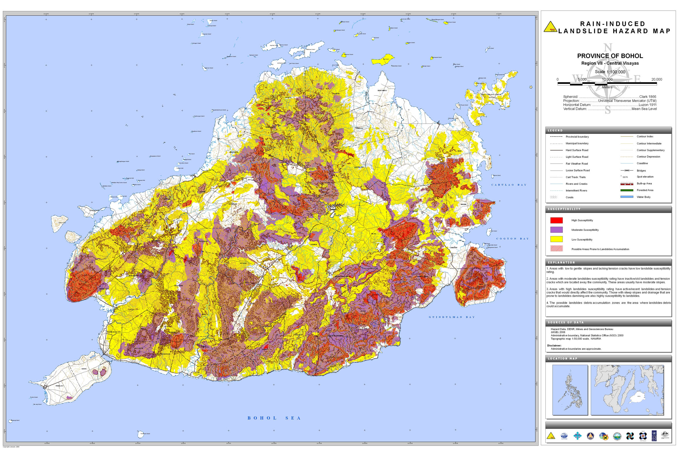
06. Bohol |
 |
 |
 |
 |
 |
 |
 |
|||
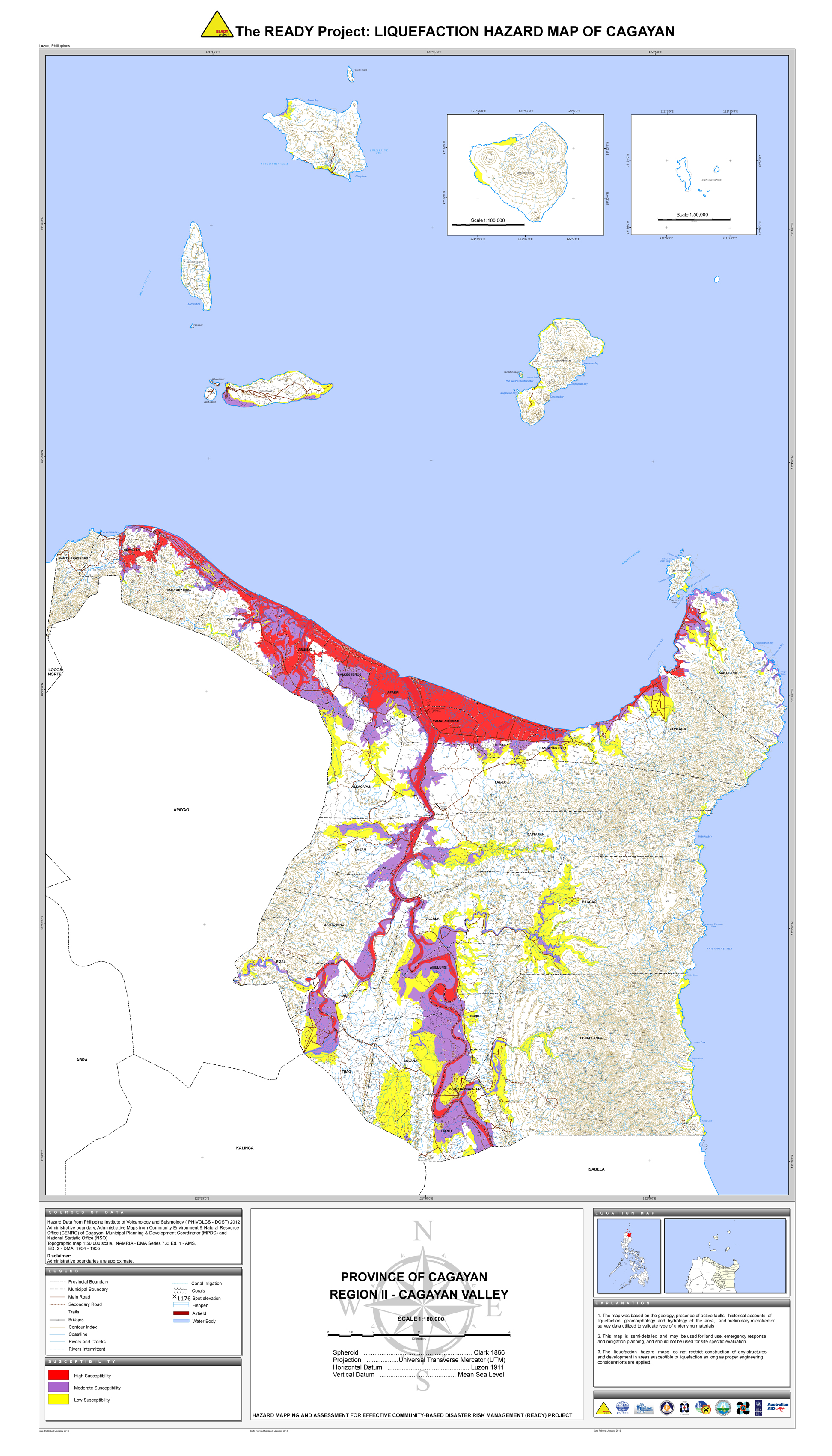
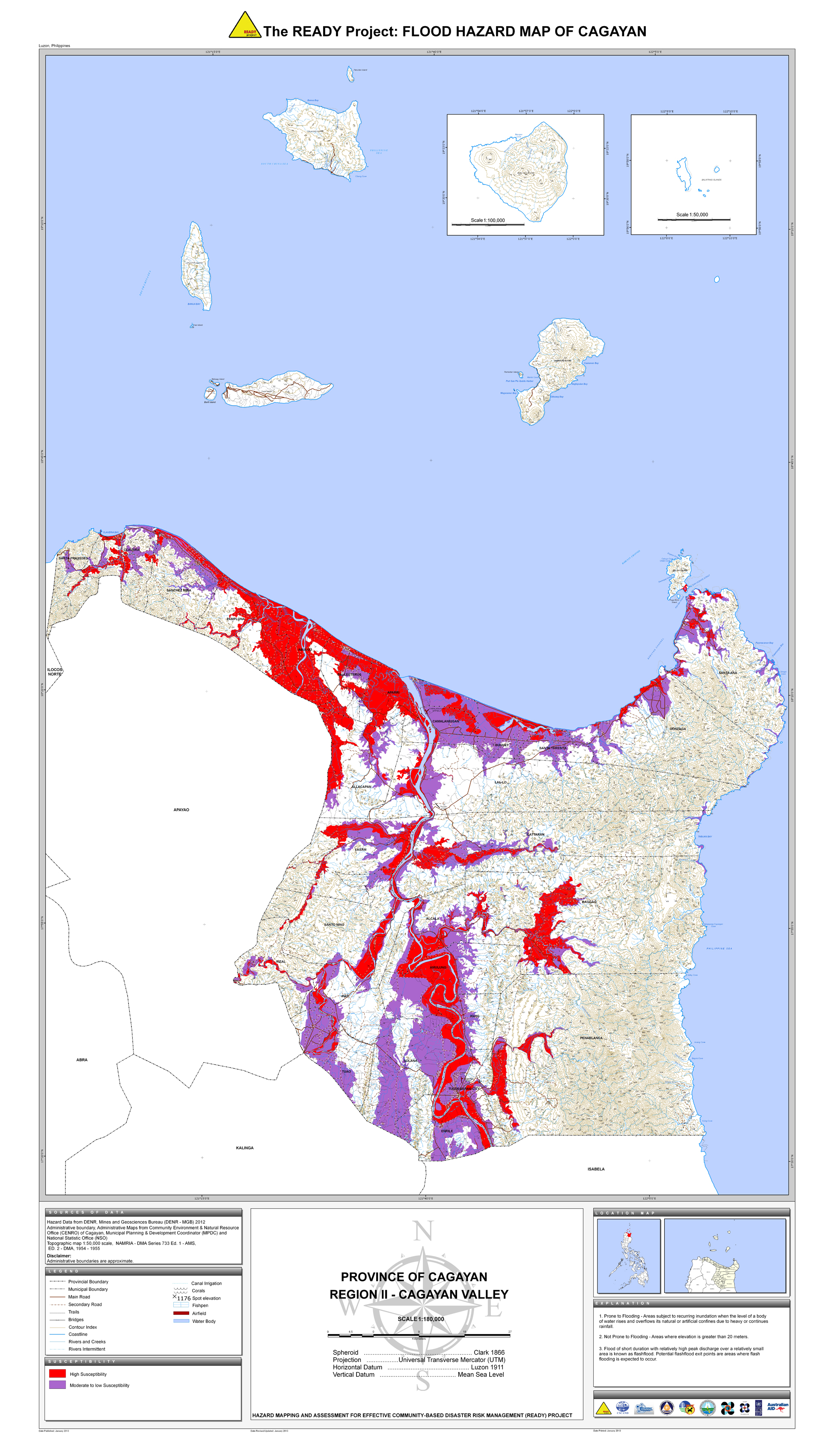
07. Cagayan |
 |
 |
 |
 |
 |
 |
 |
 |
||
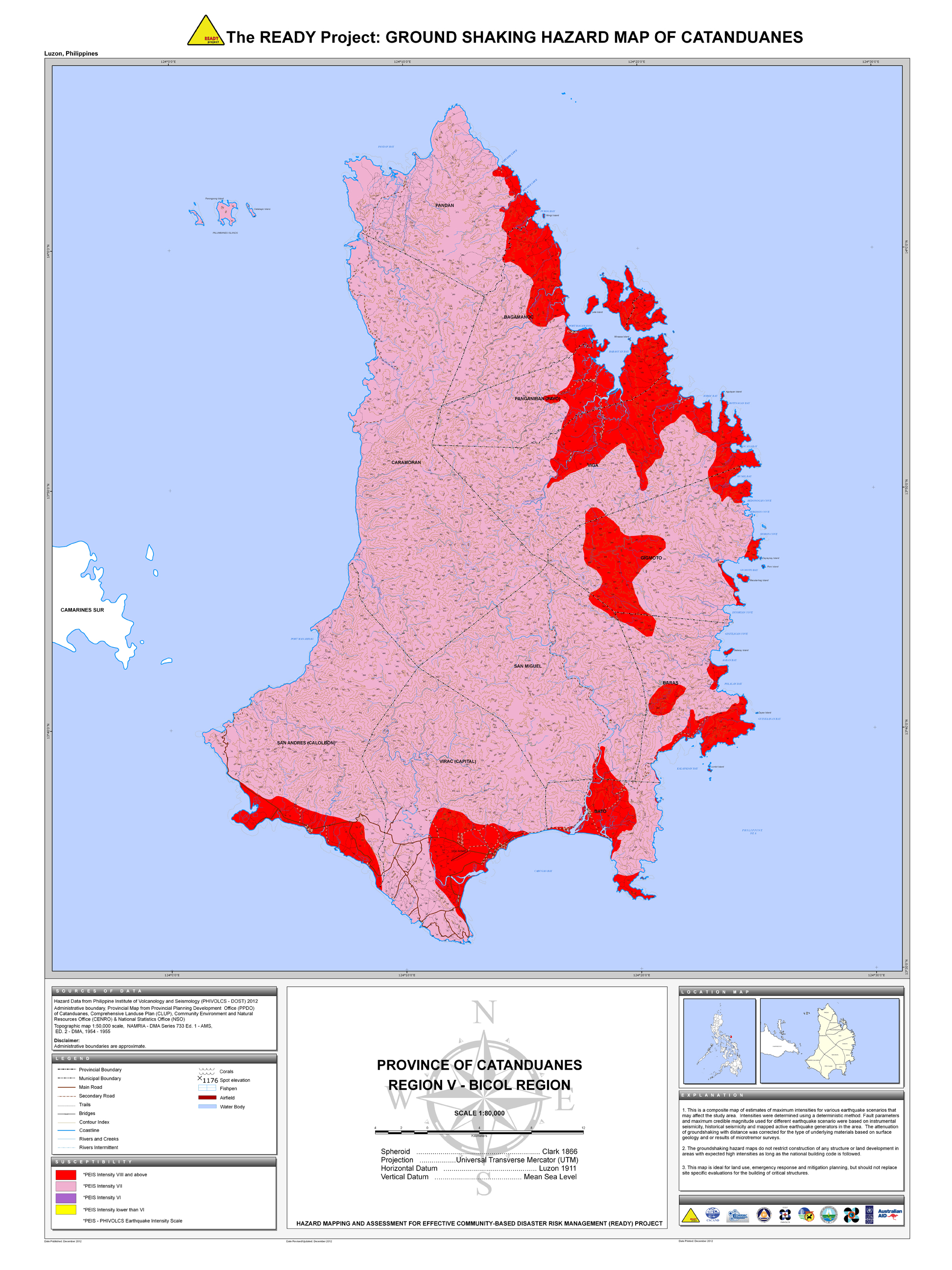
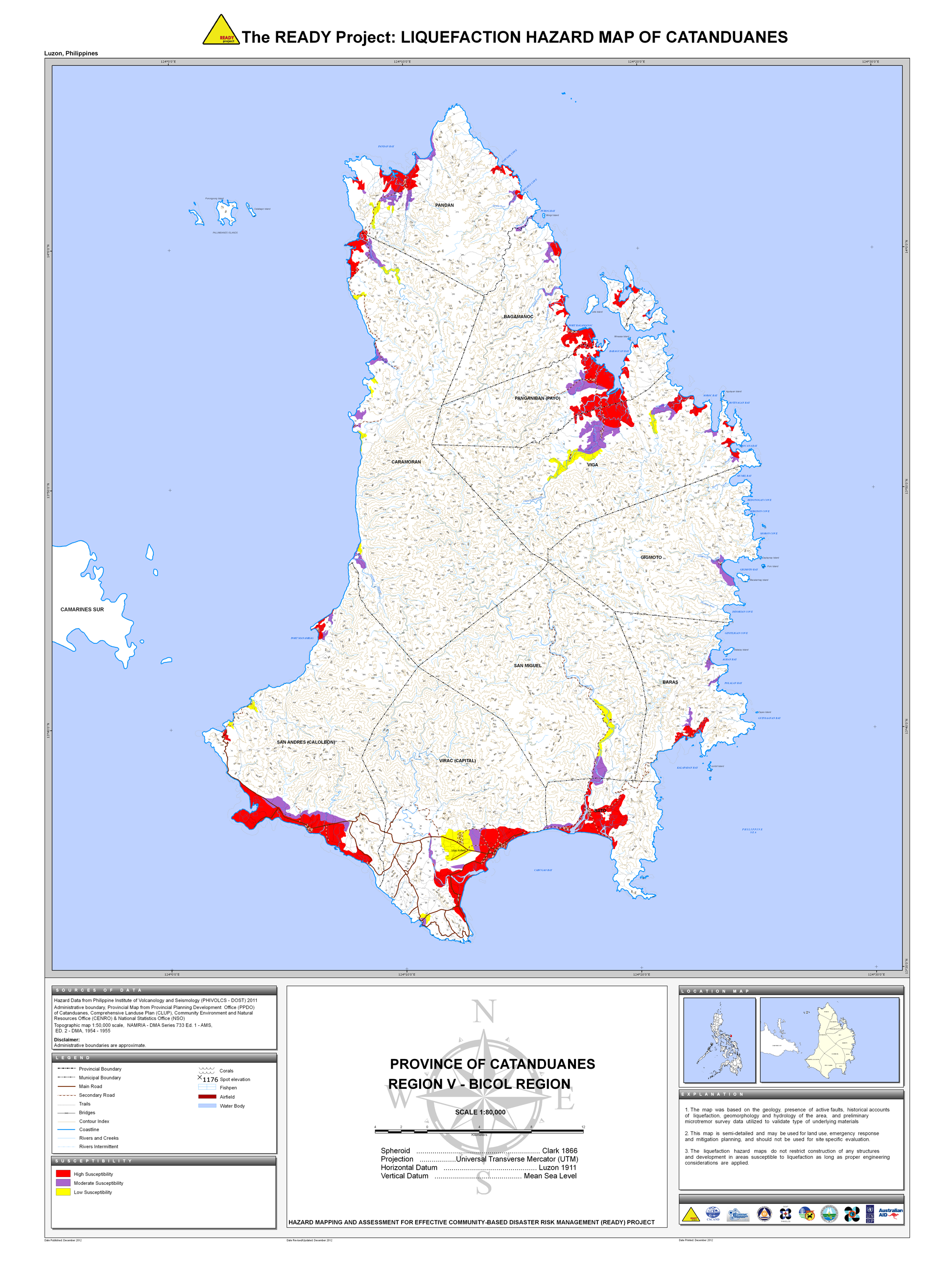
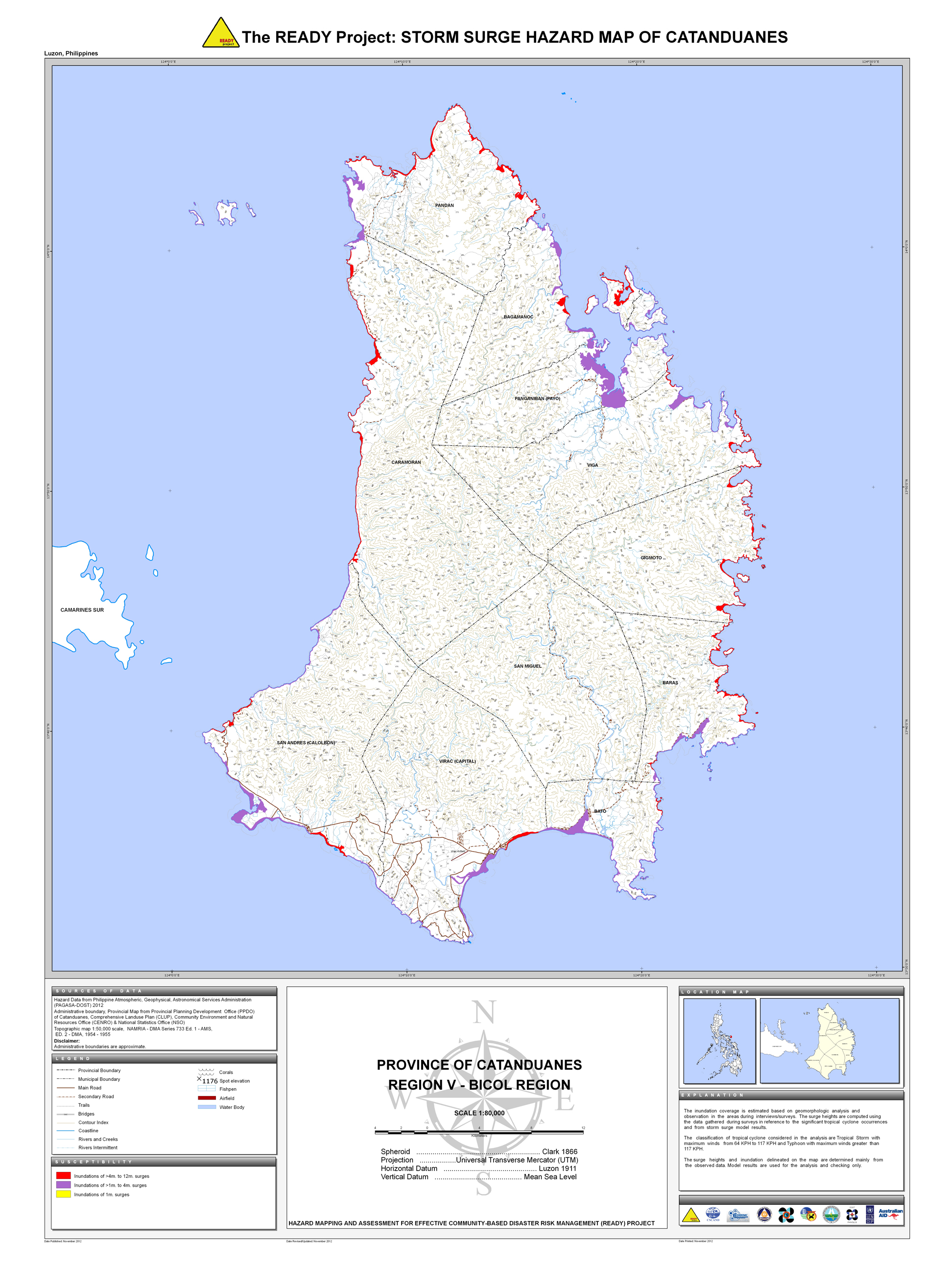
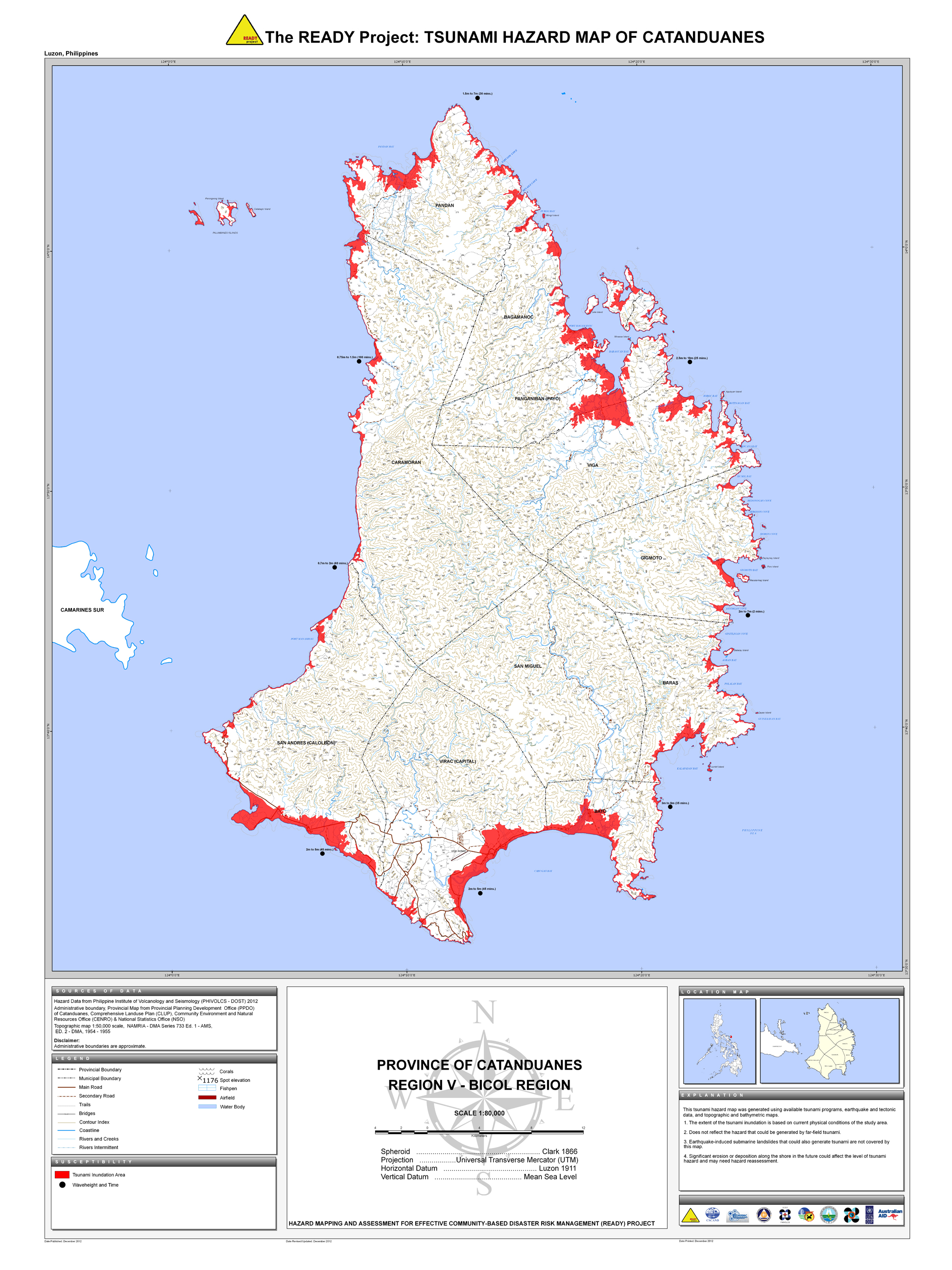
08. Catanduanes |
 |
 |
 |
 |
 |
 |
 |
|||
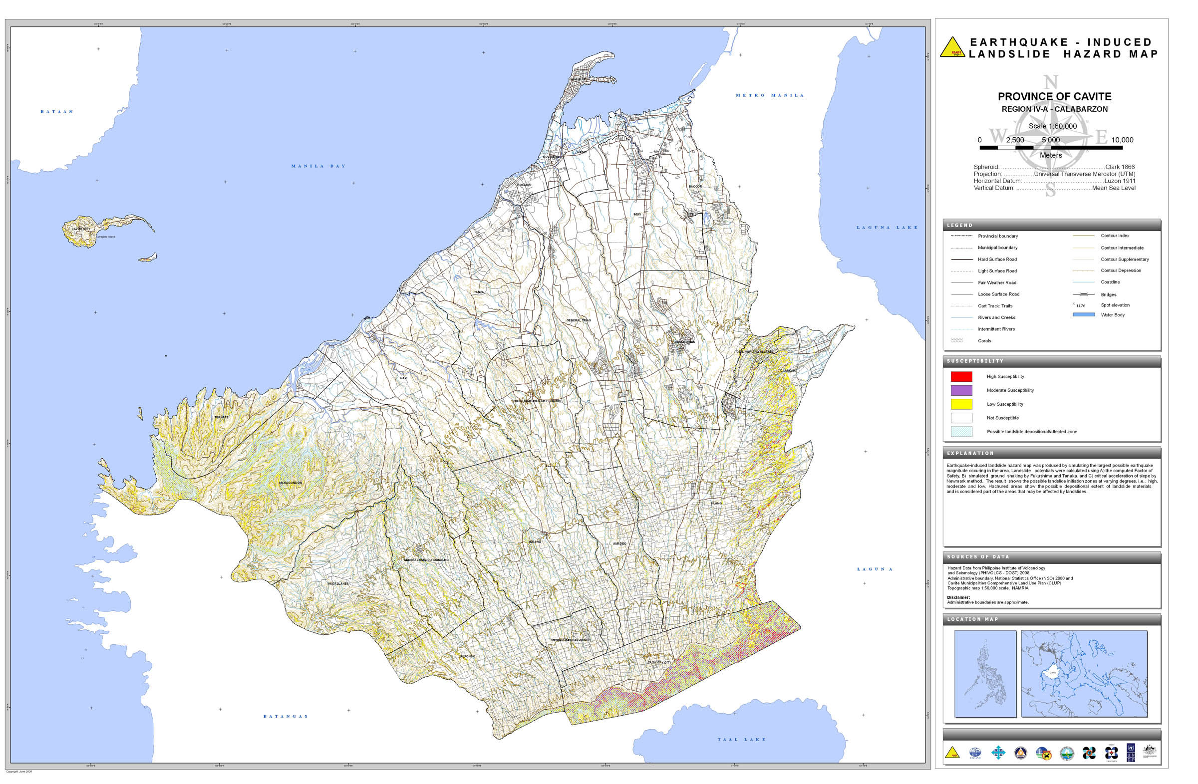
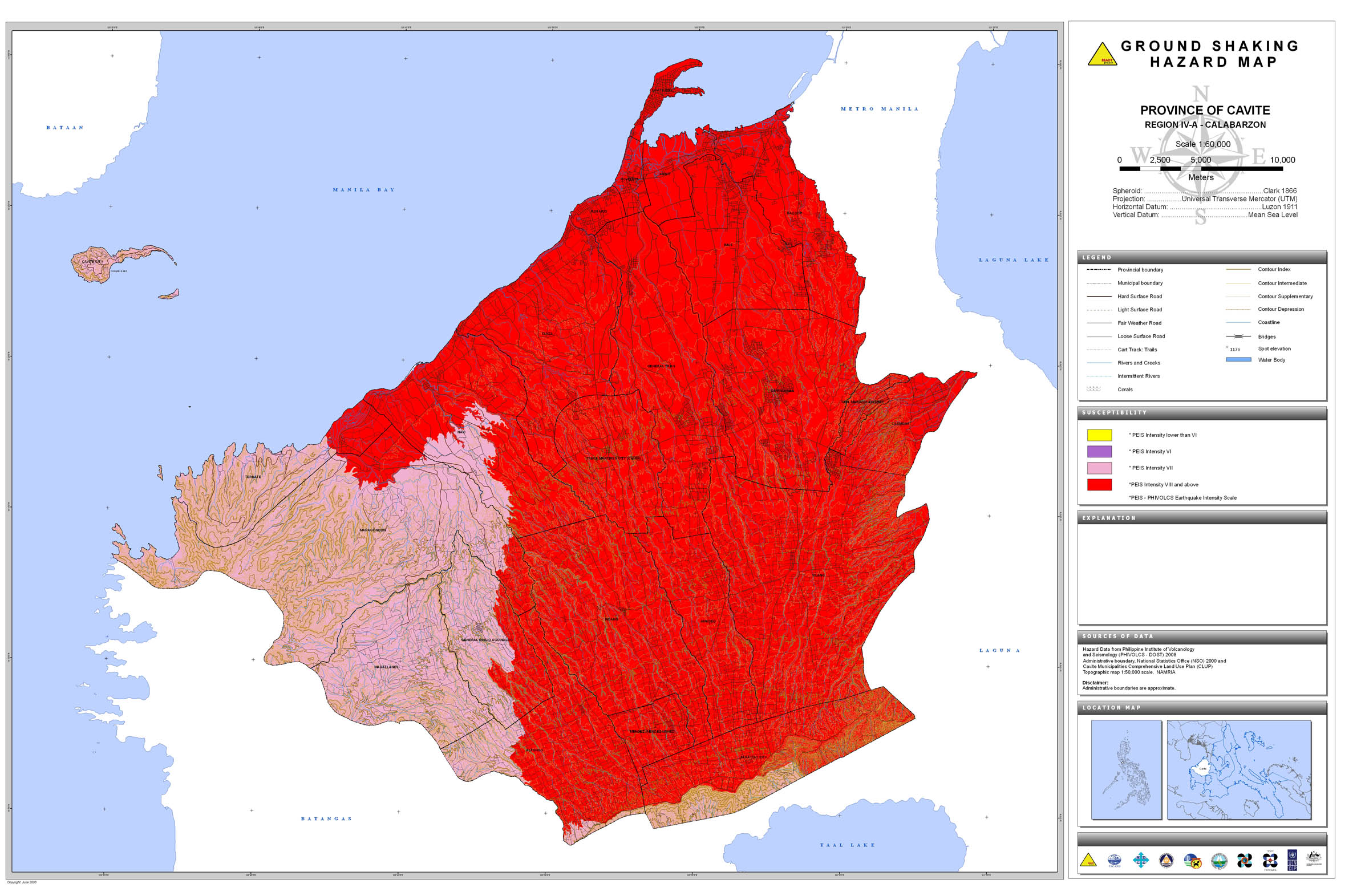
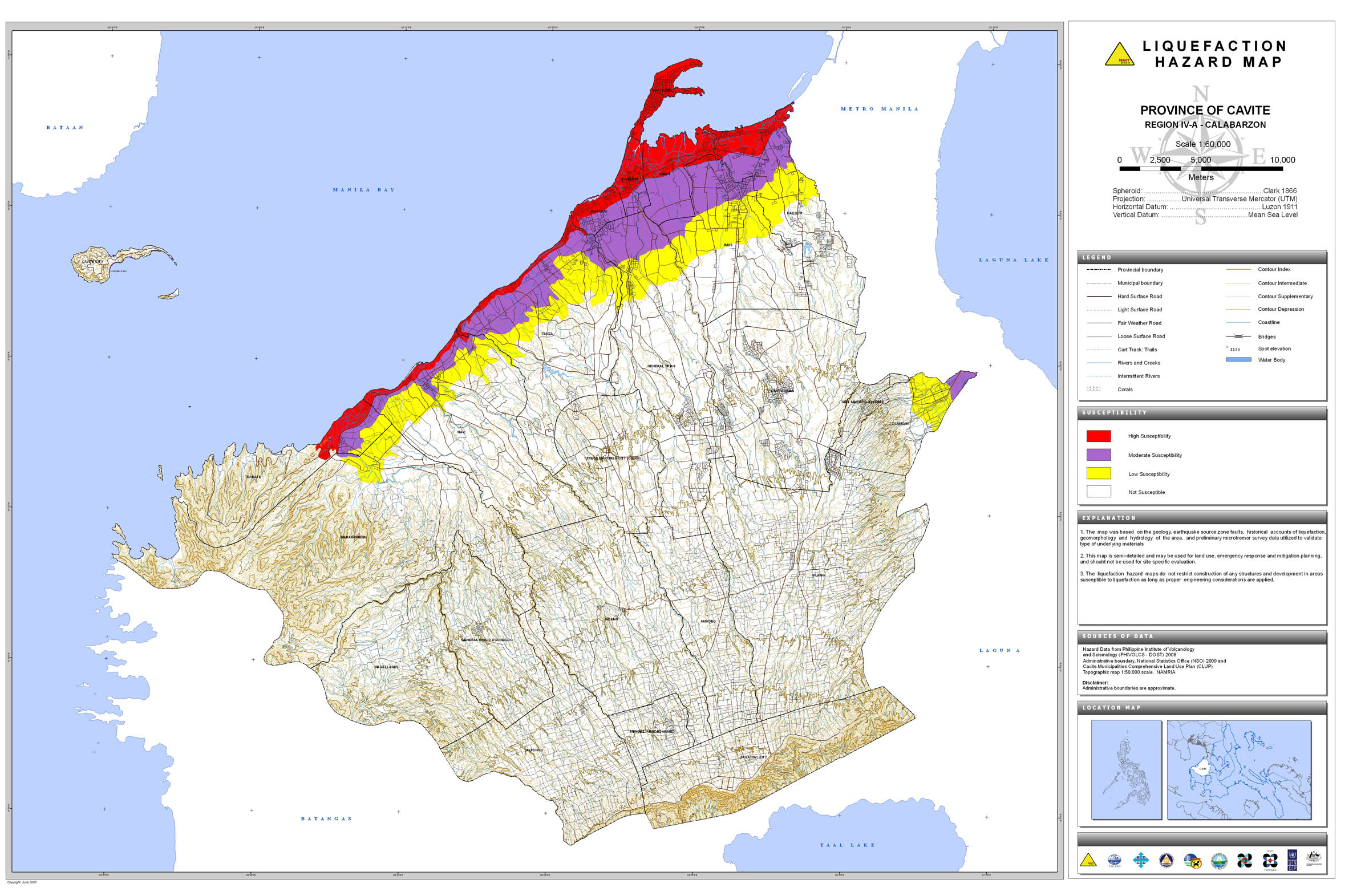
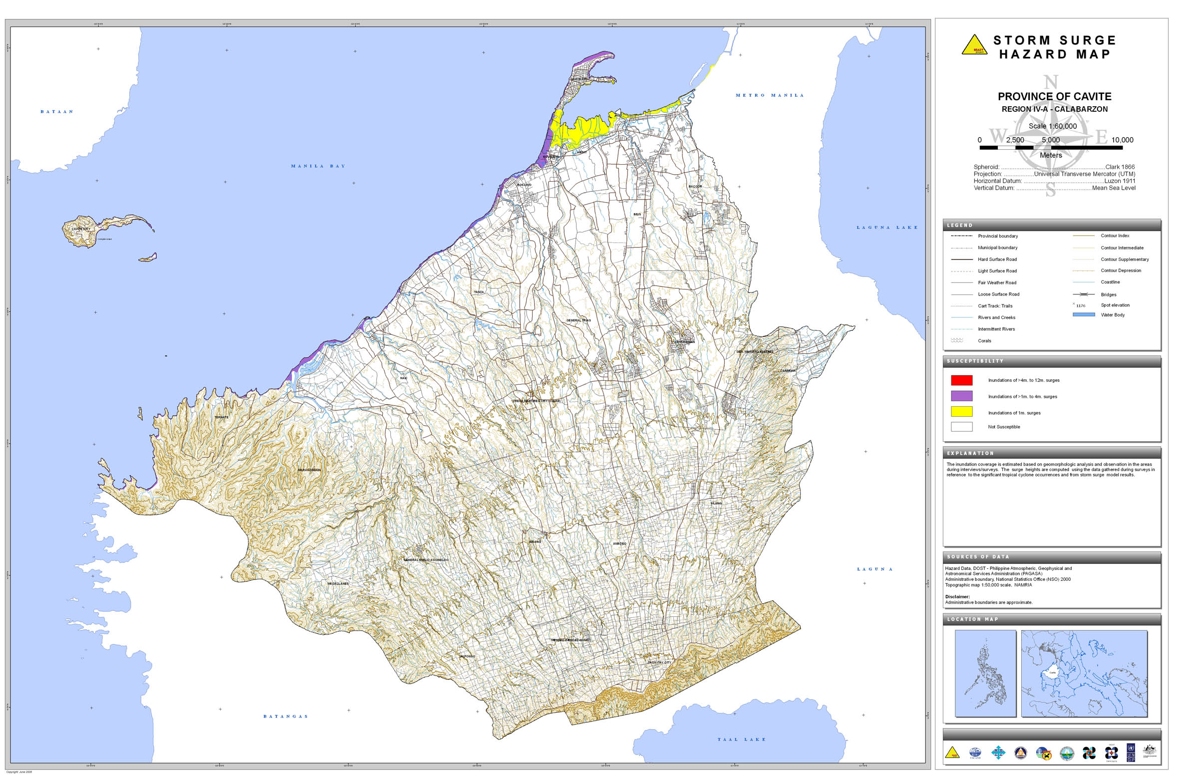
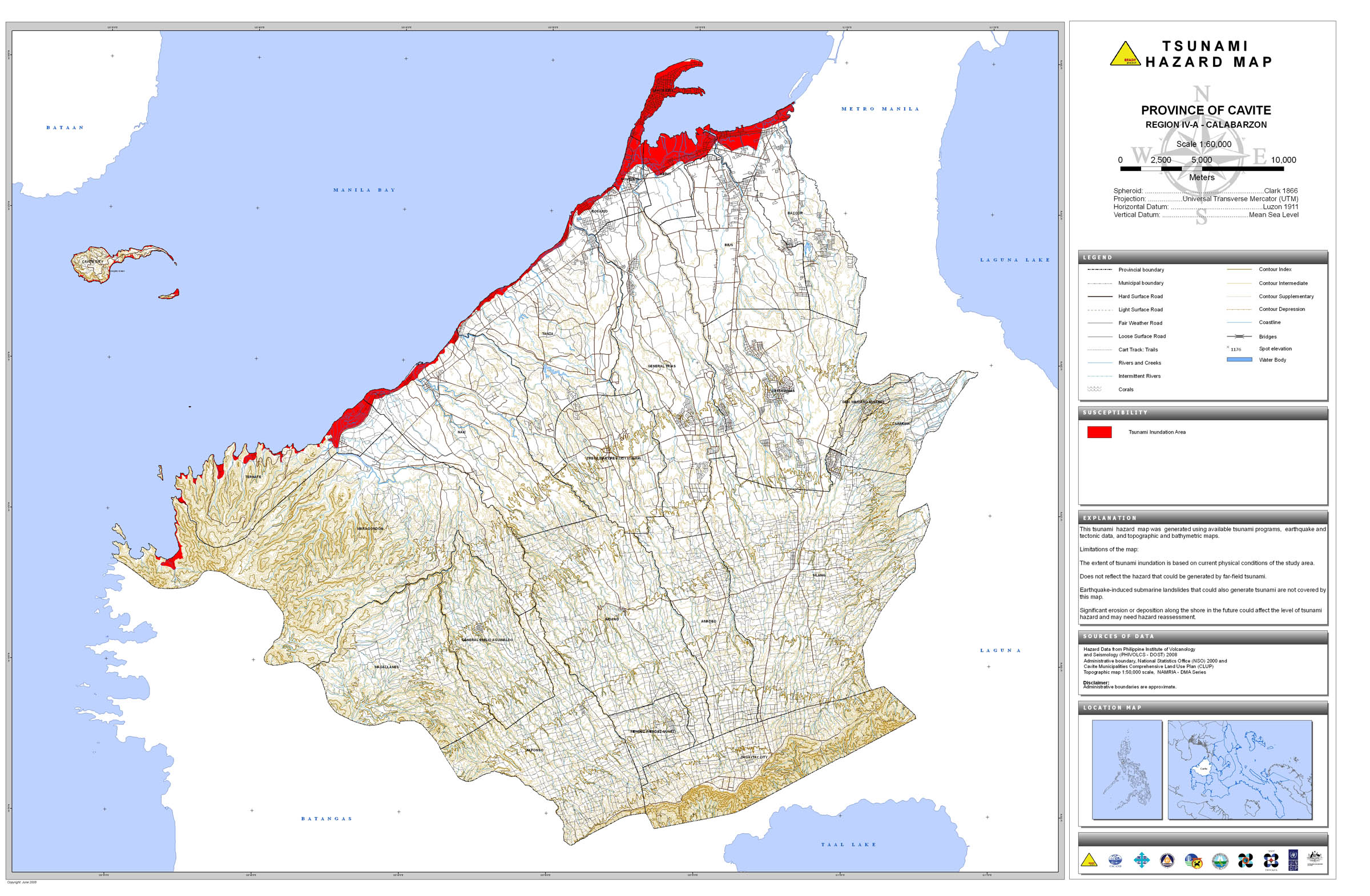
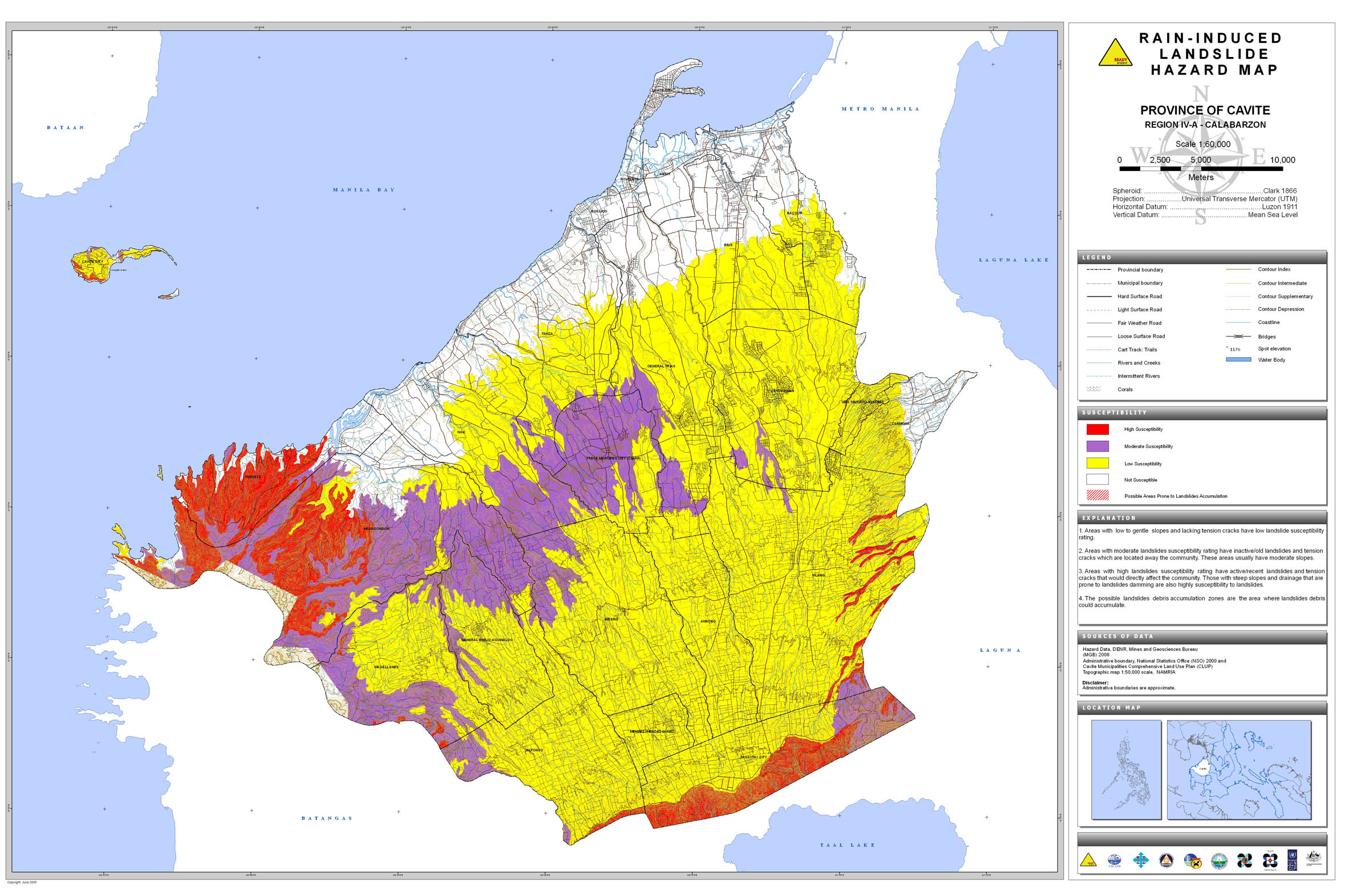
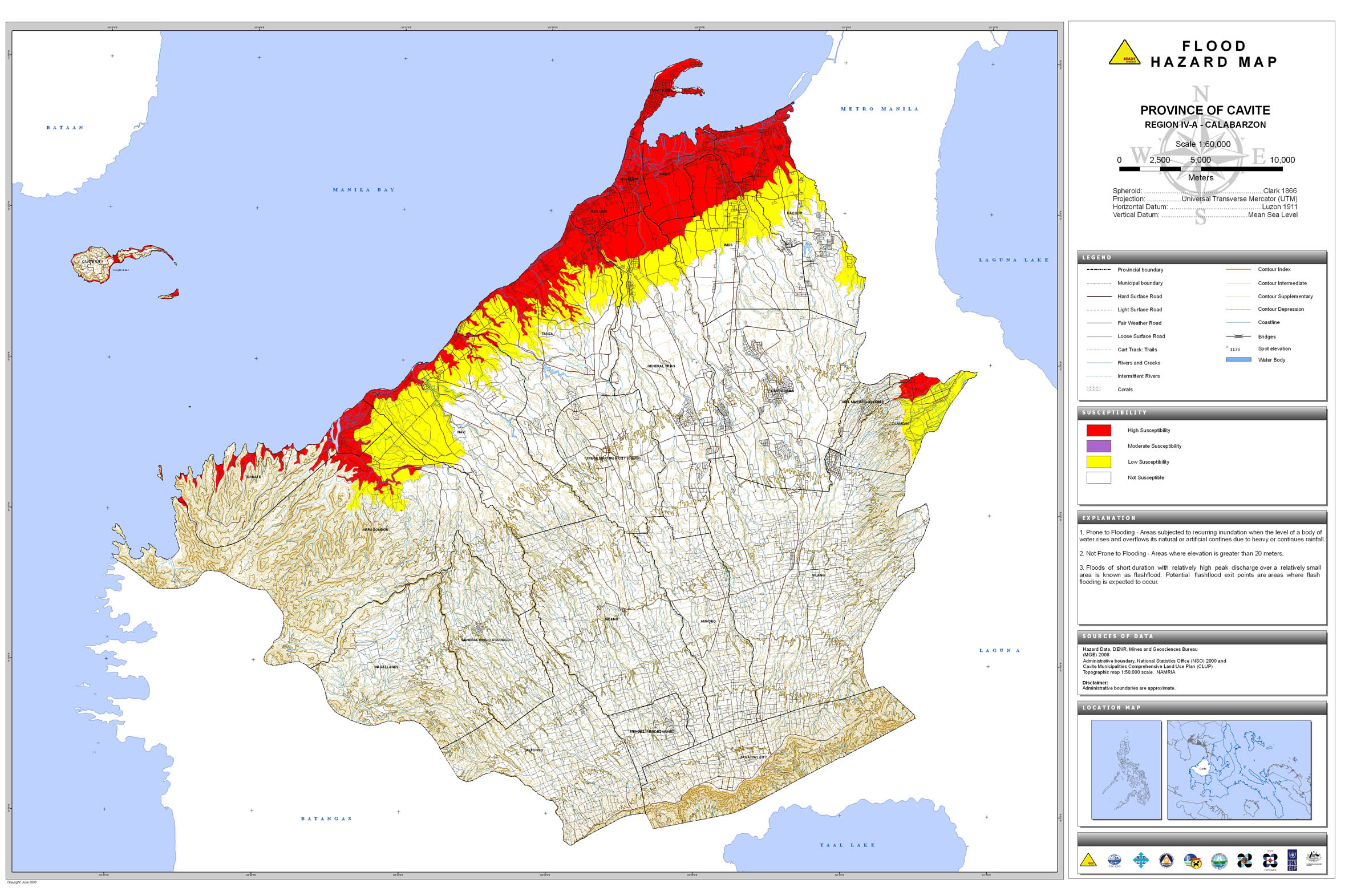
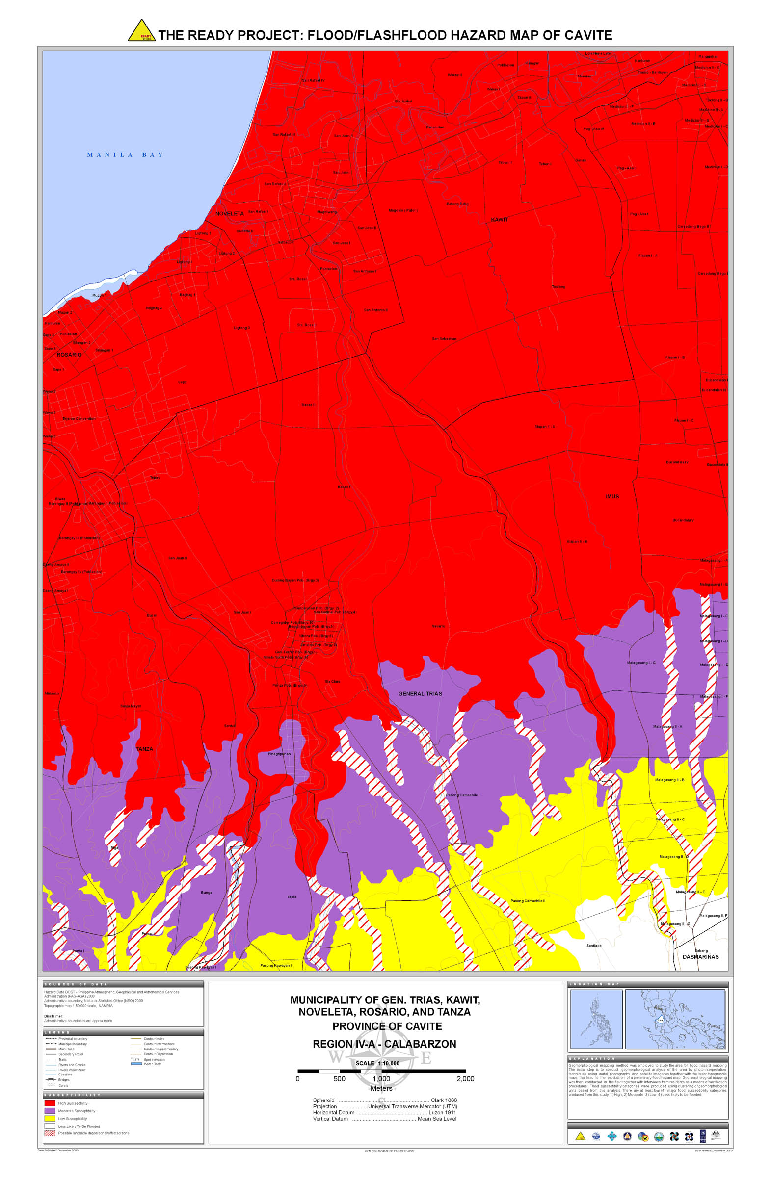
09. Cavite |
 |
 |
 |
 |
 |
 |
 |
 |
 |
|
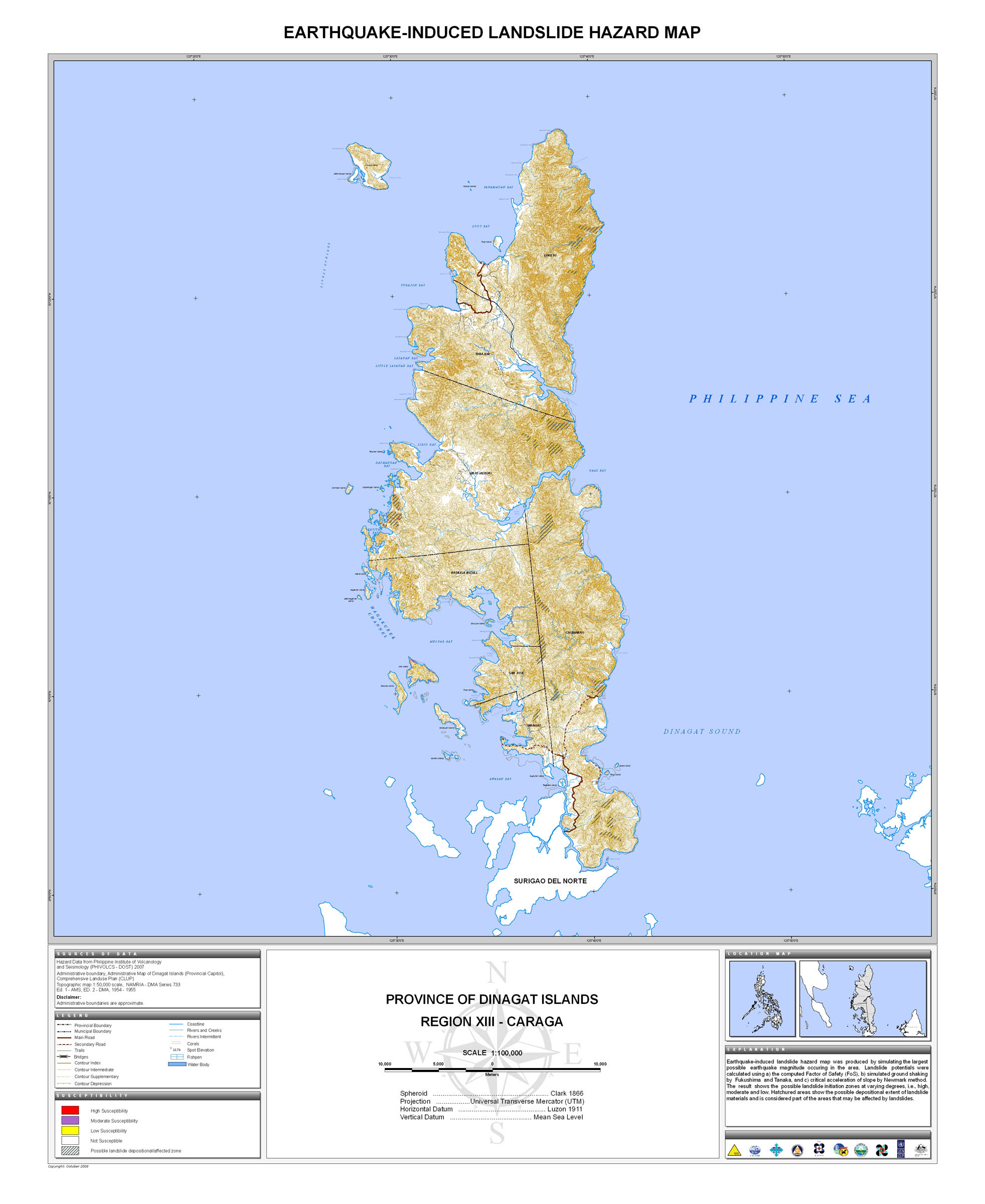
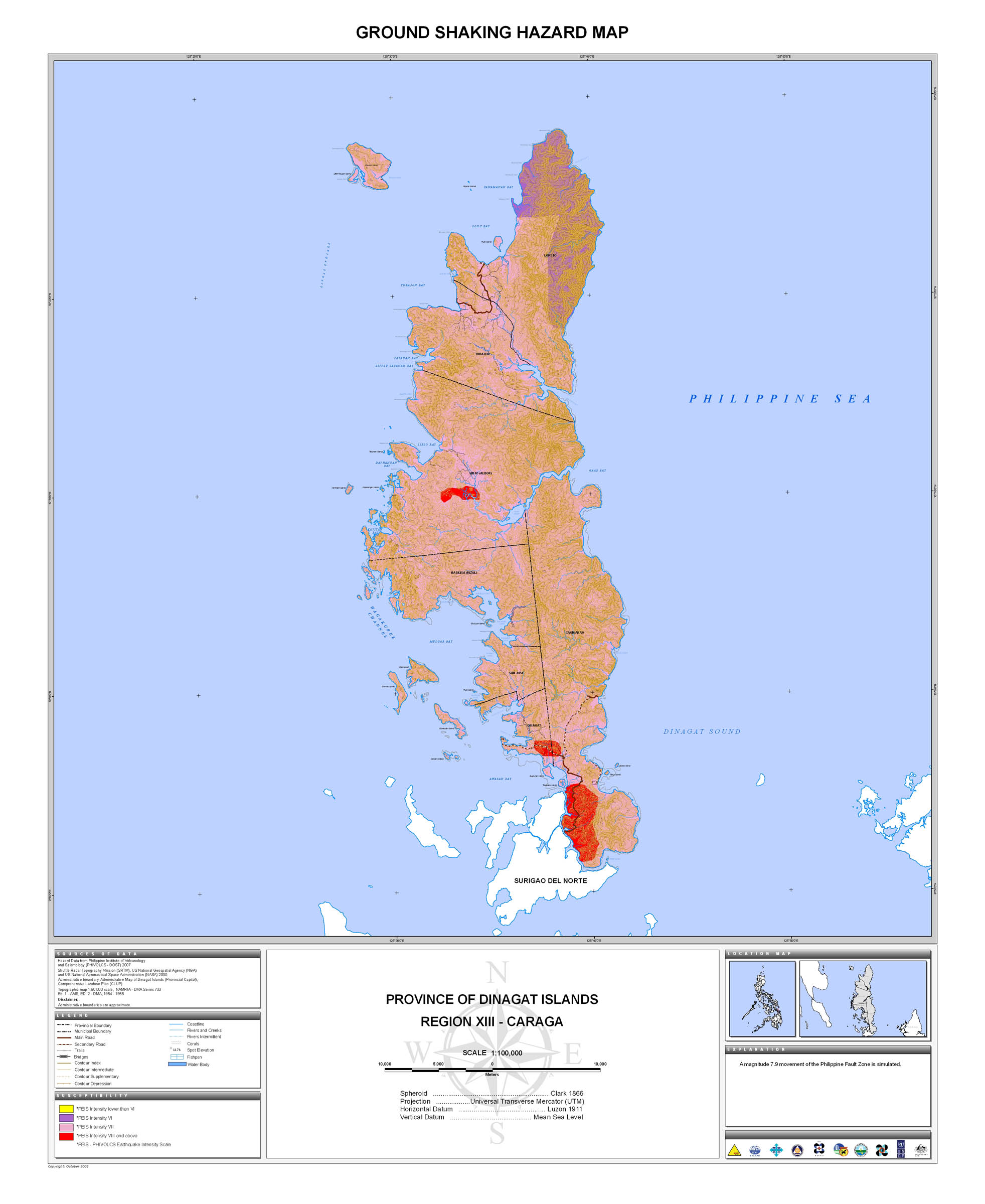
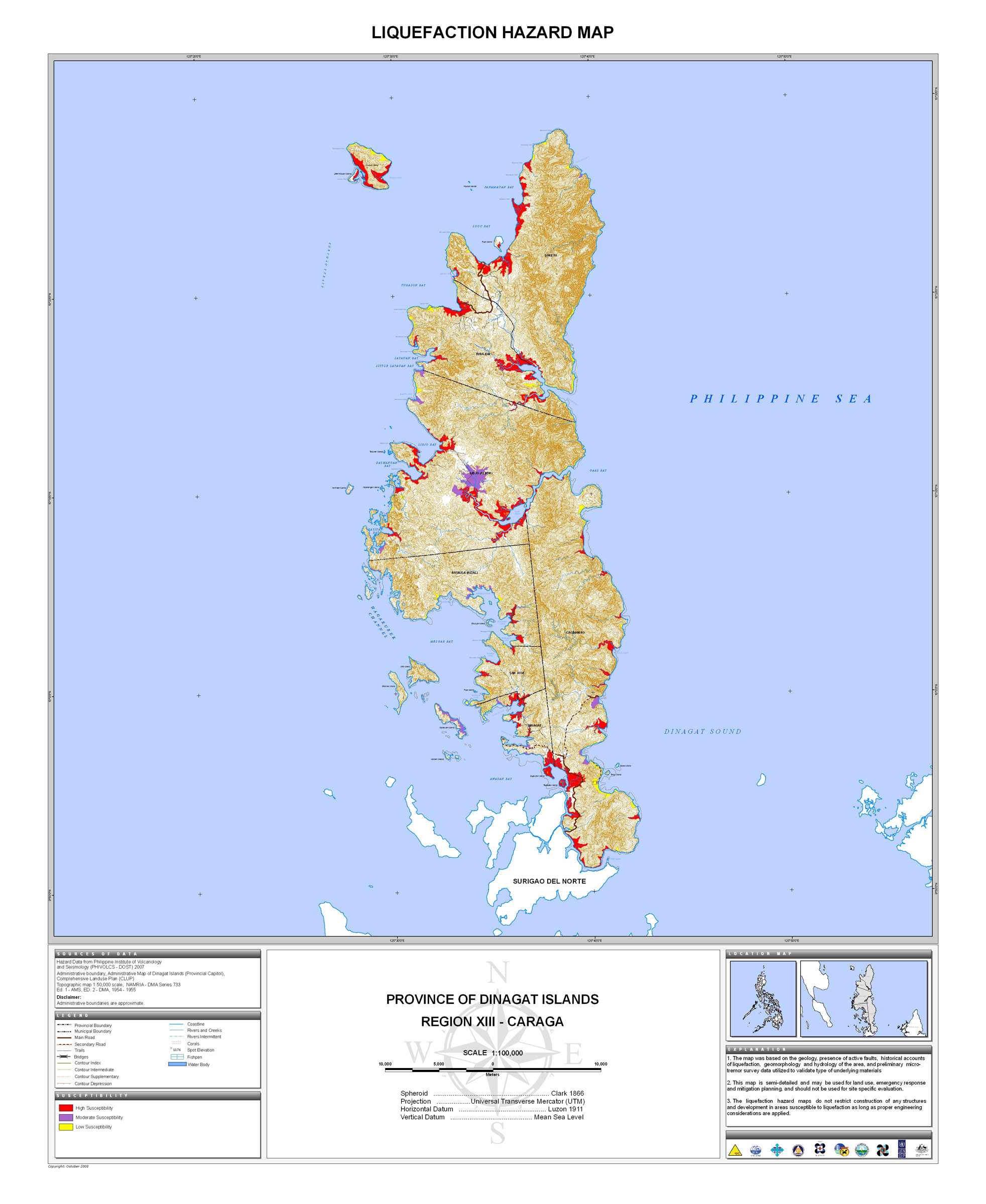
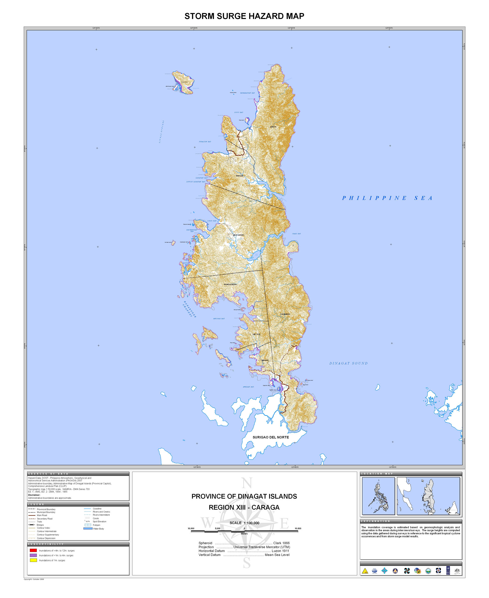
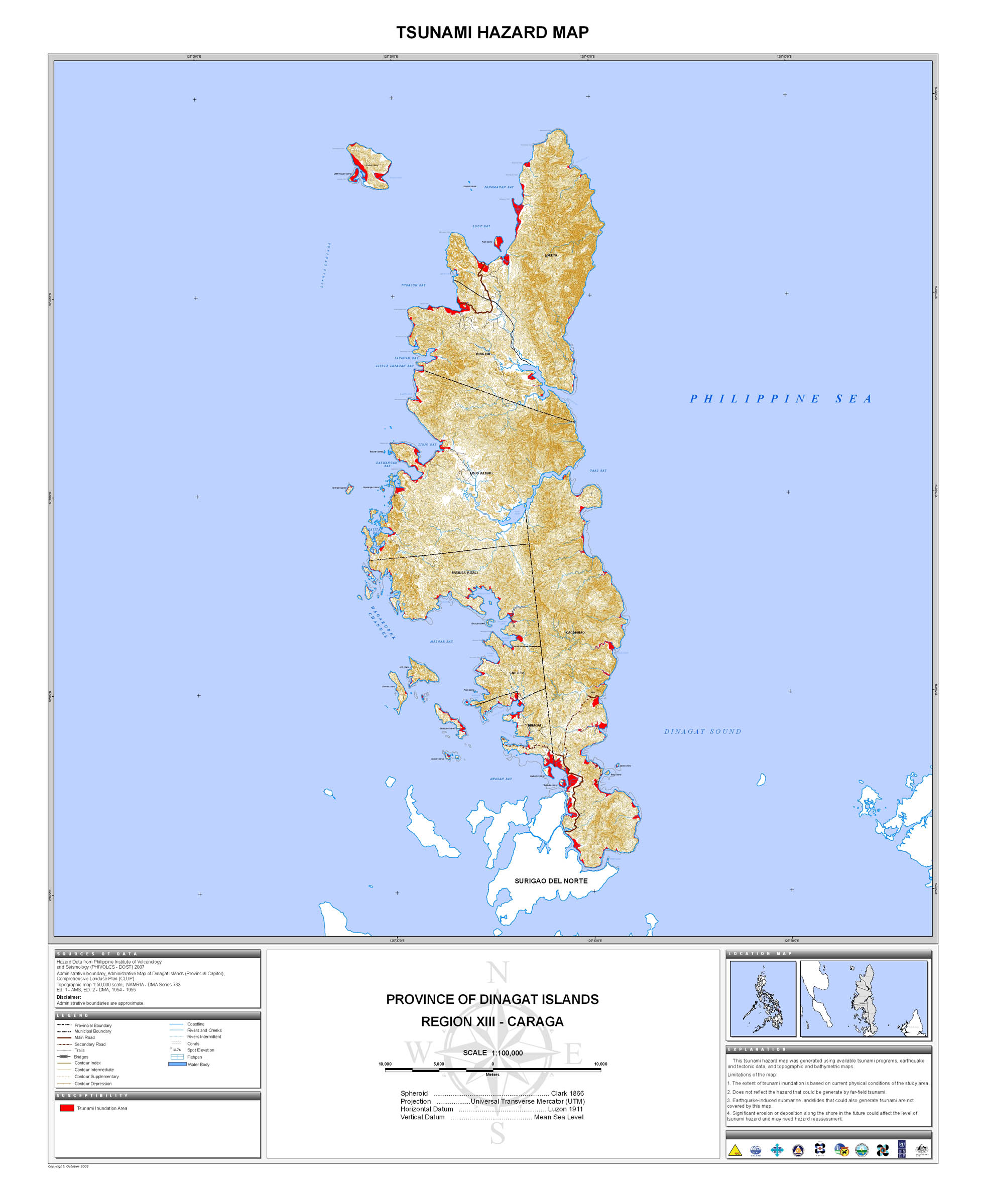
10. Dinagat Island |
 |
 |
 |
 |
 |
 |
 |
|||
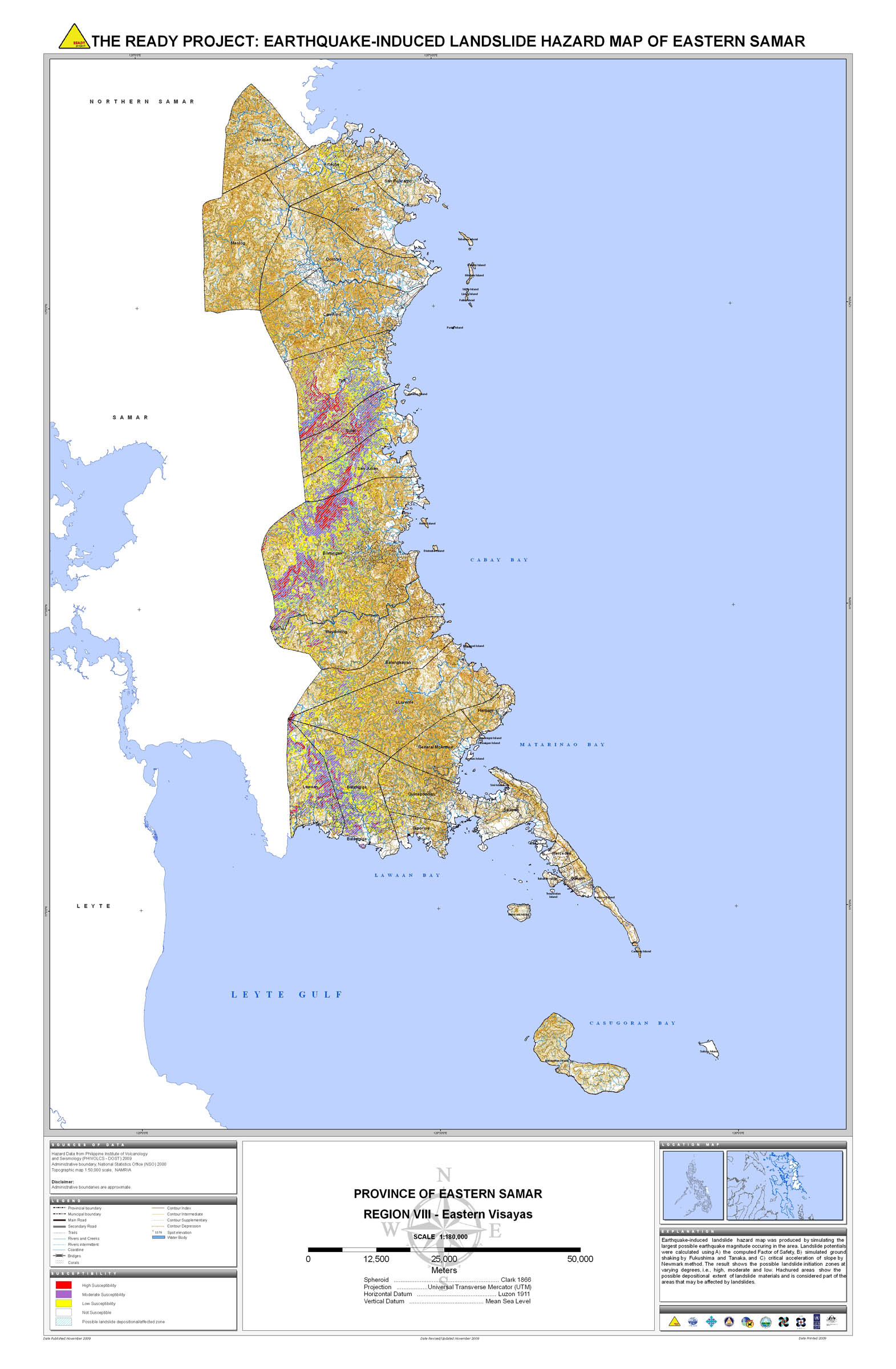
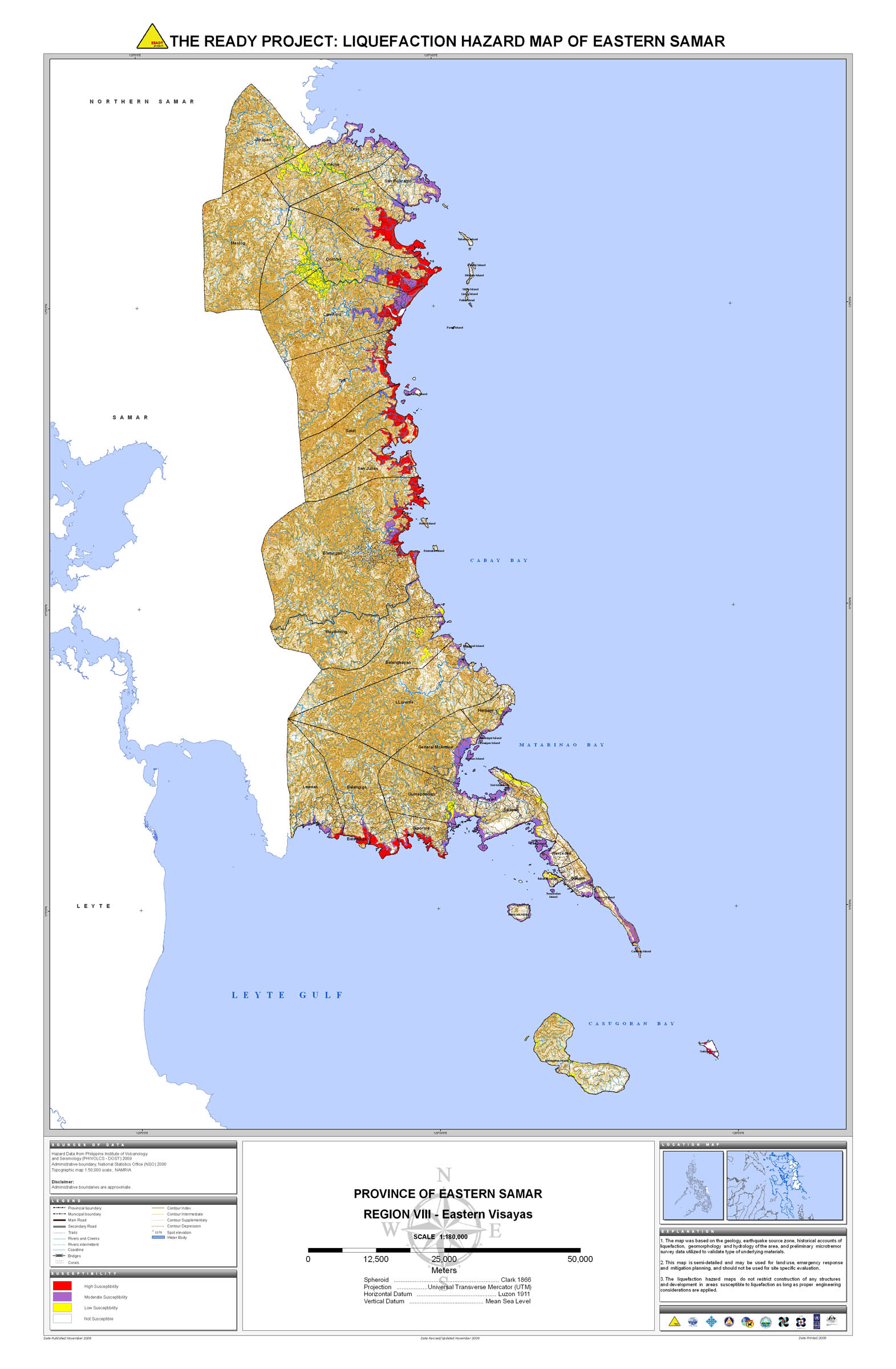
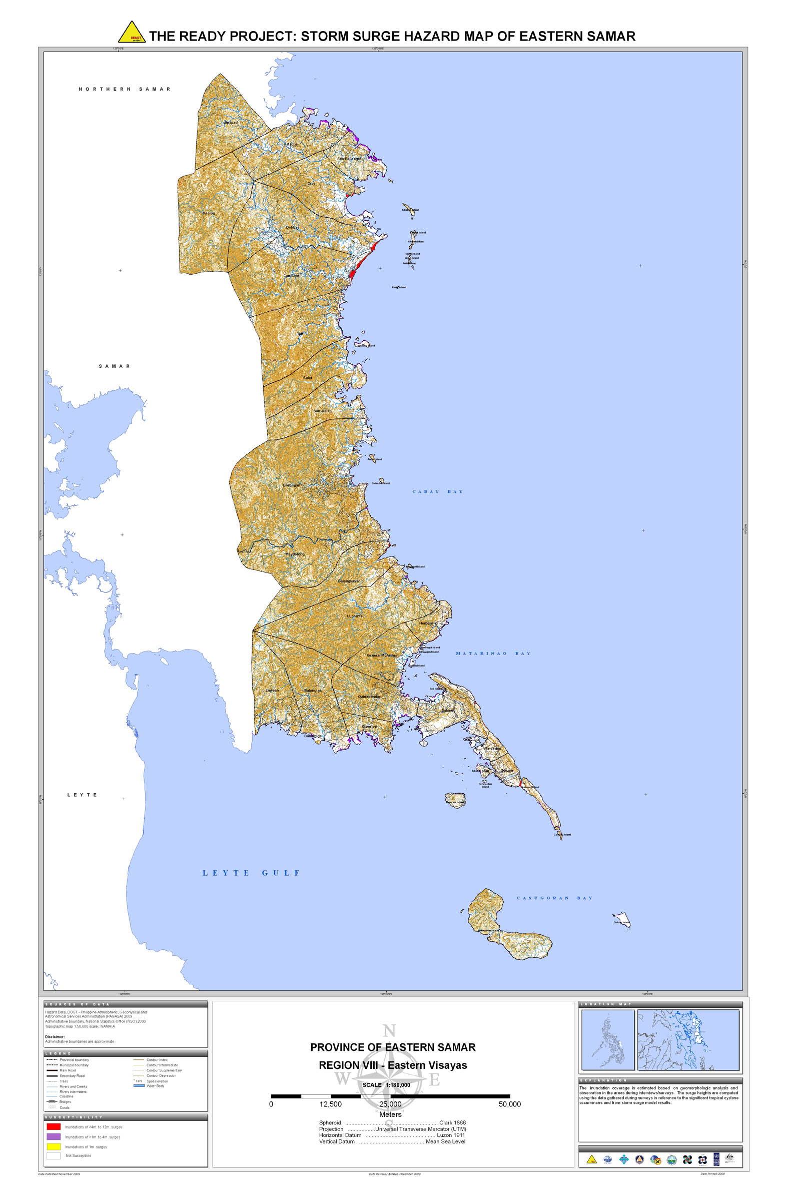
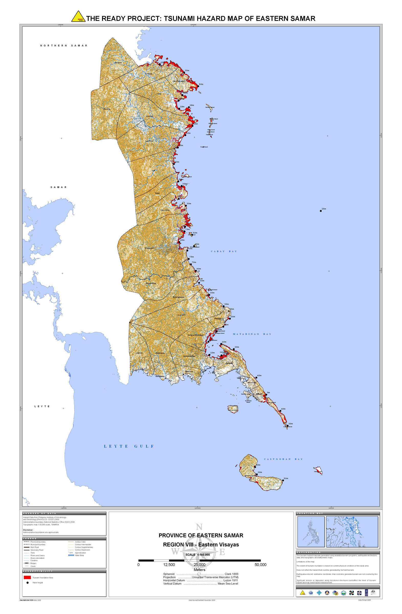
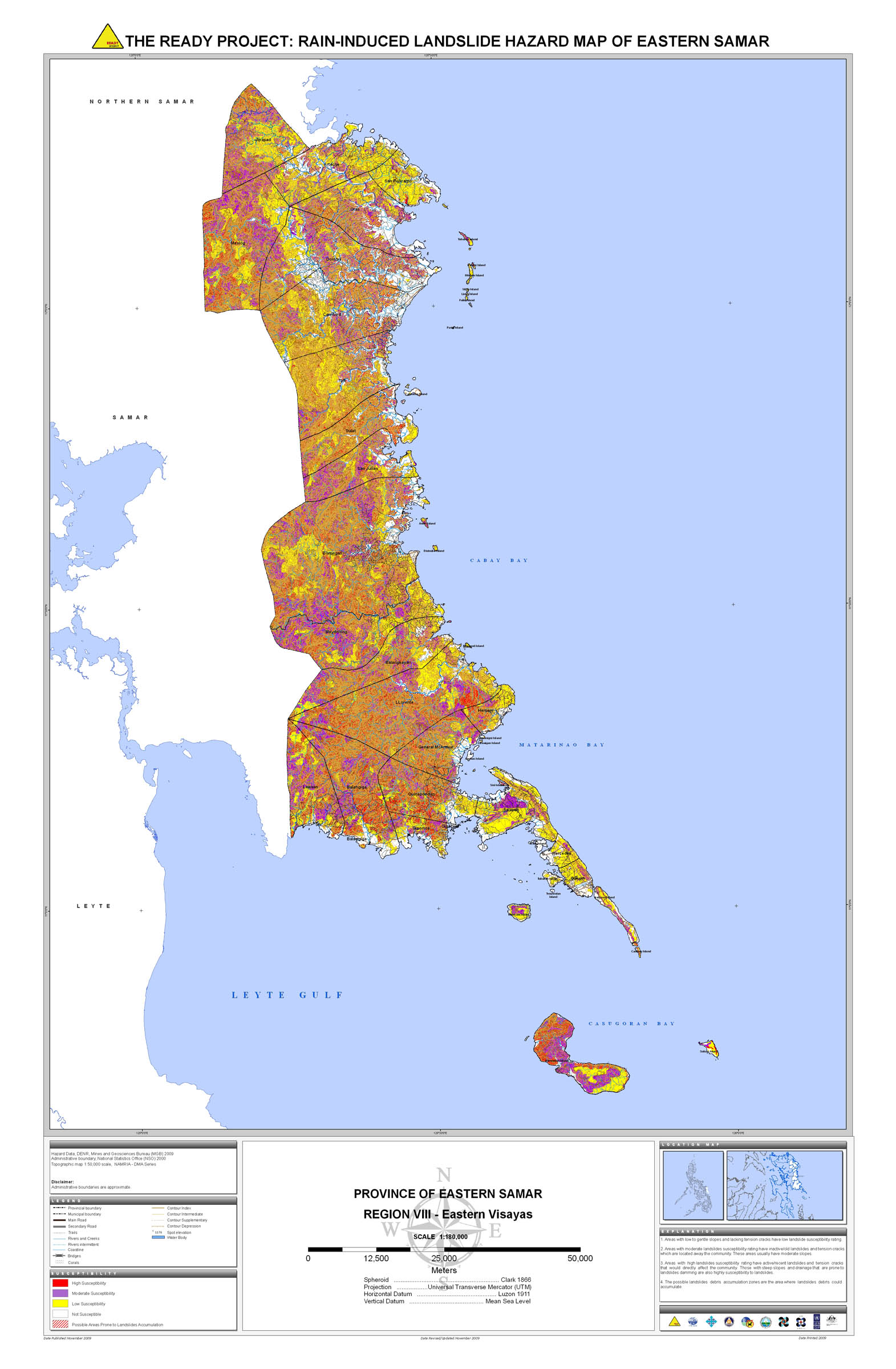
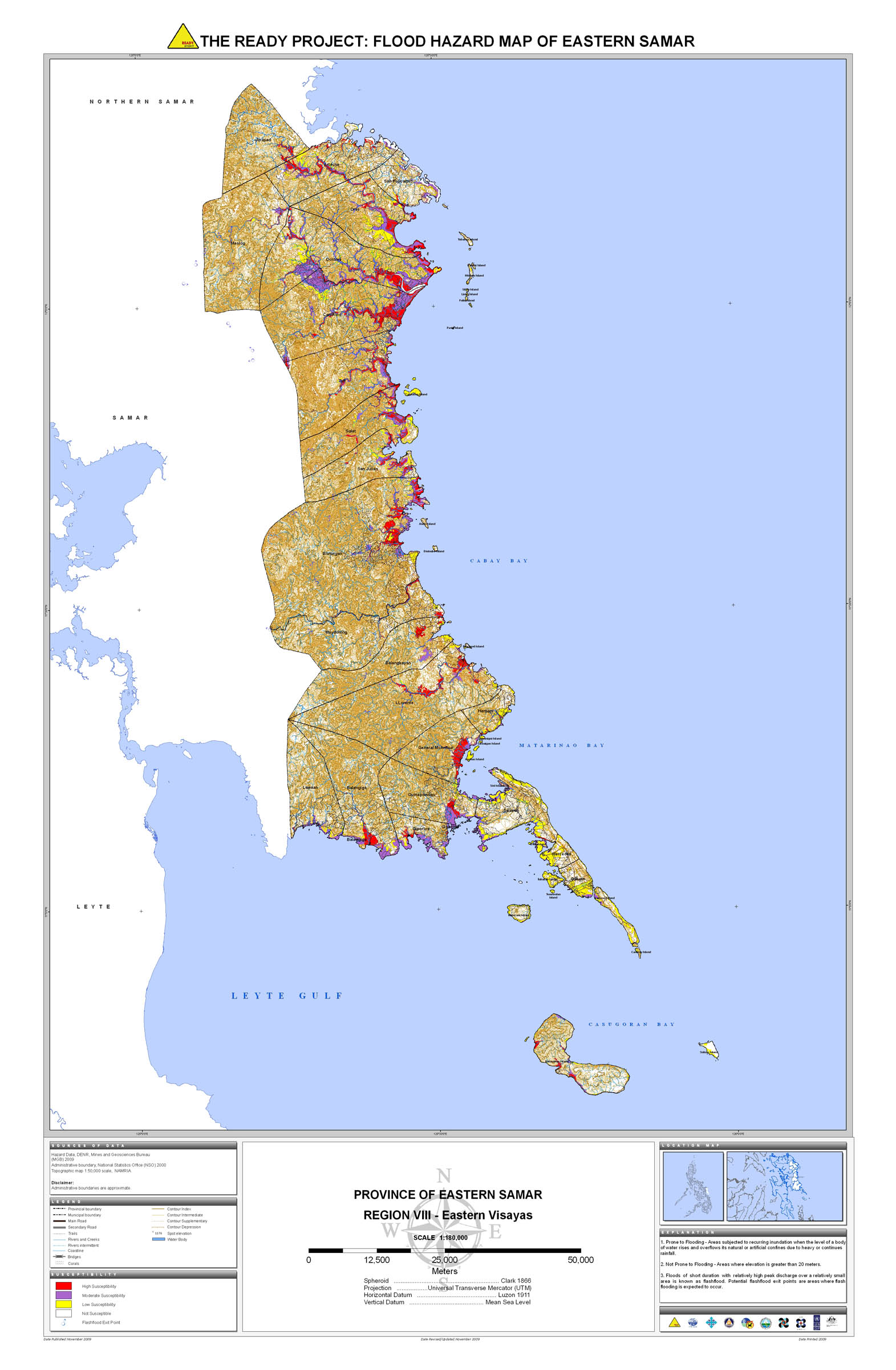
11. Eastern Samar |
 |
 |
 |
 |
 |
 |
 |
 |
||
12. Ilocos Norte |
 |
 |
 |
 |
 |
 |
 |
 |
||
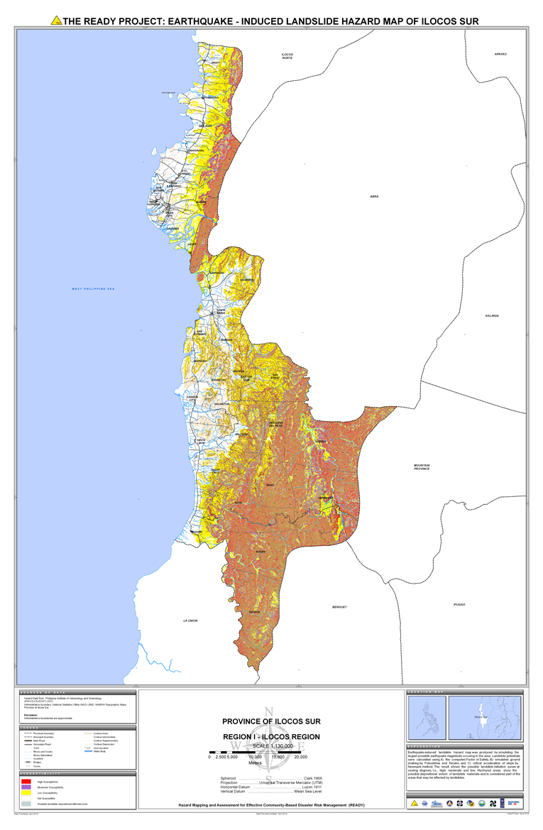
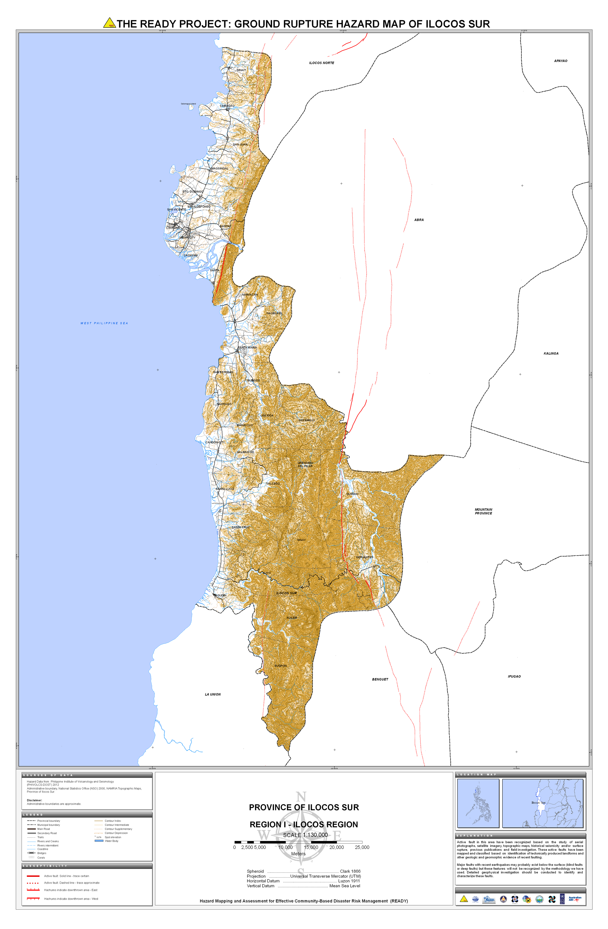
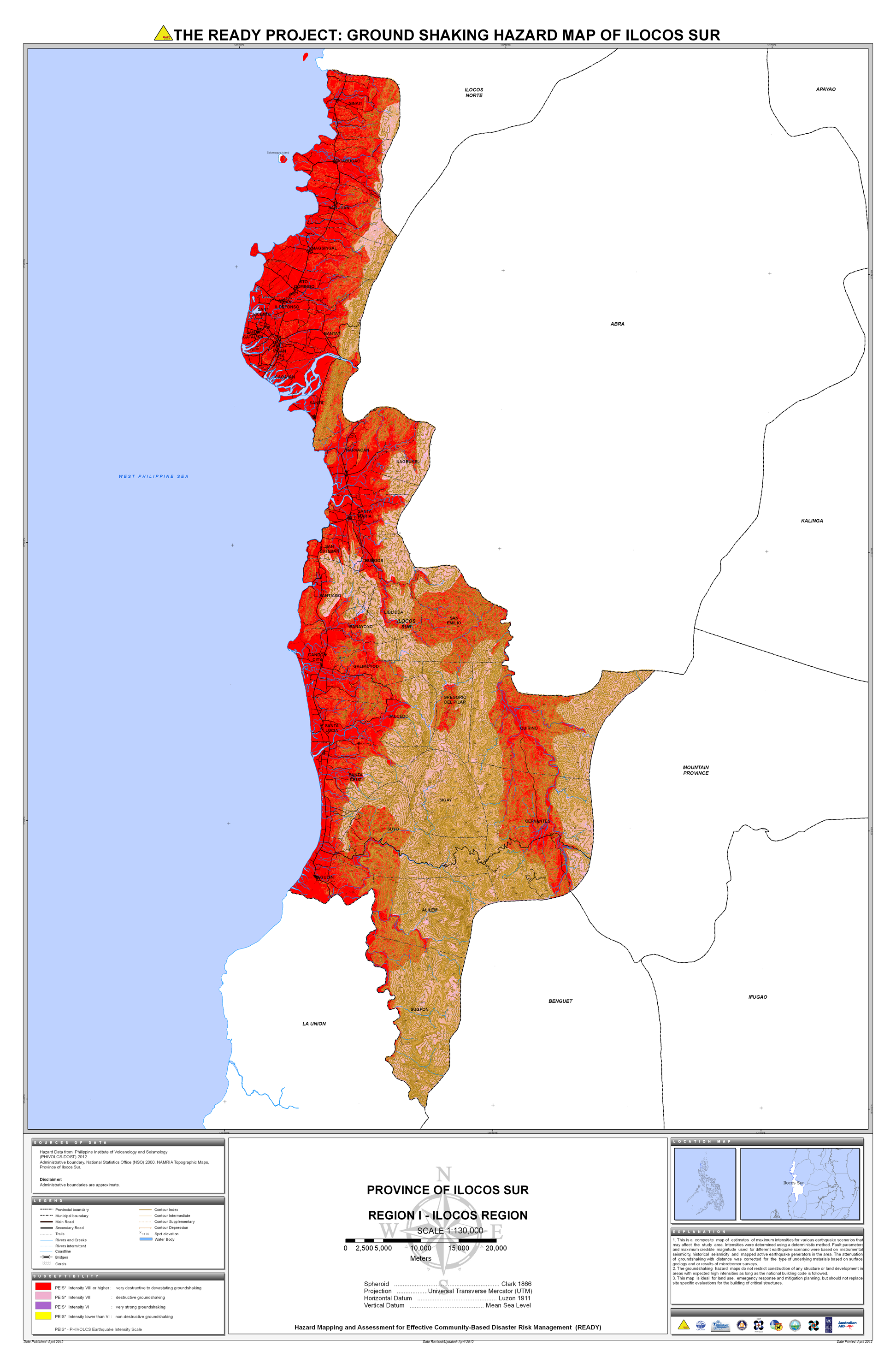
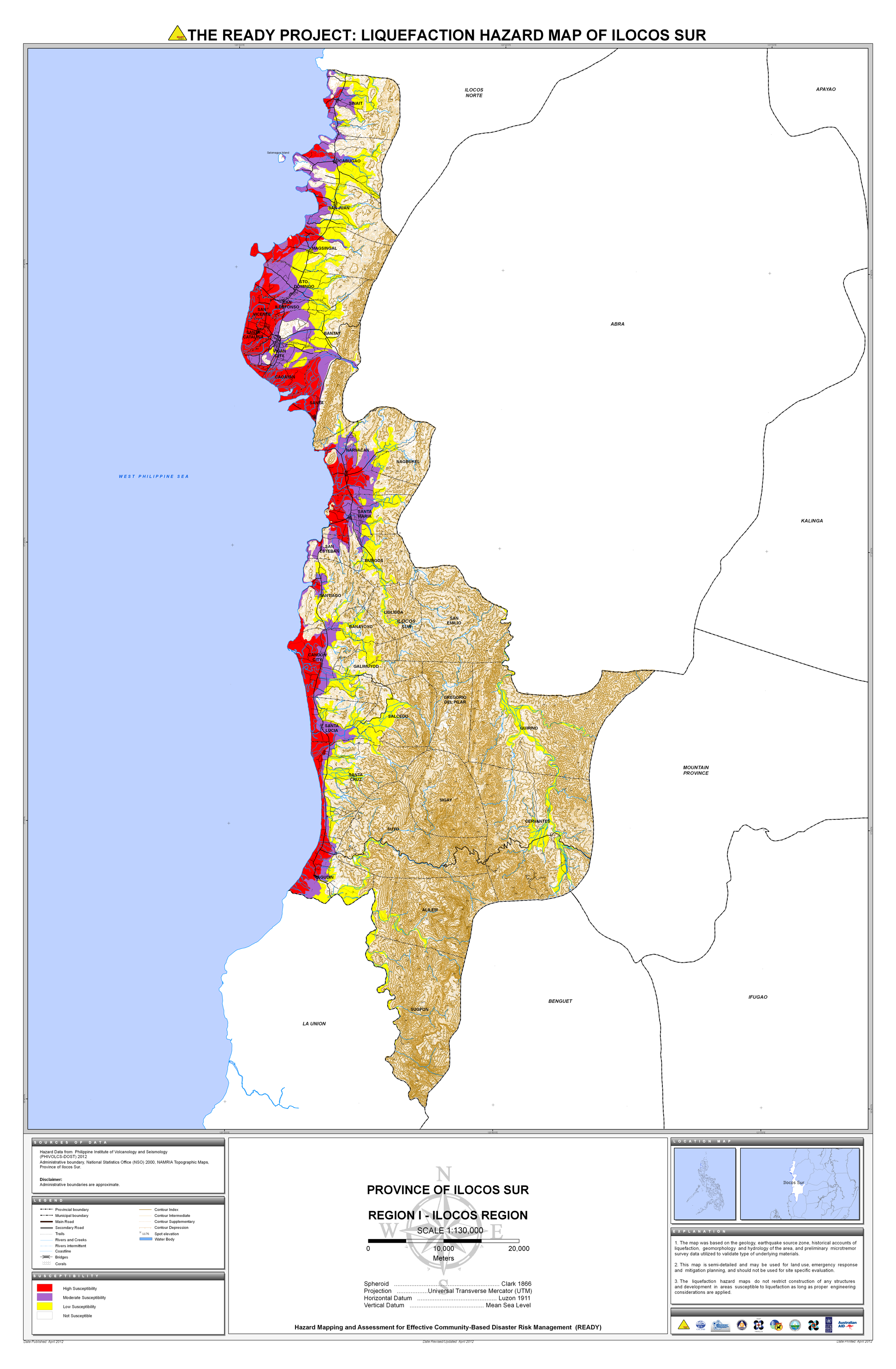
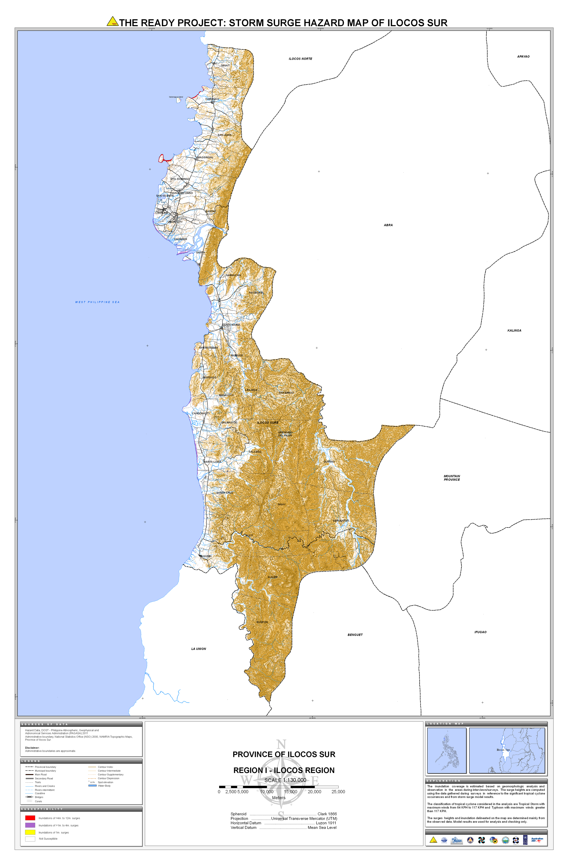
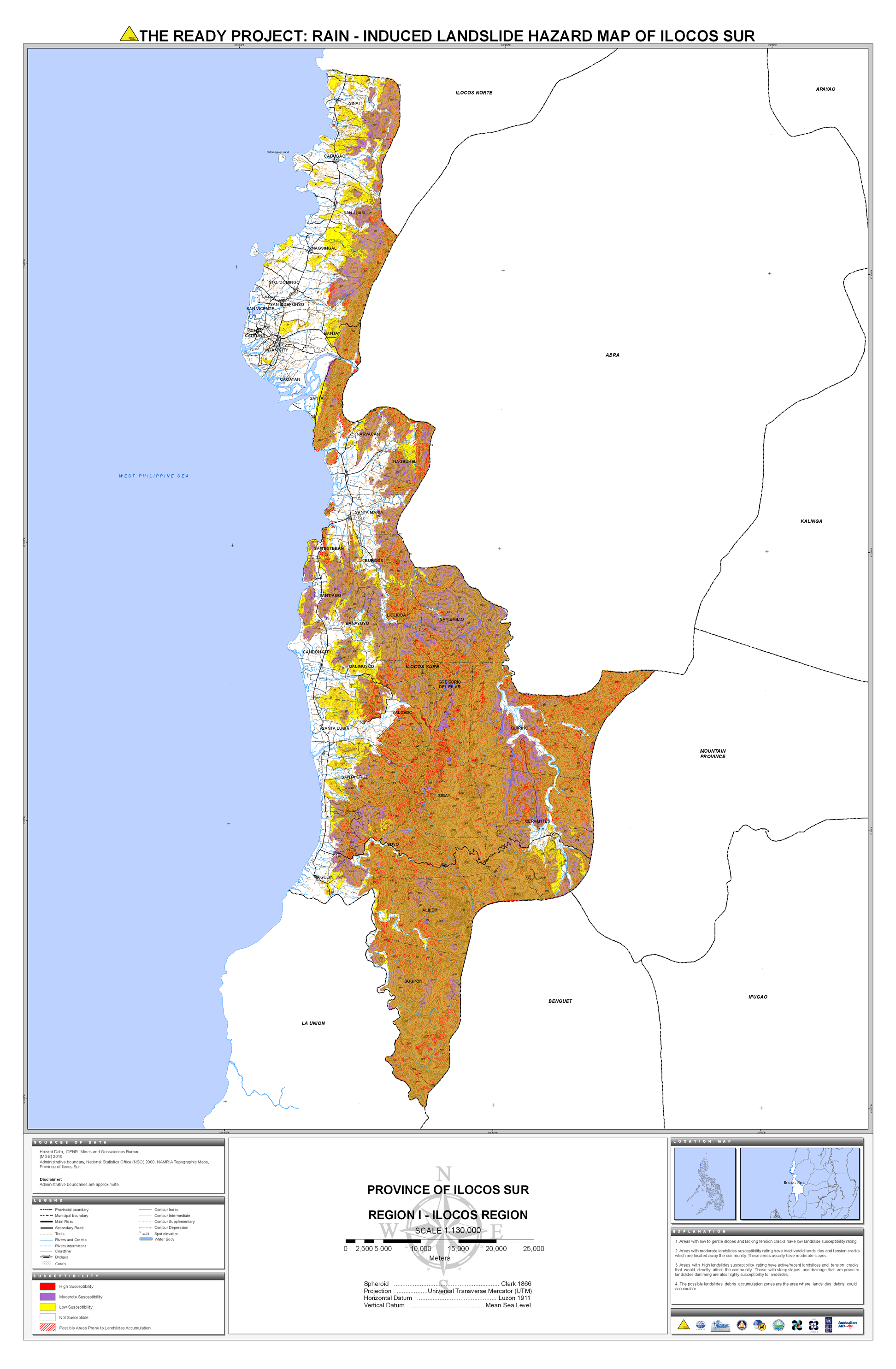
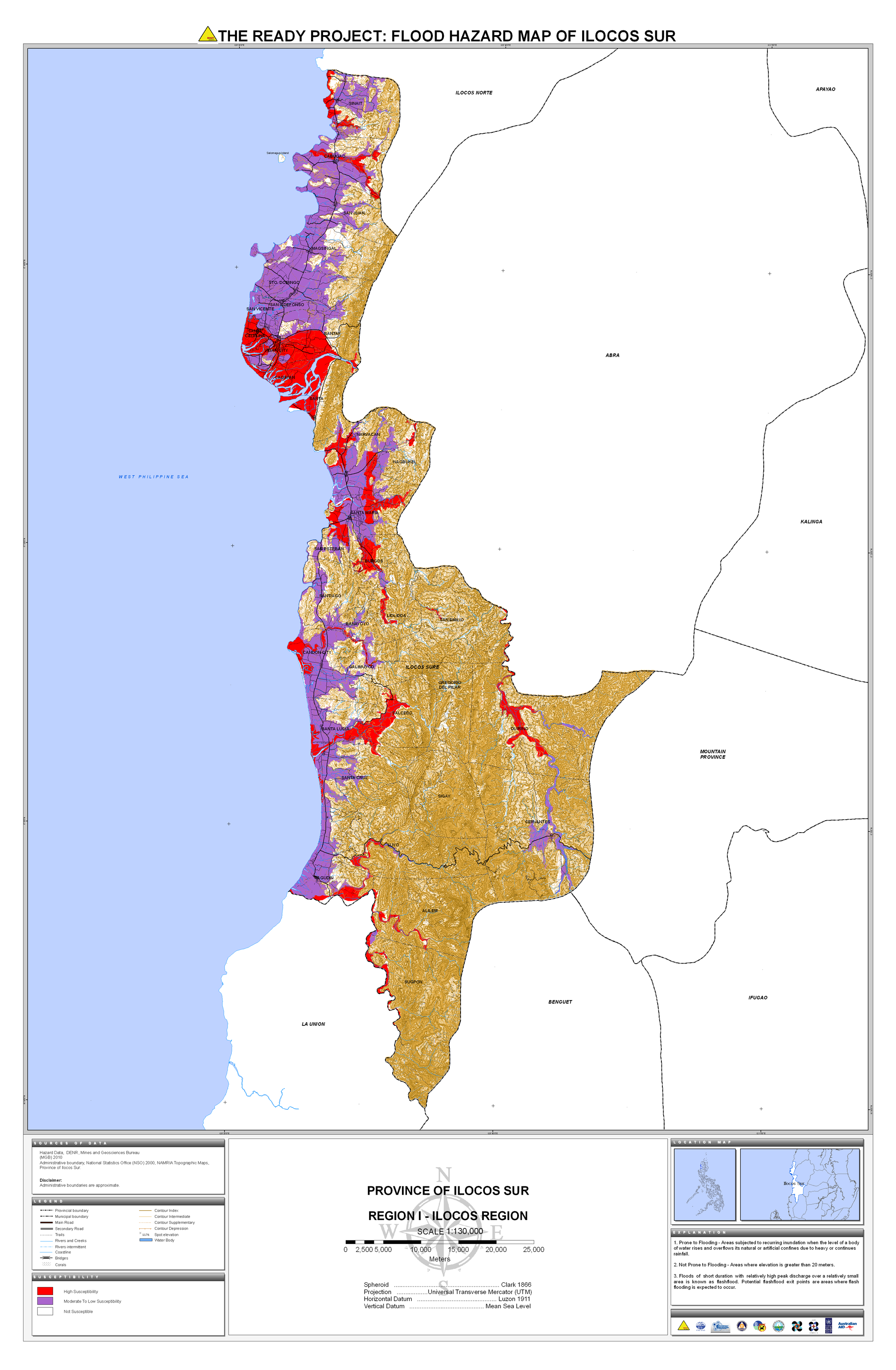
13. Ilocos Sur |
 |
 |
 |
 |
 |
 |
 |
 |
||
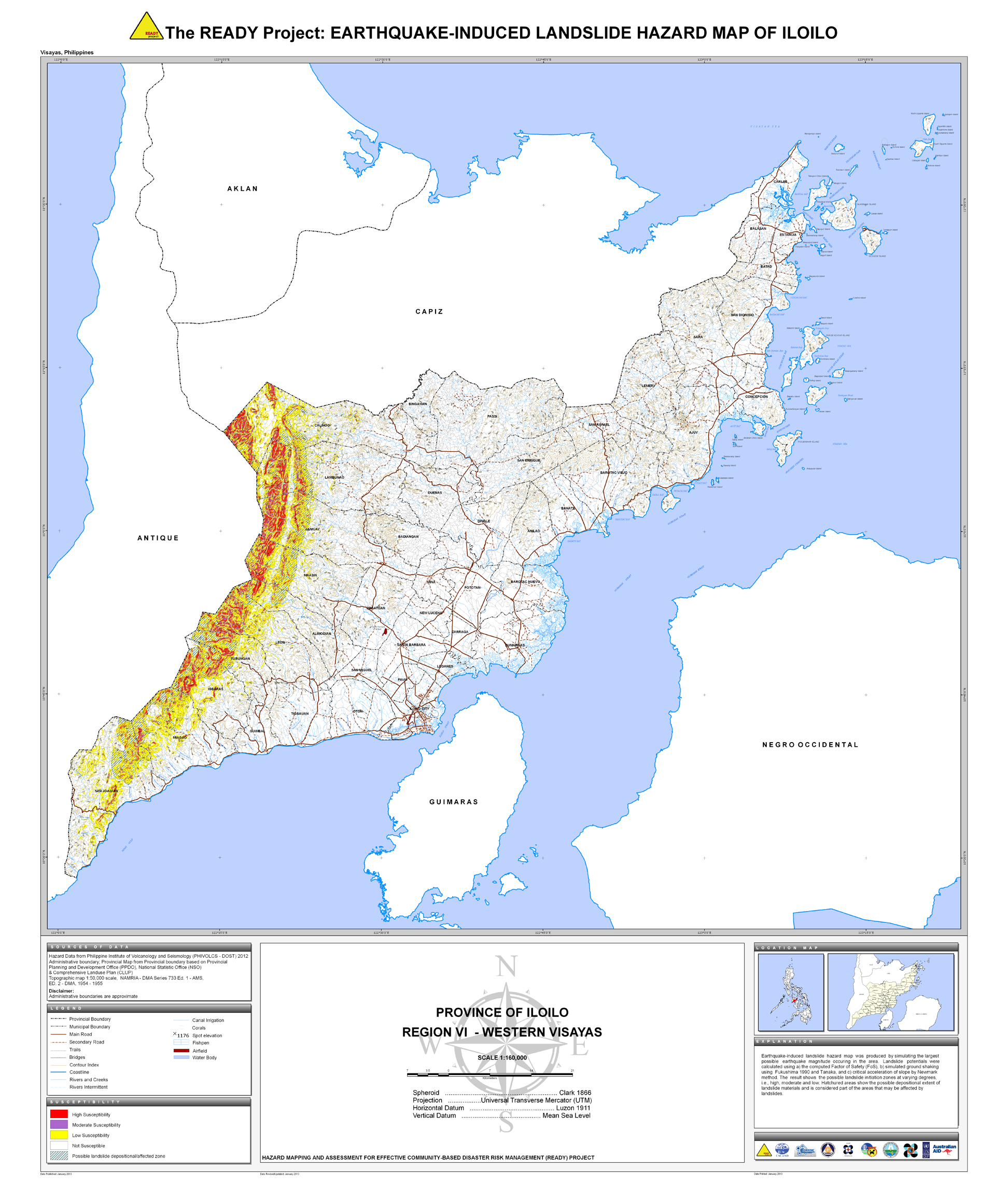
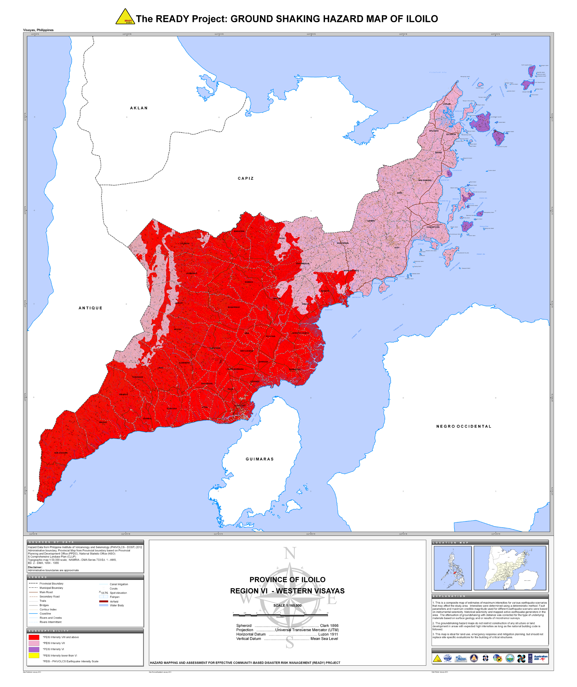
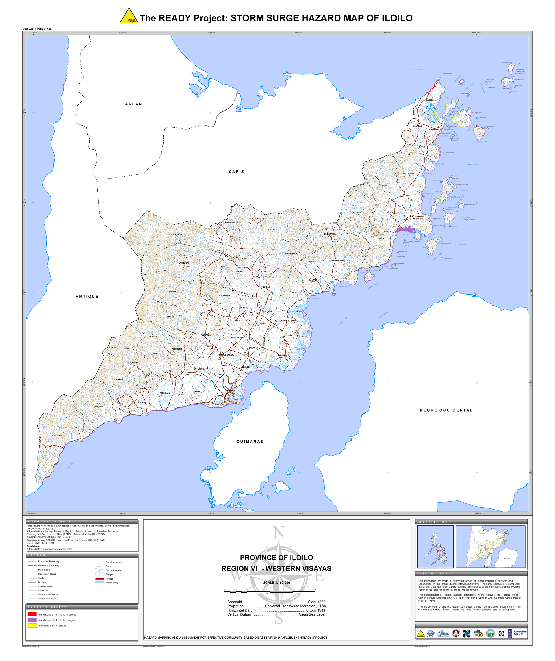
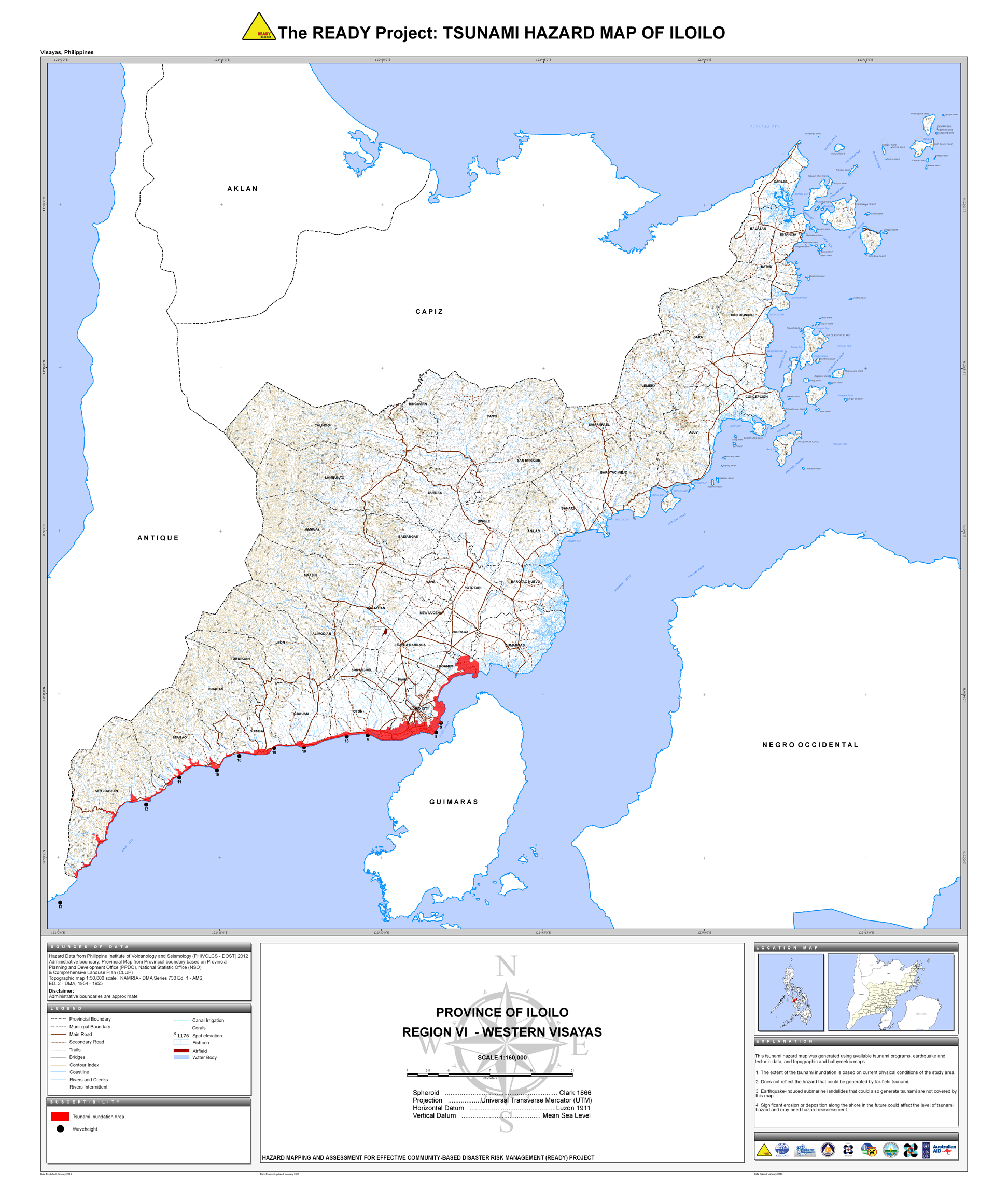
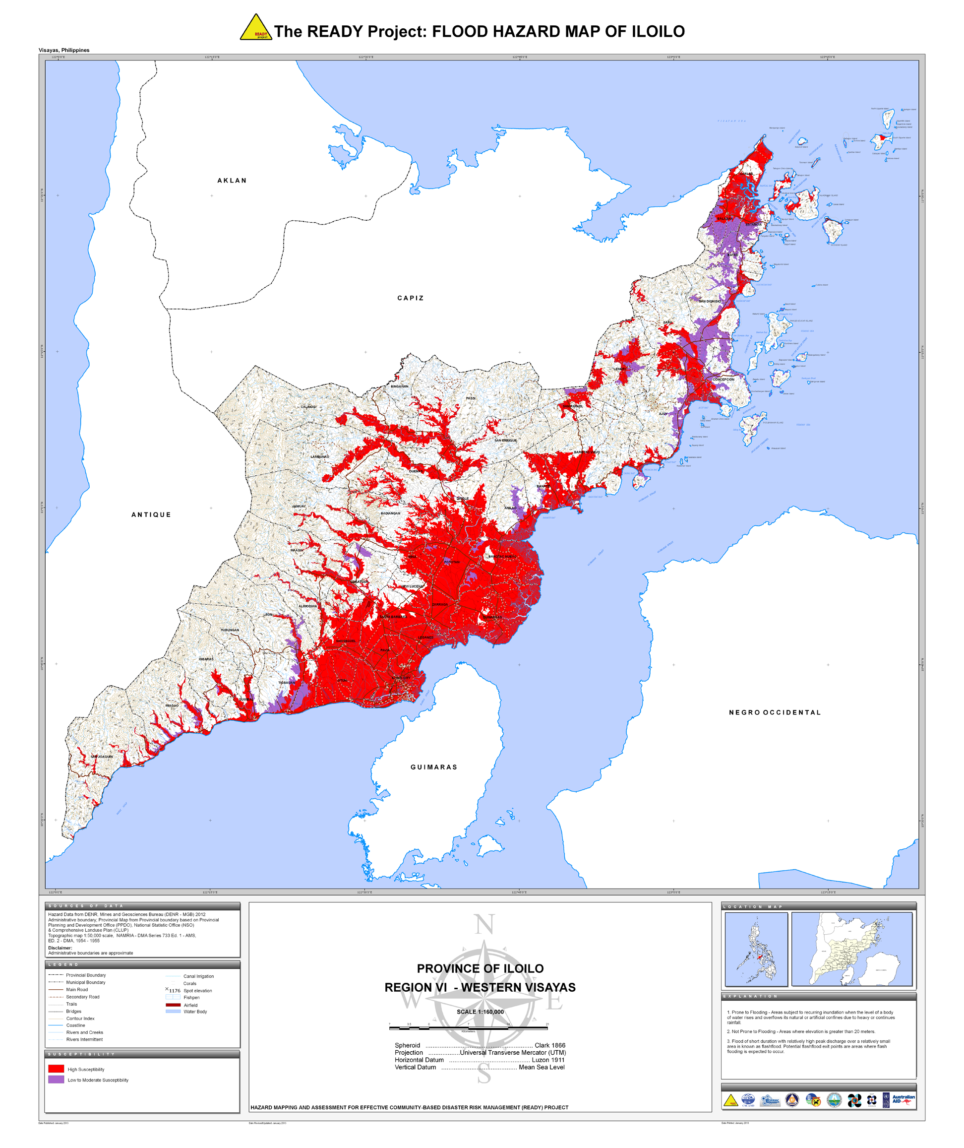
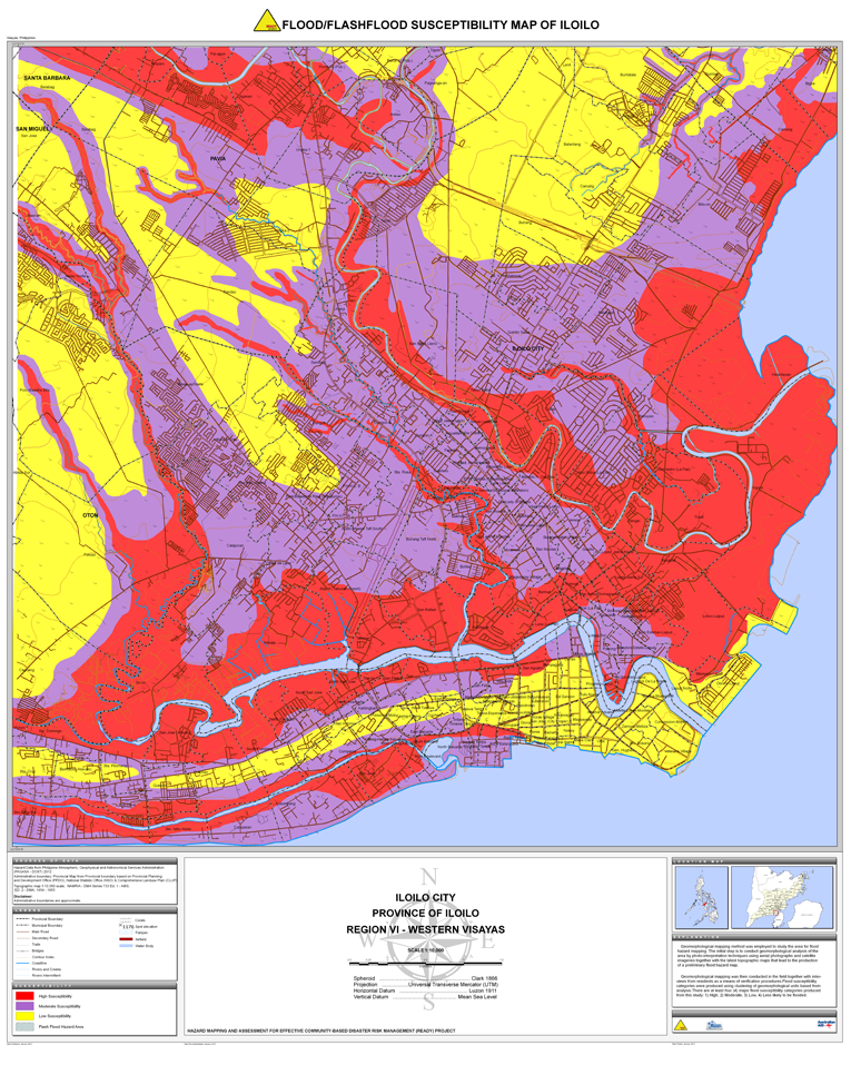
14. Iloilo |
 |
 |
 |
 |
 |
 |
 |
 |
 |
|
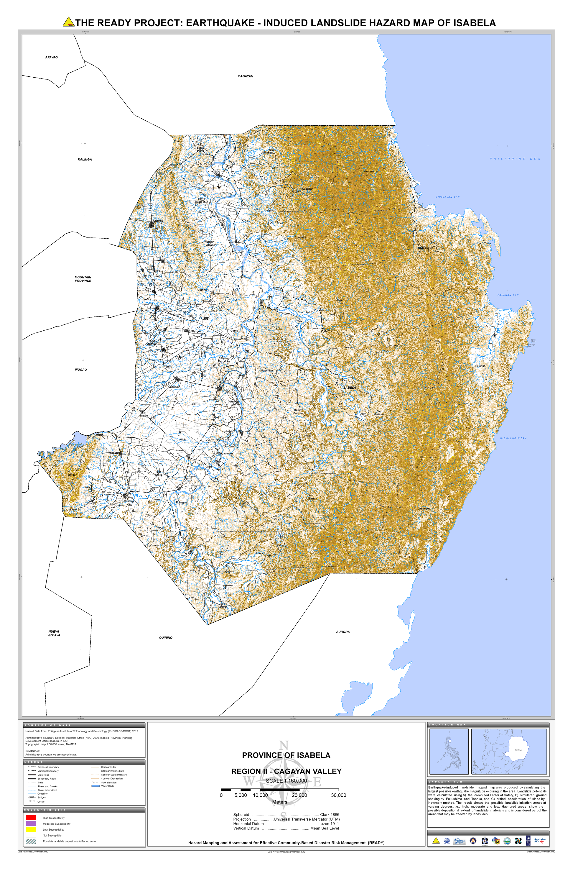
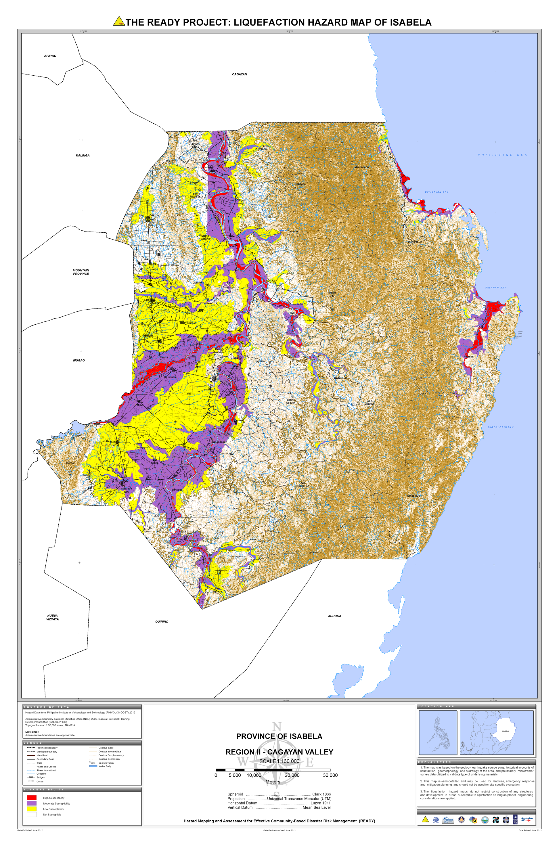
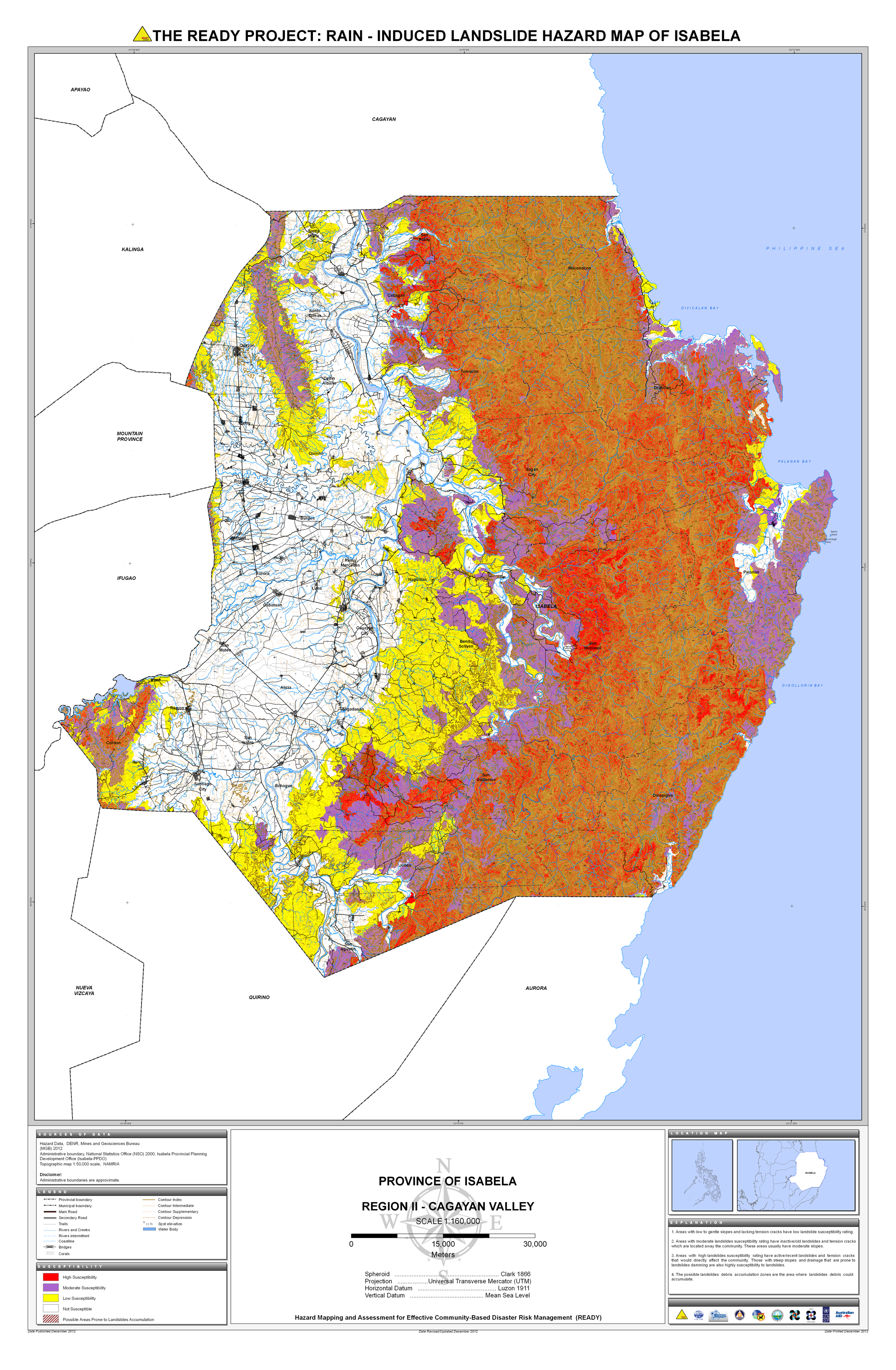
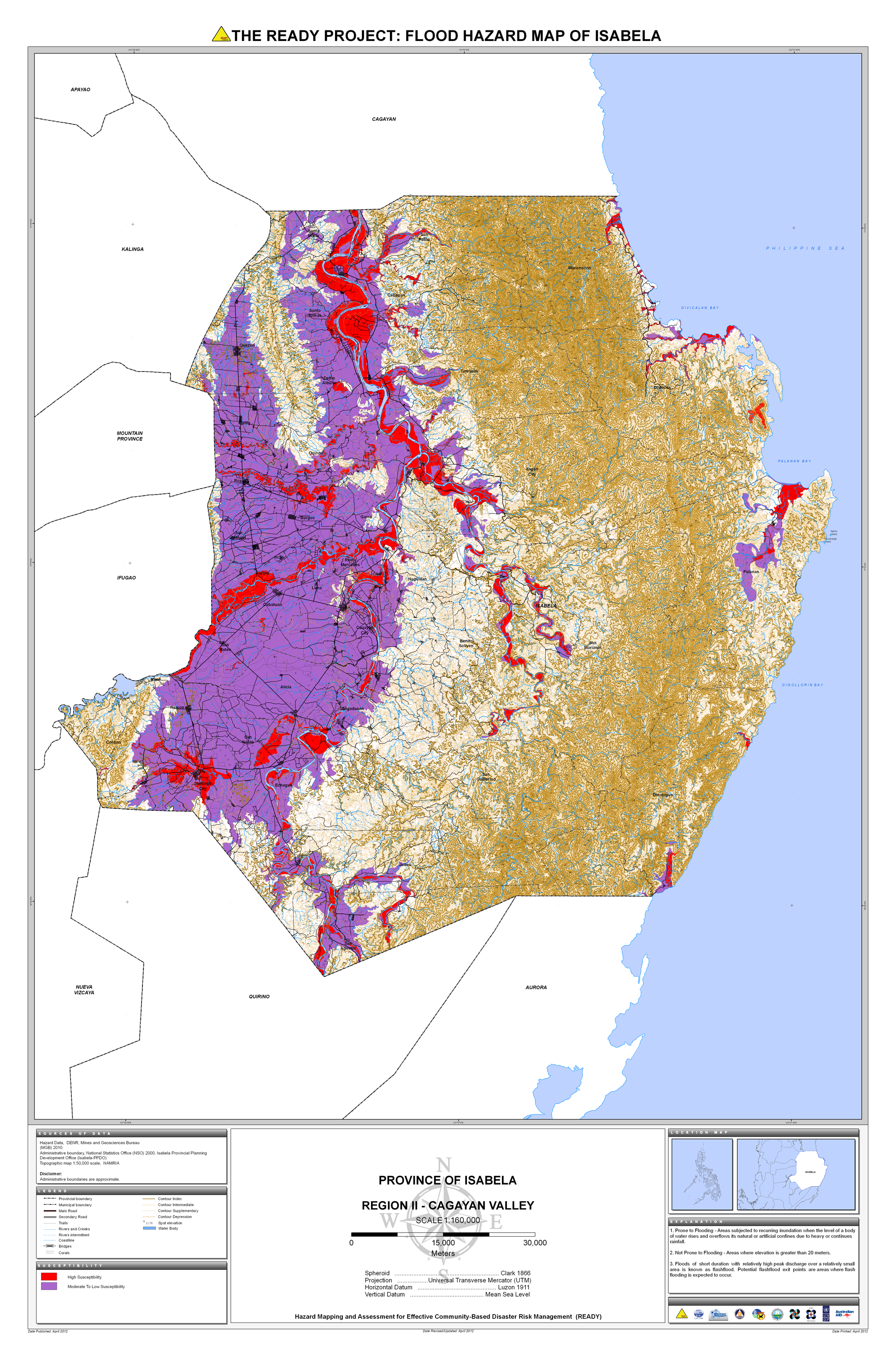
15. Isabela |
 |
 |
 |
 |
 |
 |
 |
* |
||
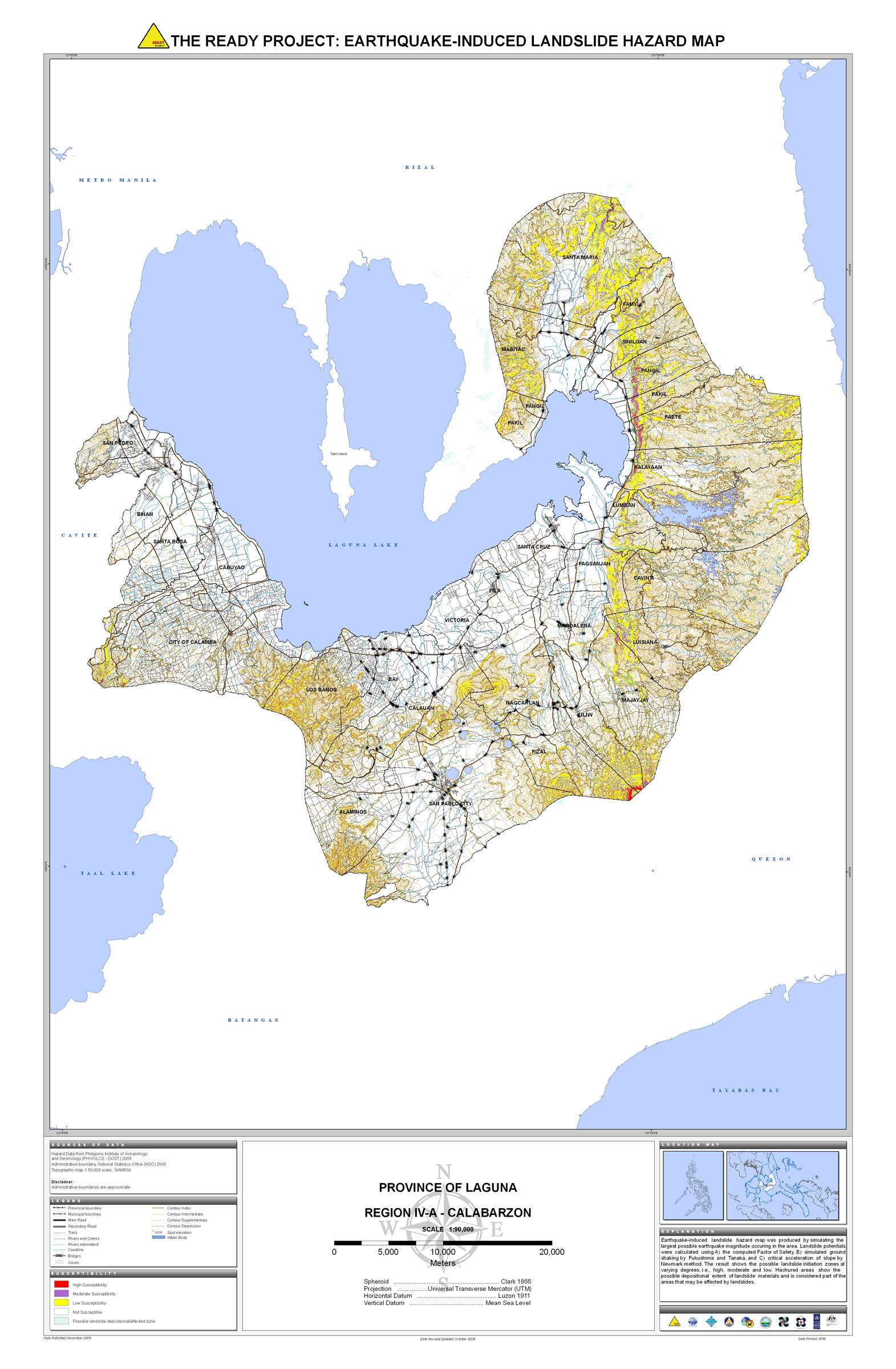
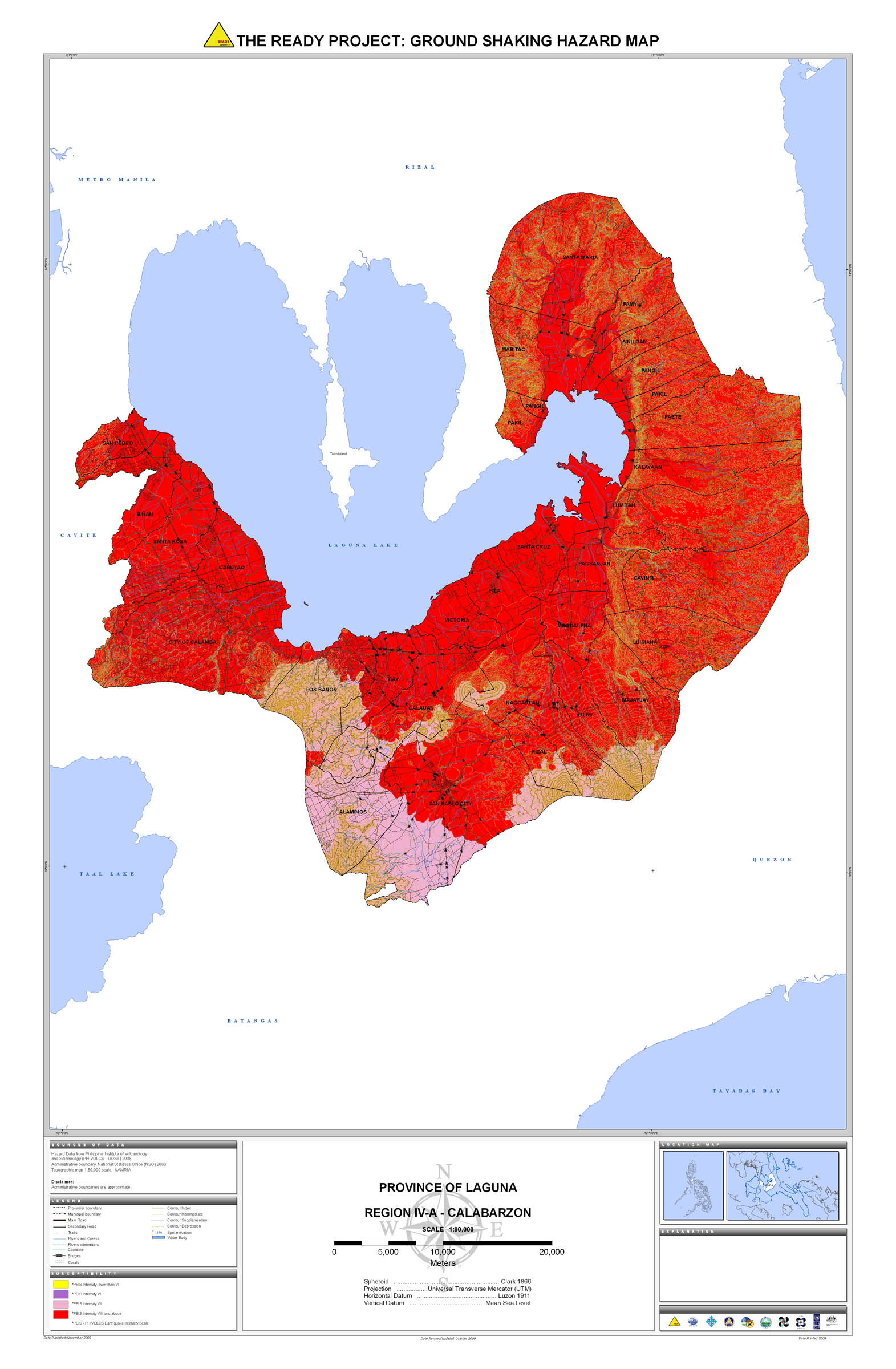
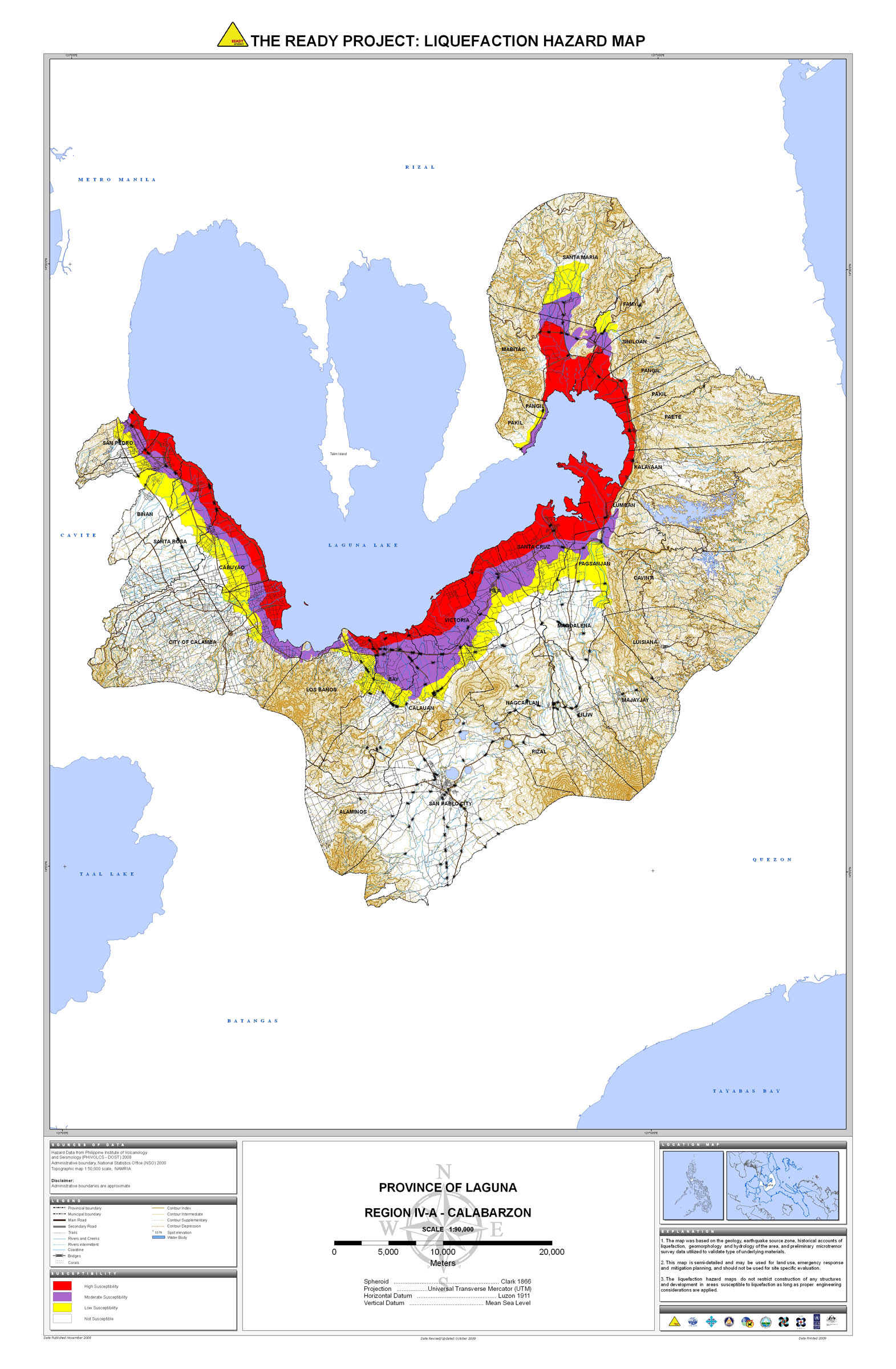
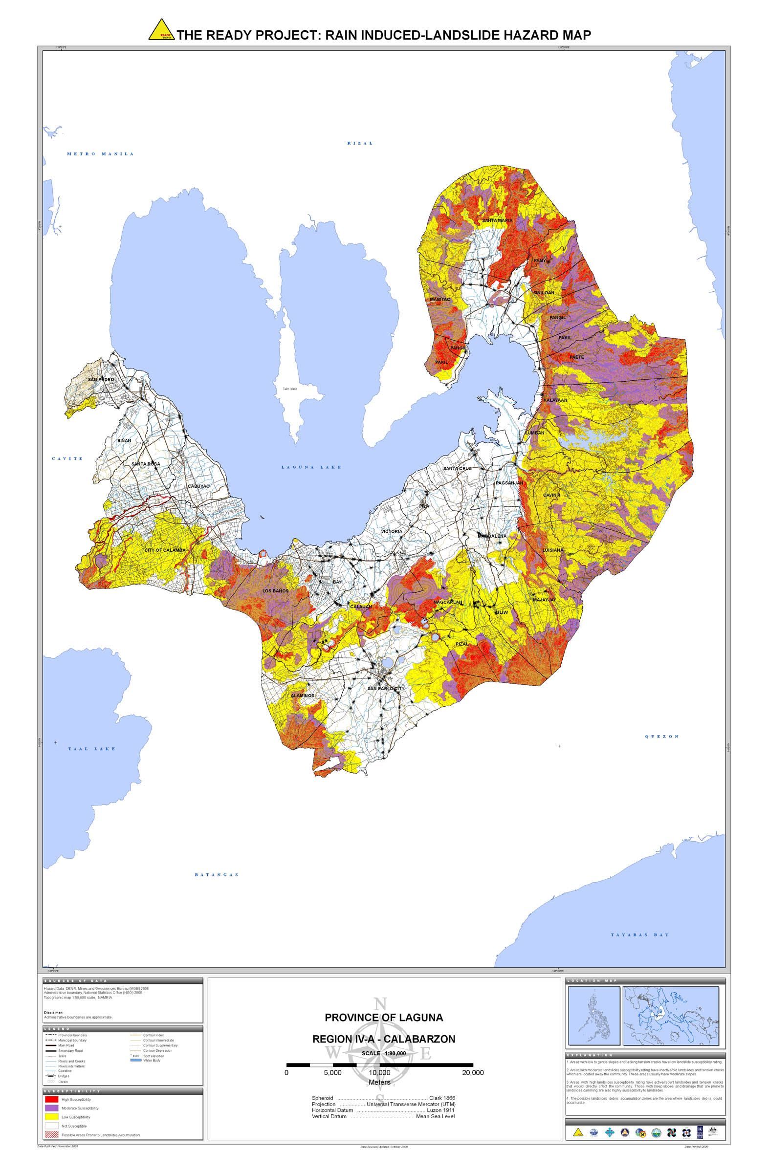
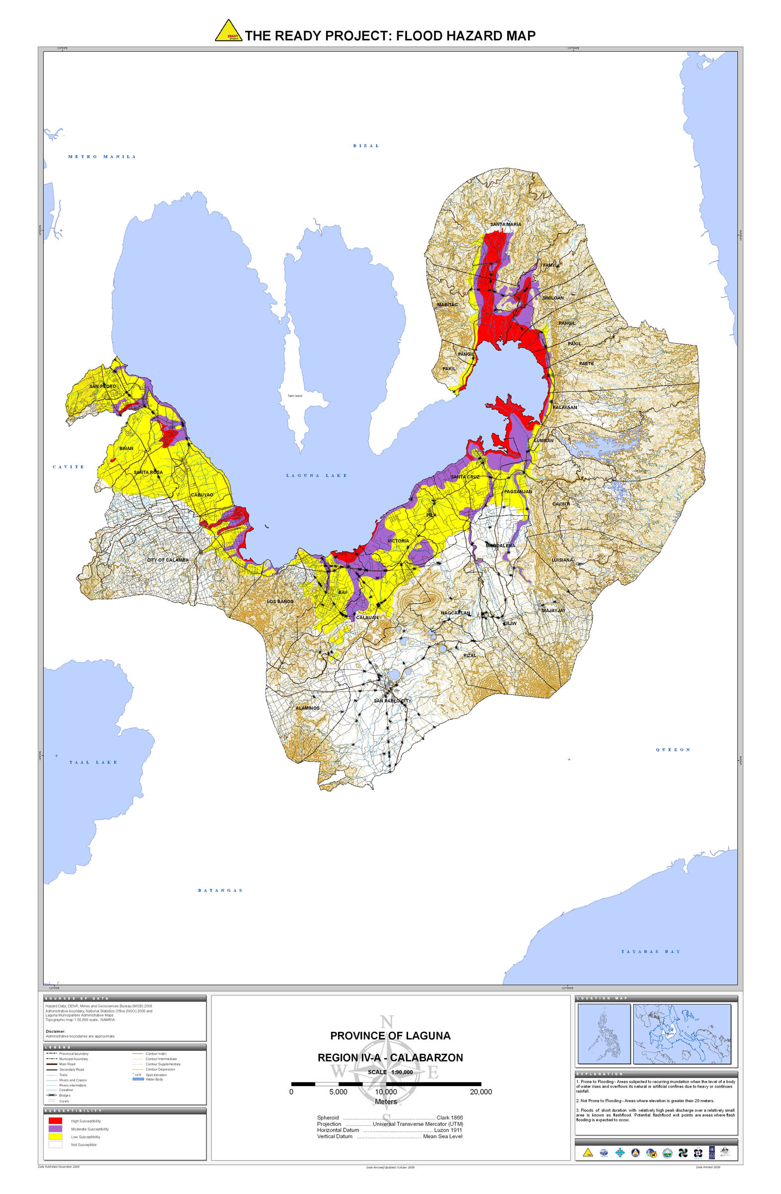
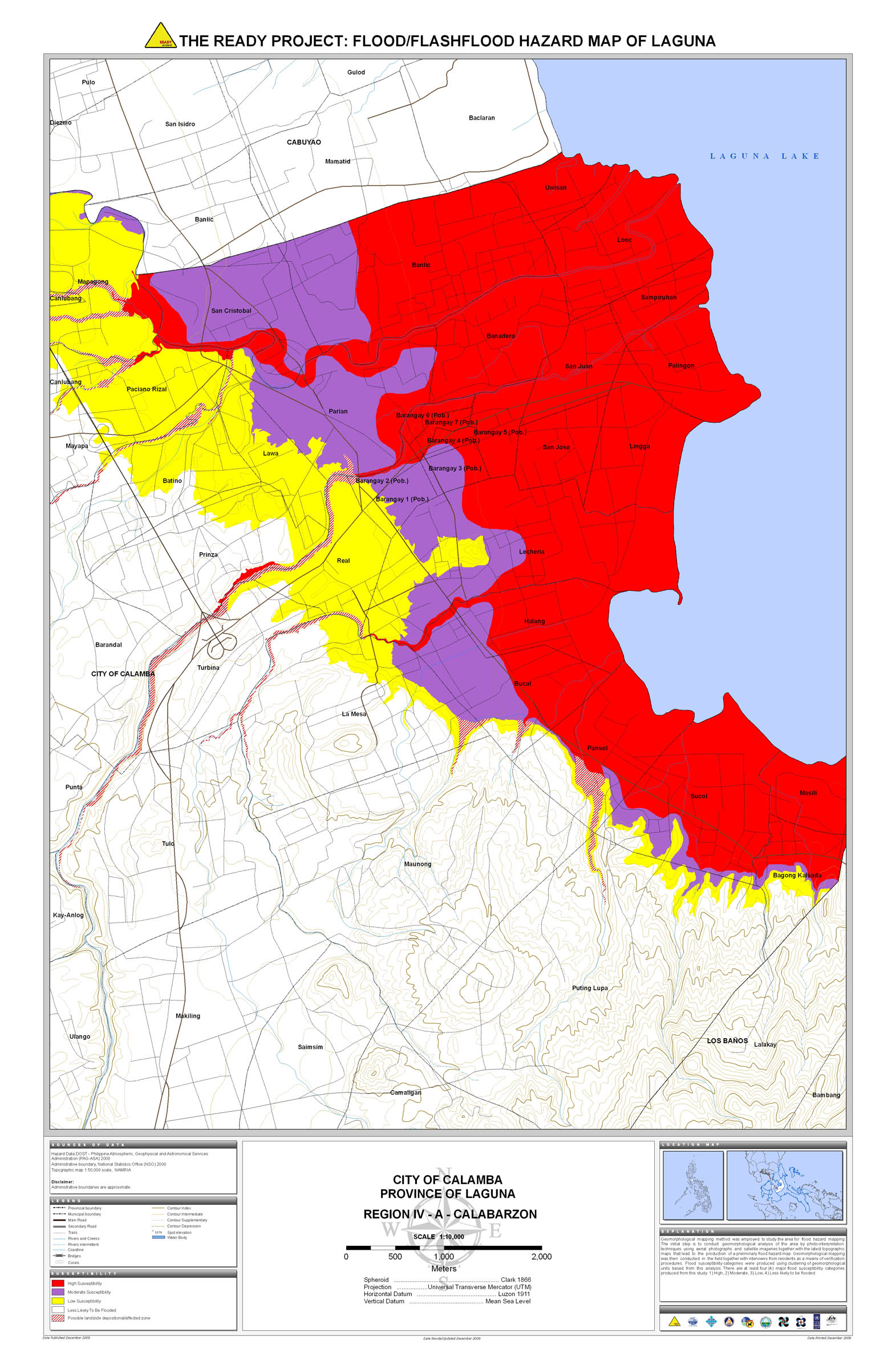
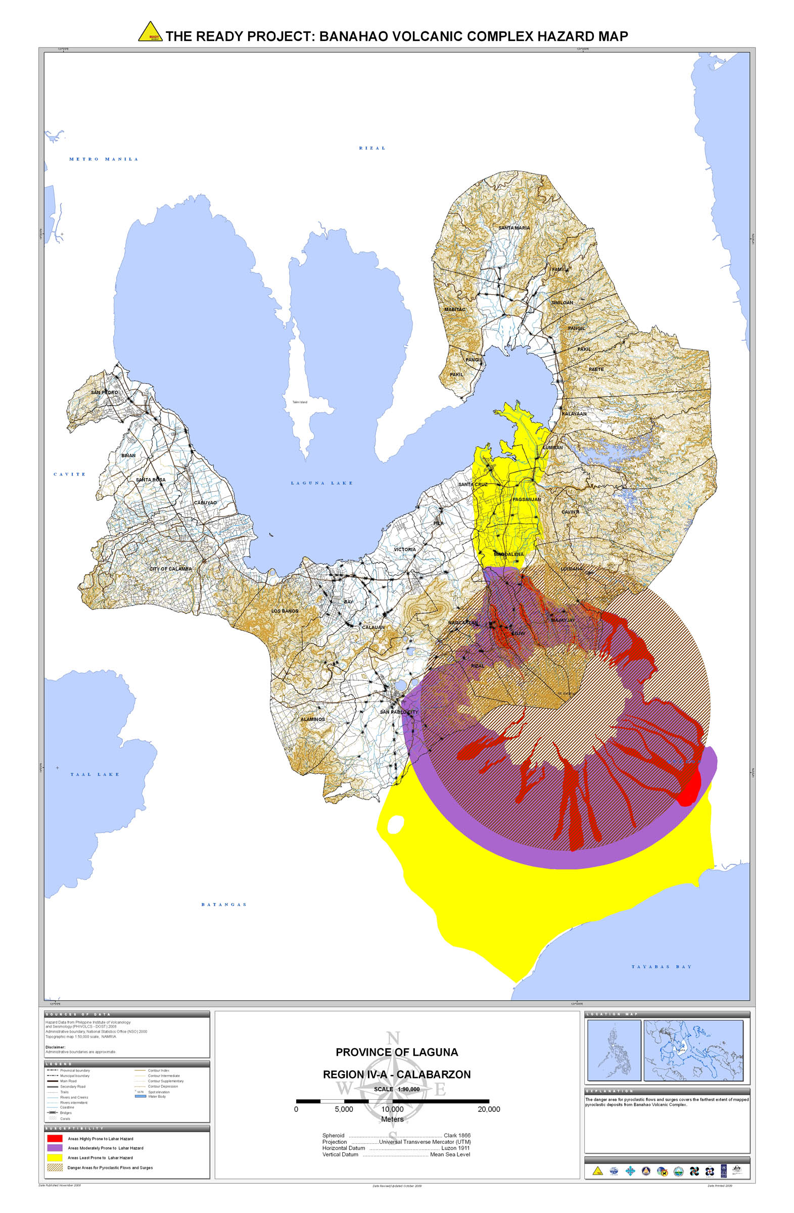
16. Laguna |
 |
 |
 |
 |
 |
 |
 |
 | ||
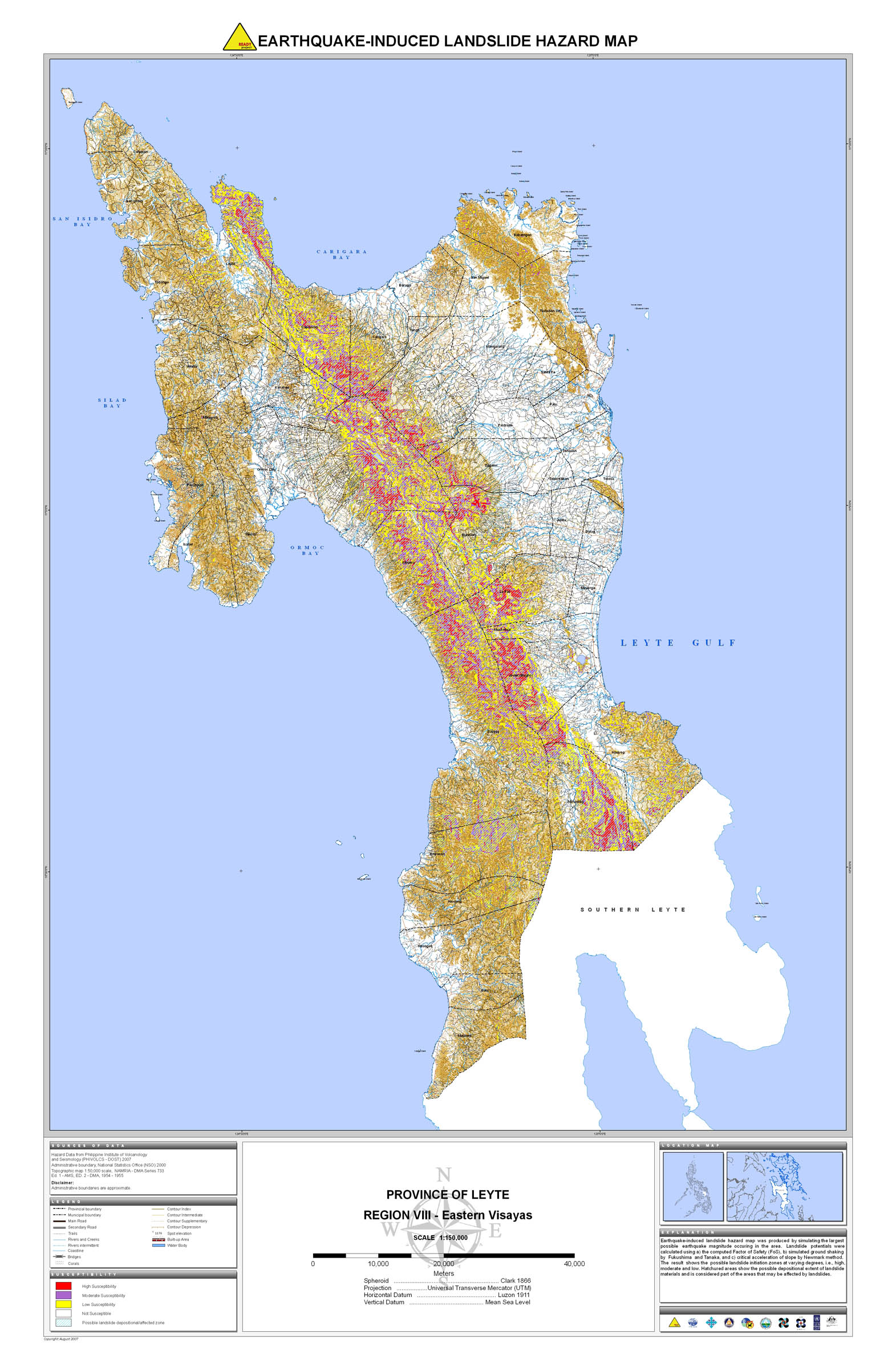
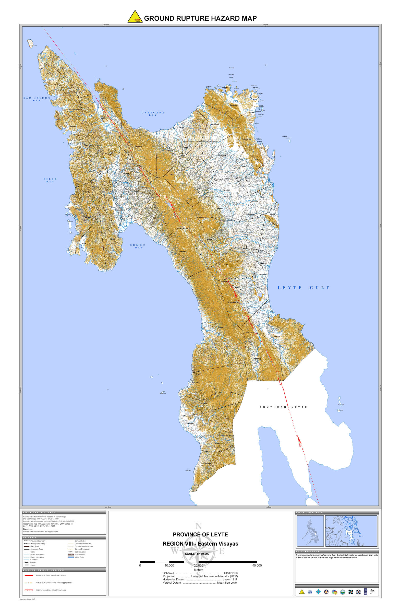
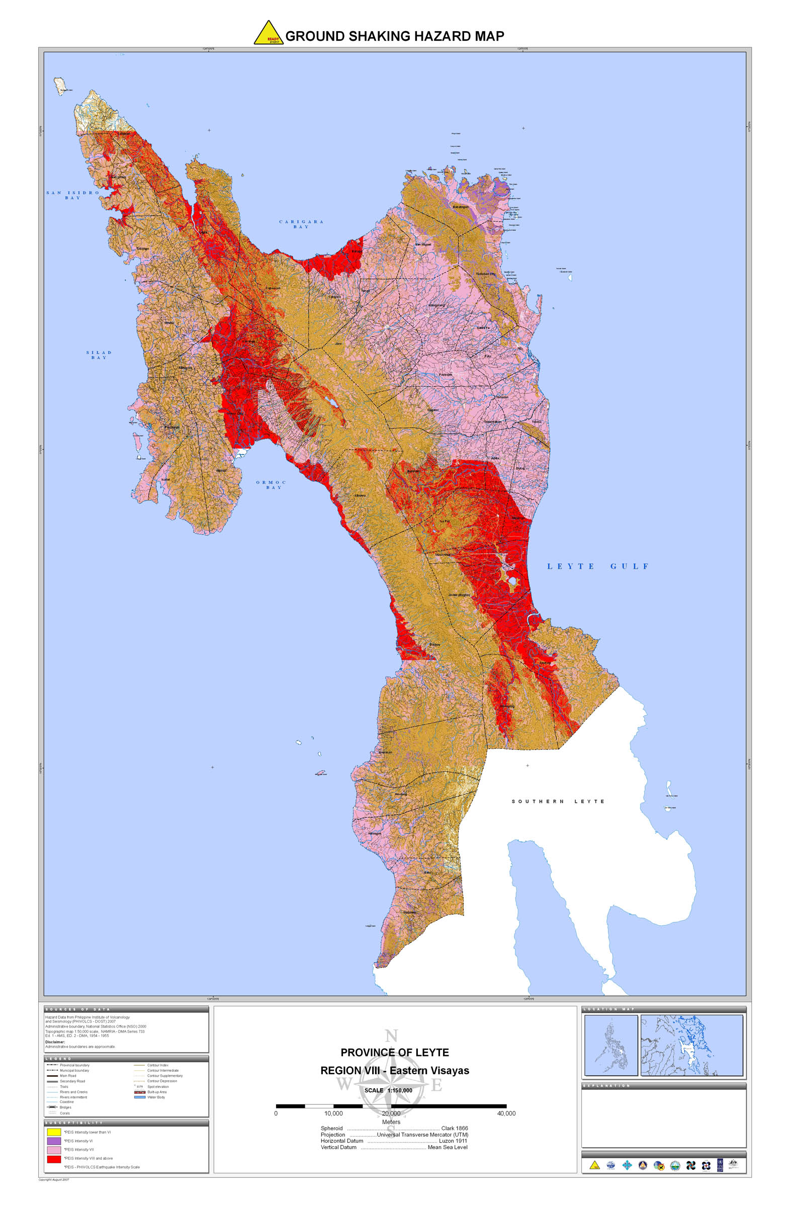
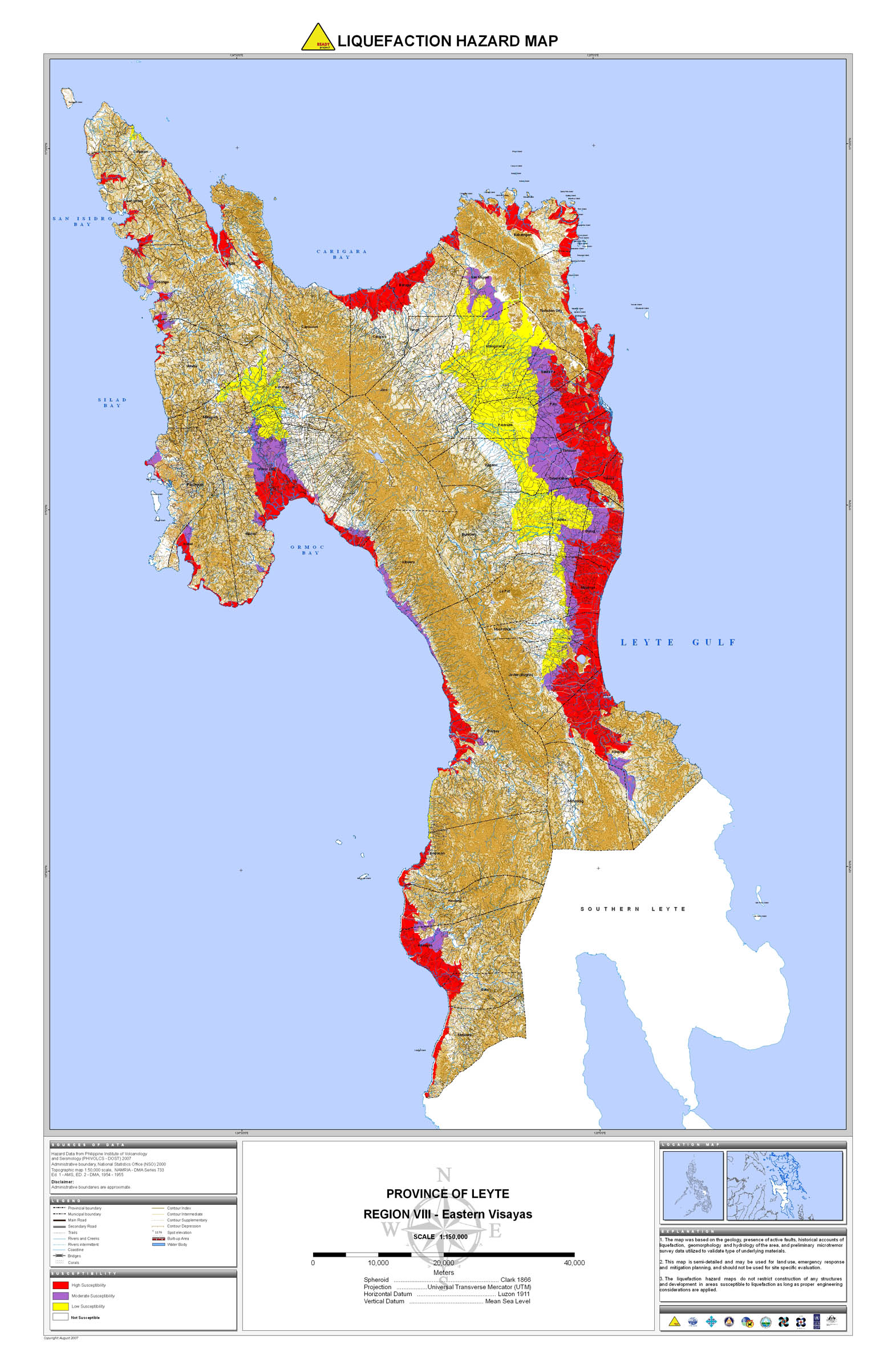
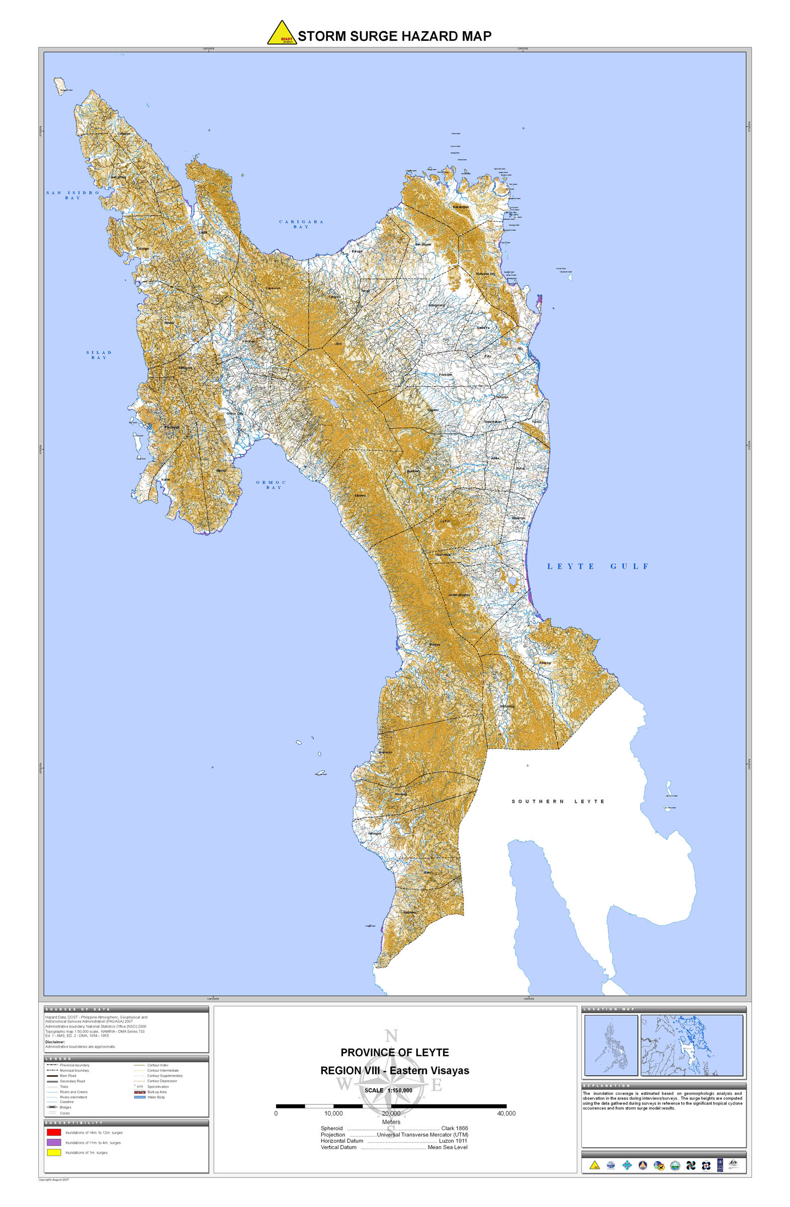
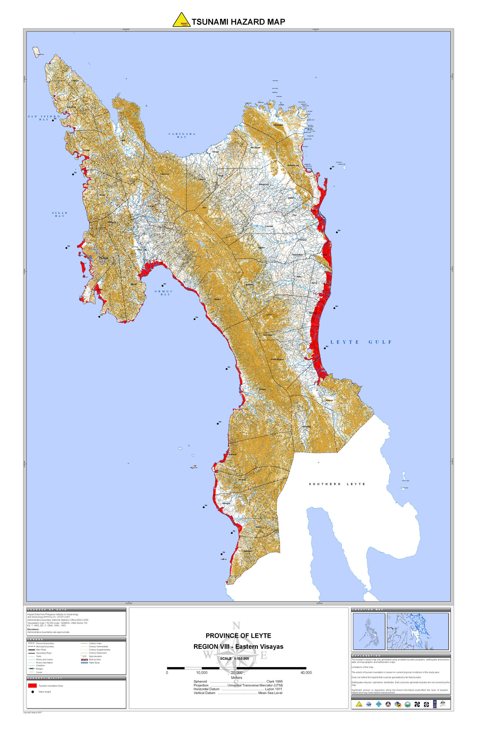
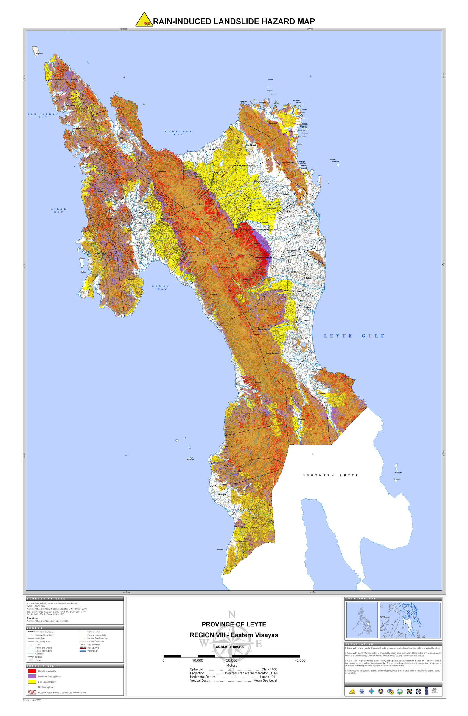
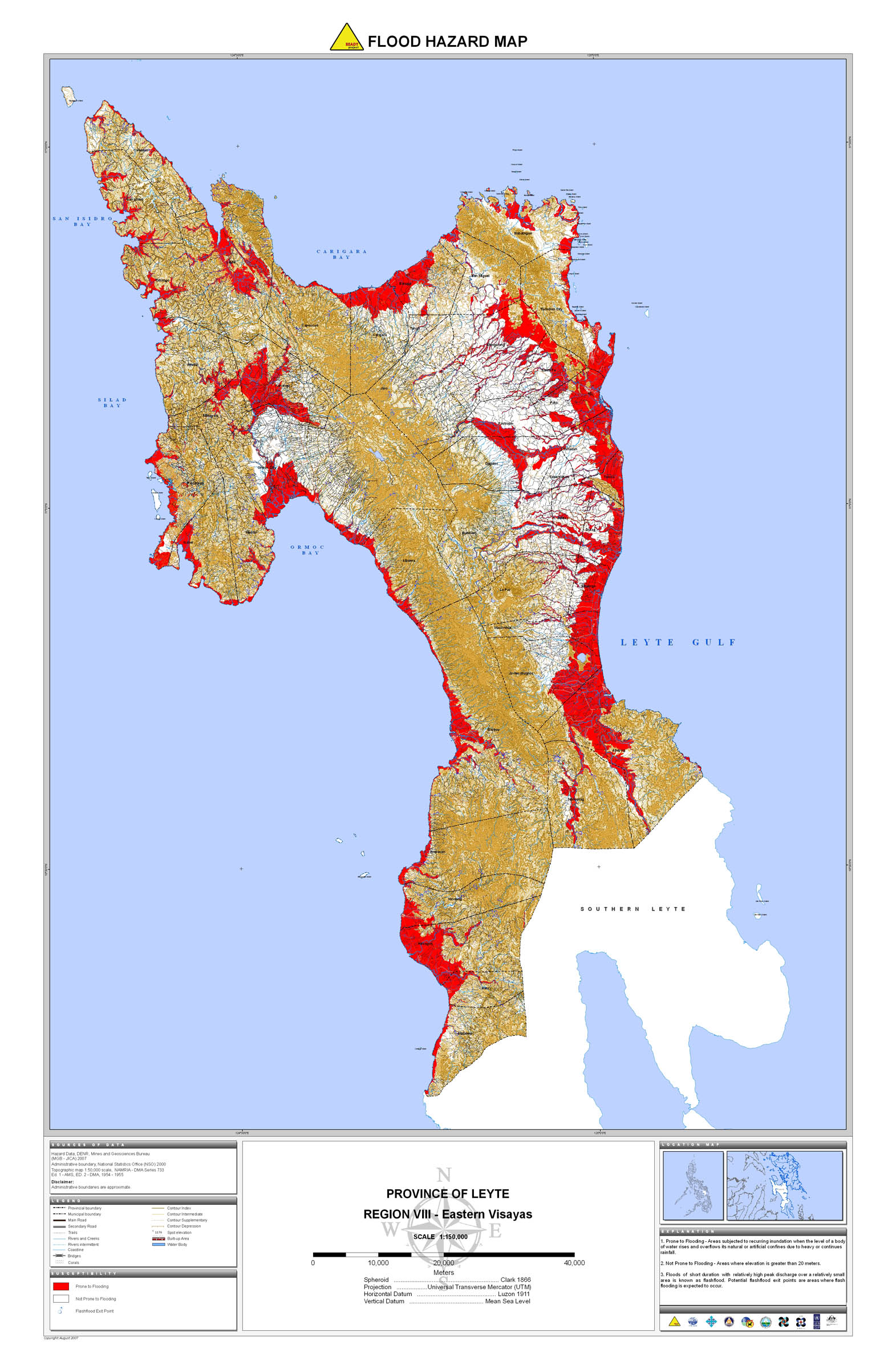
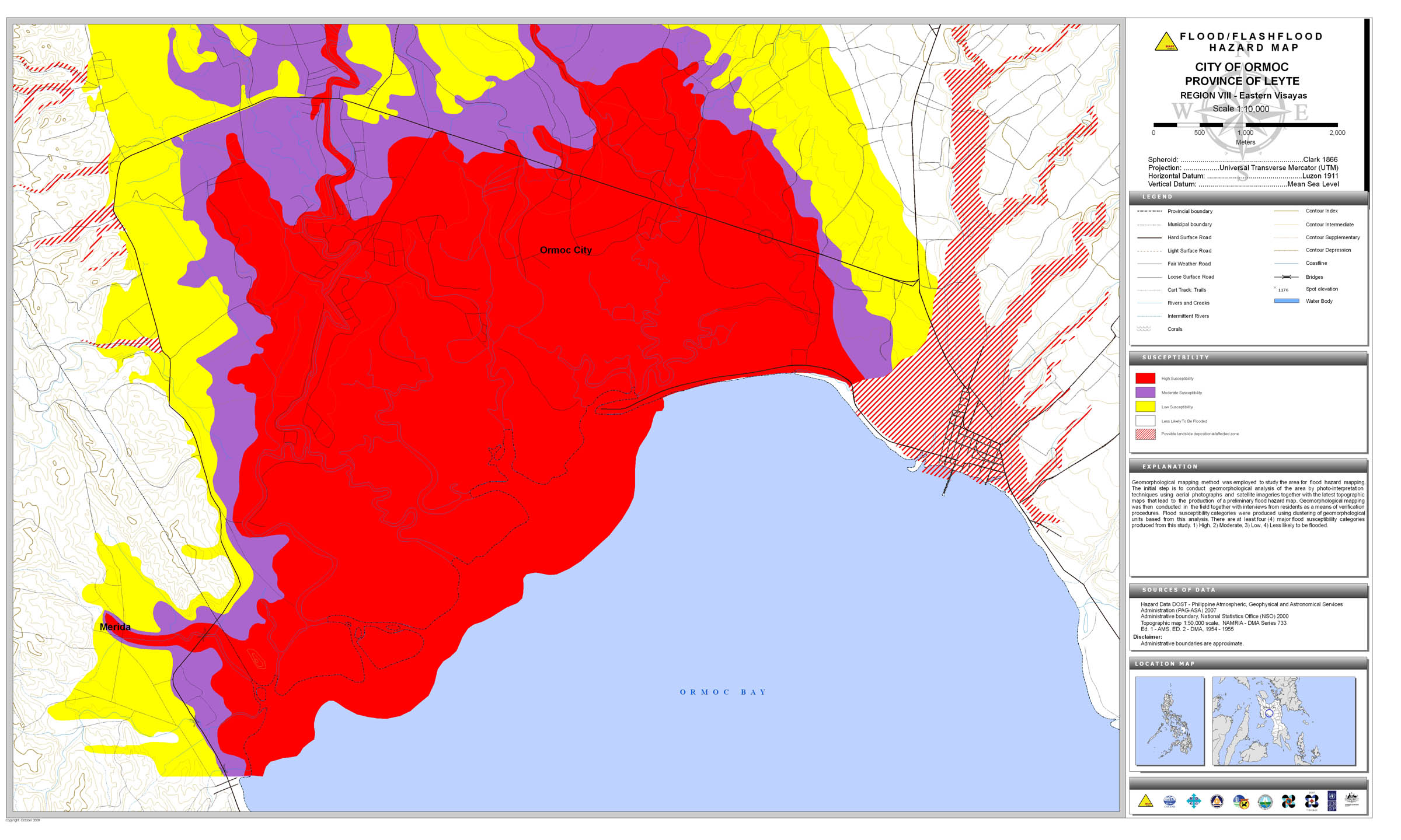
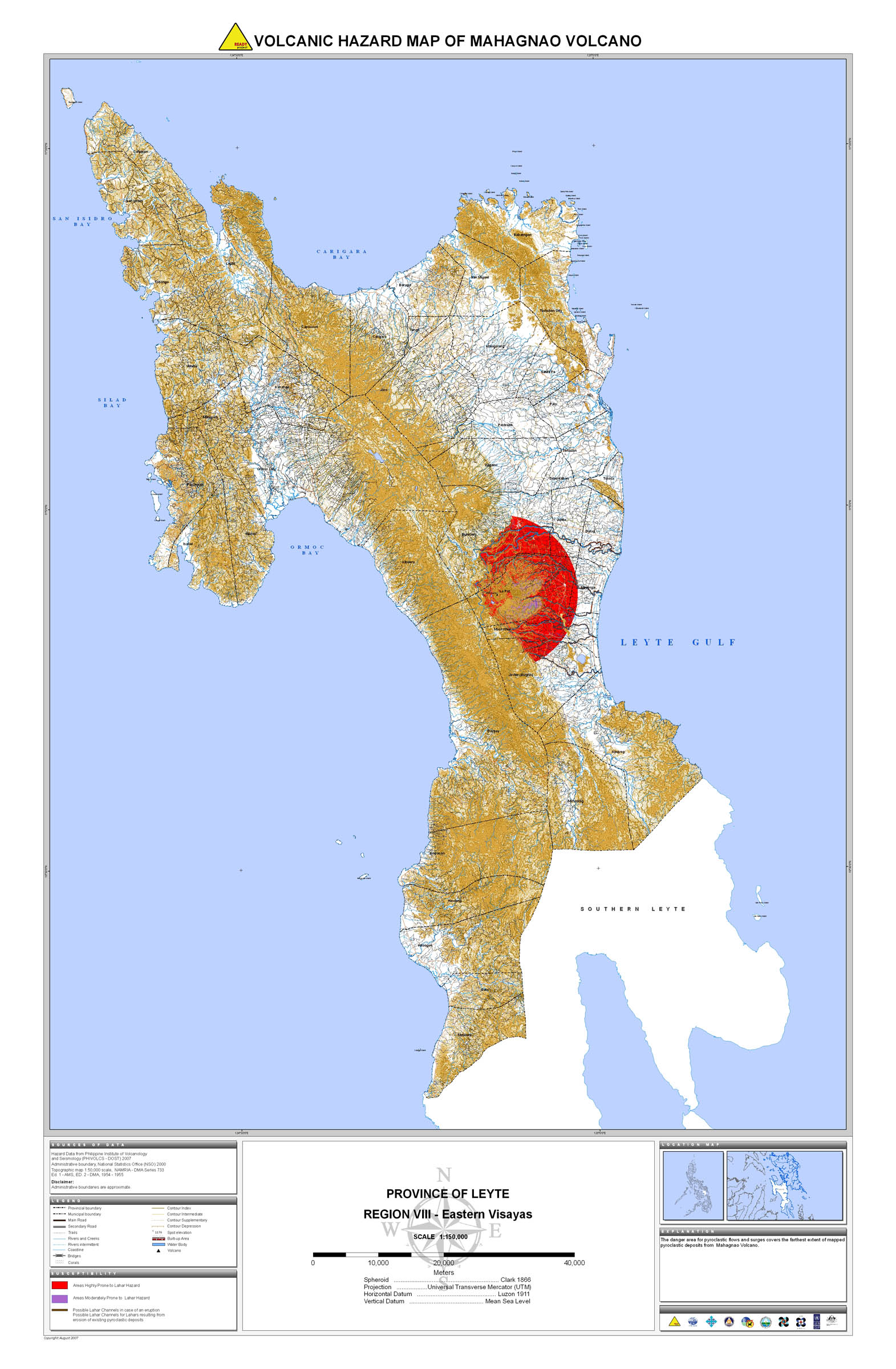
17. Leyte |
 |
 |
 |
 |
 |
 |
 |
 |
 |
 |
18. Northern Samar |
 |
 |
 |
 |
 |
 |
 |
 |
||
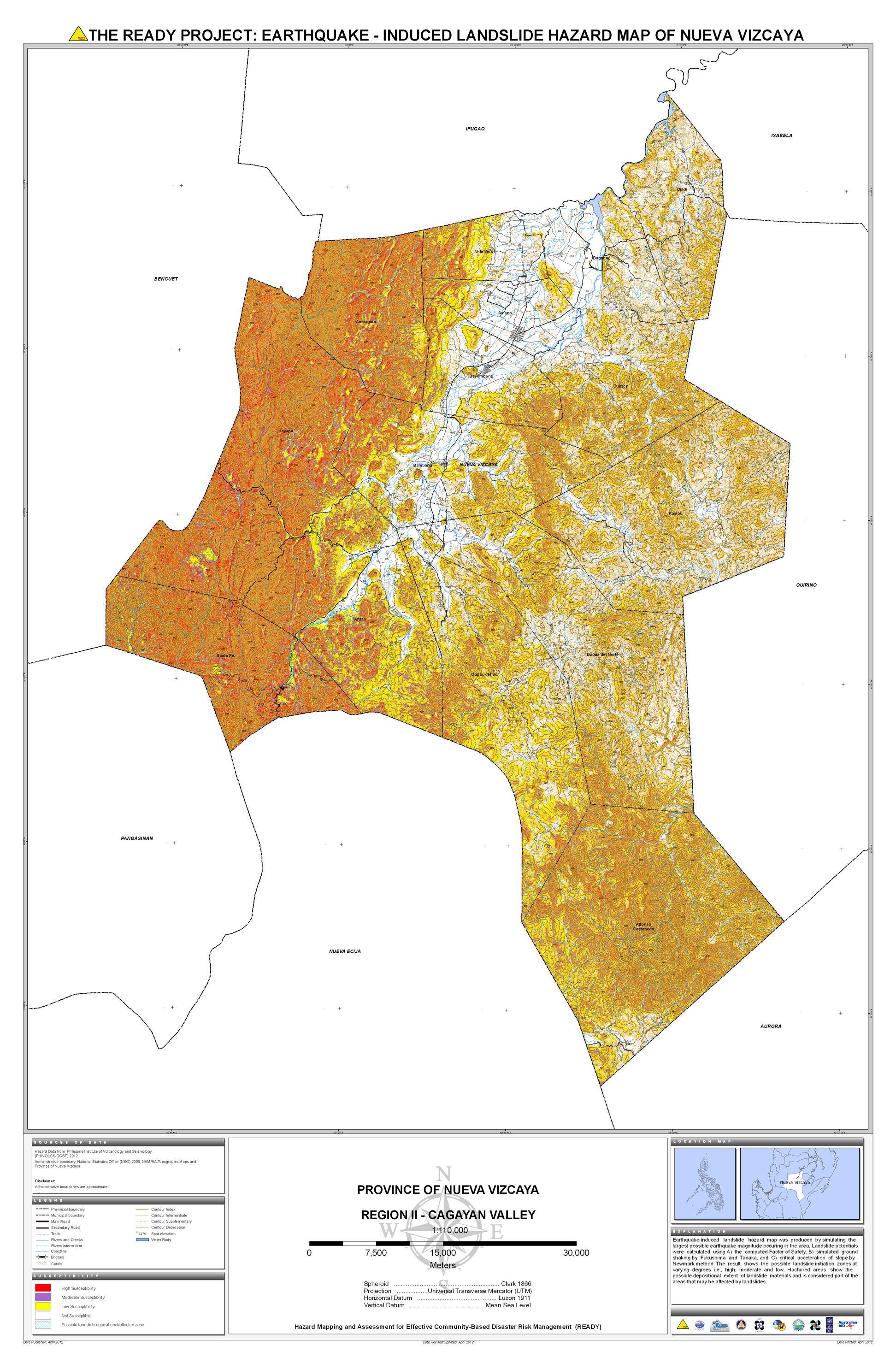
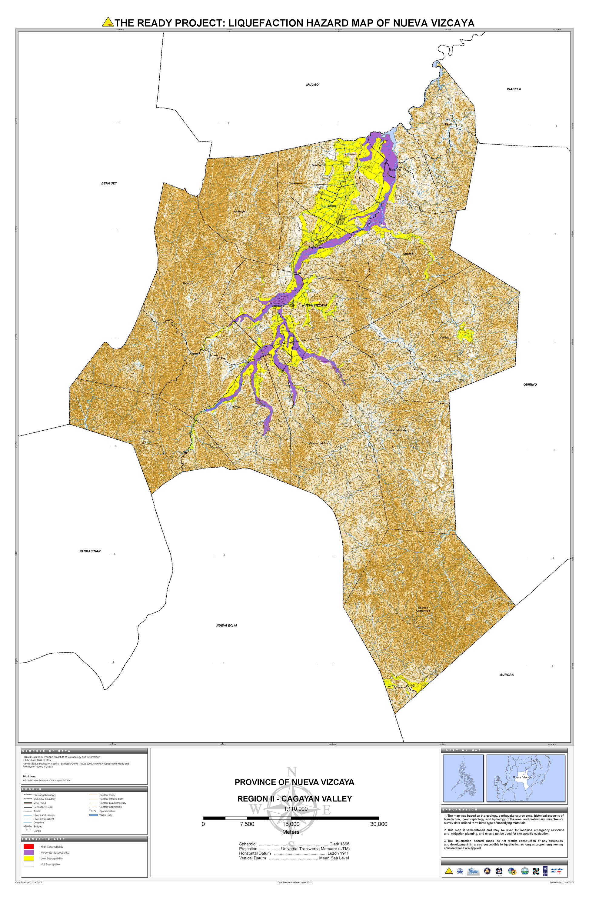
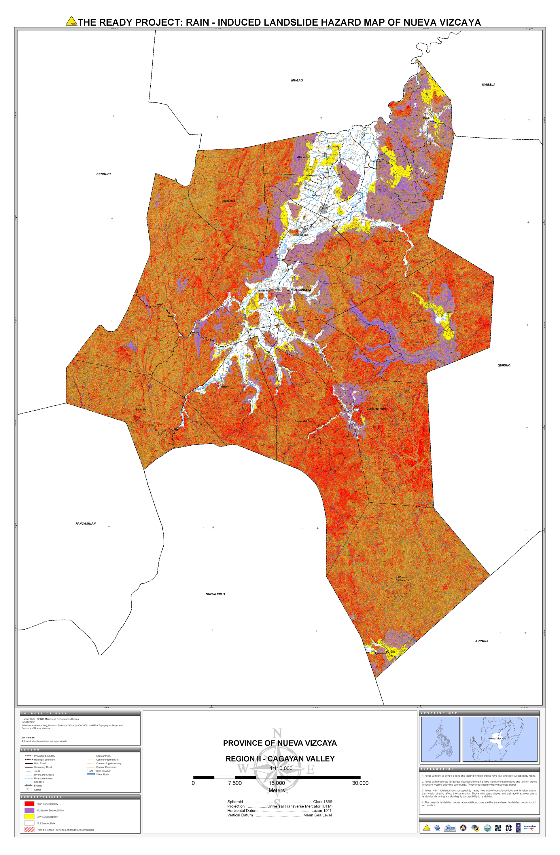
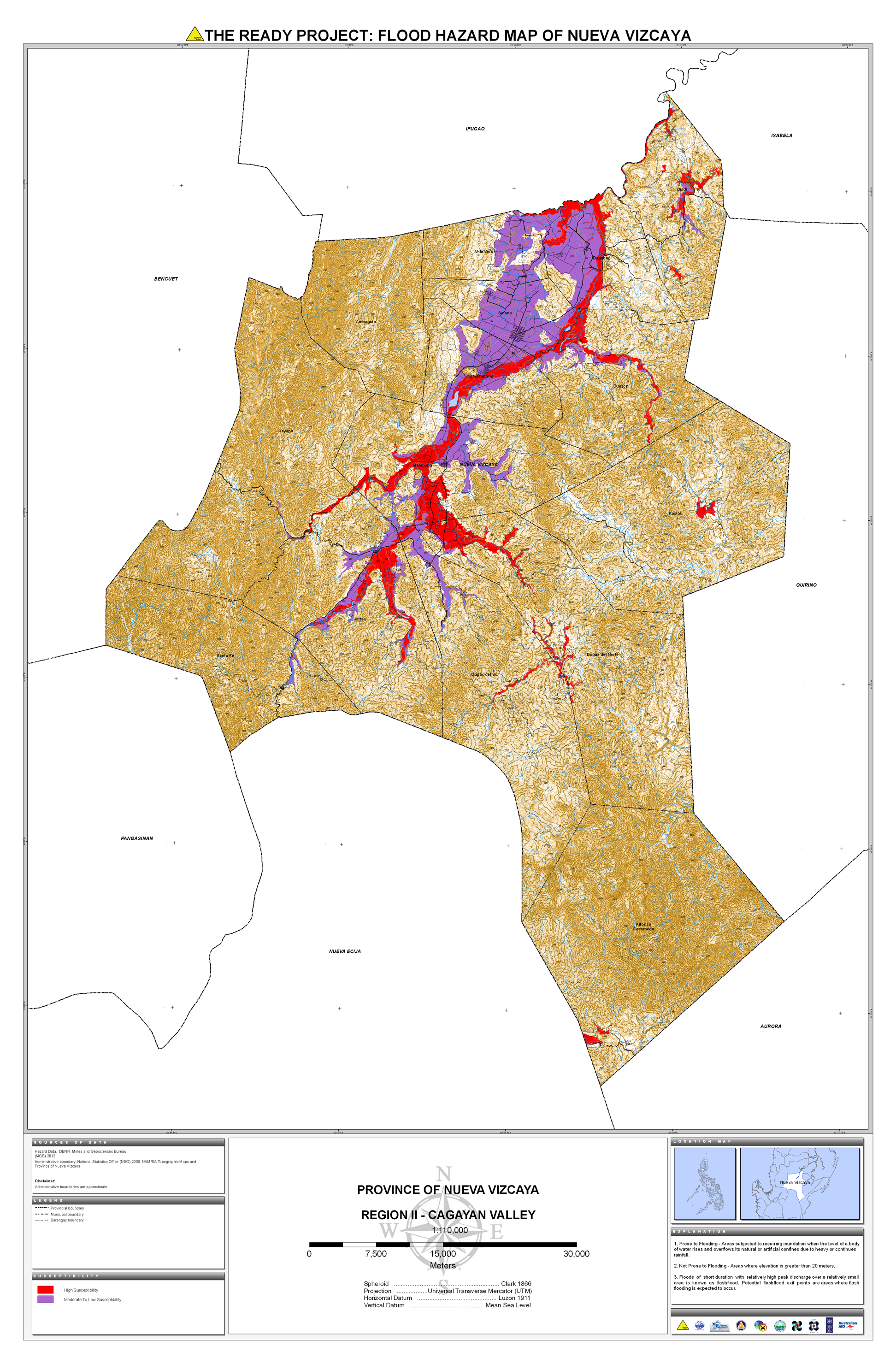
19. Nueva Viscaya |
 |
 |
 |
 |
 |
 |
||||
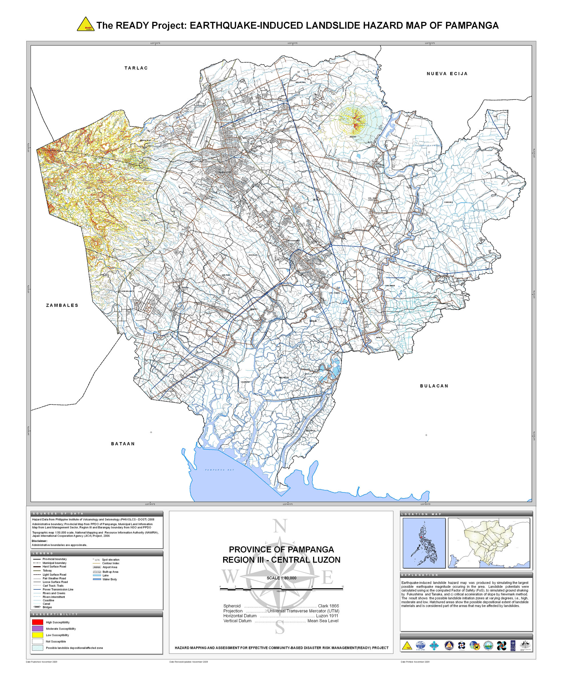
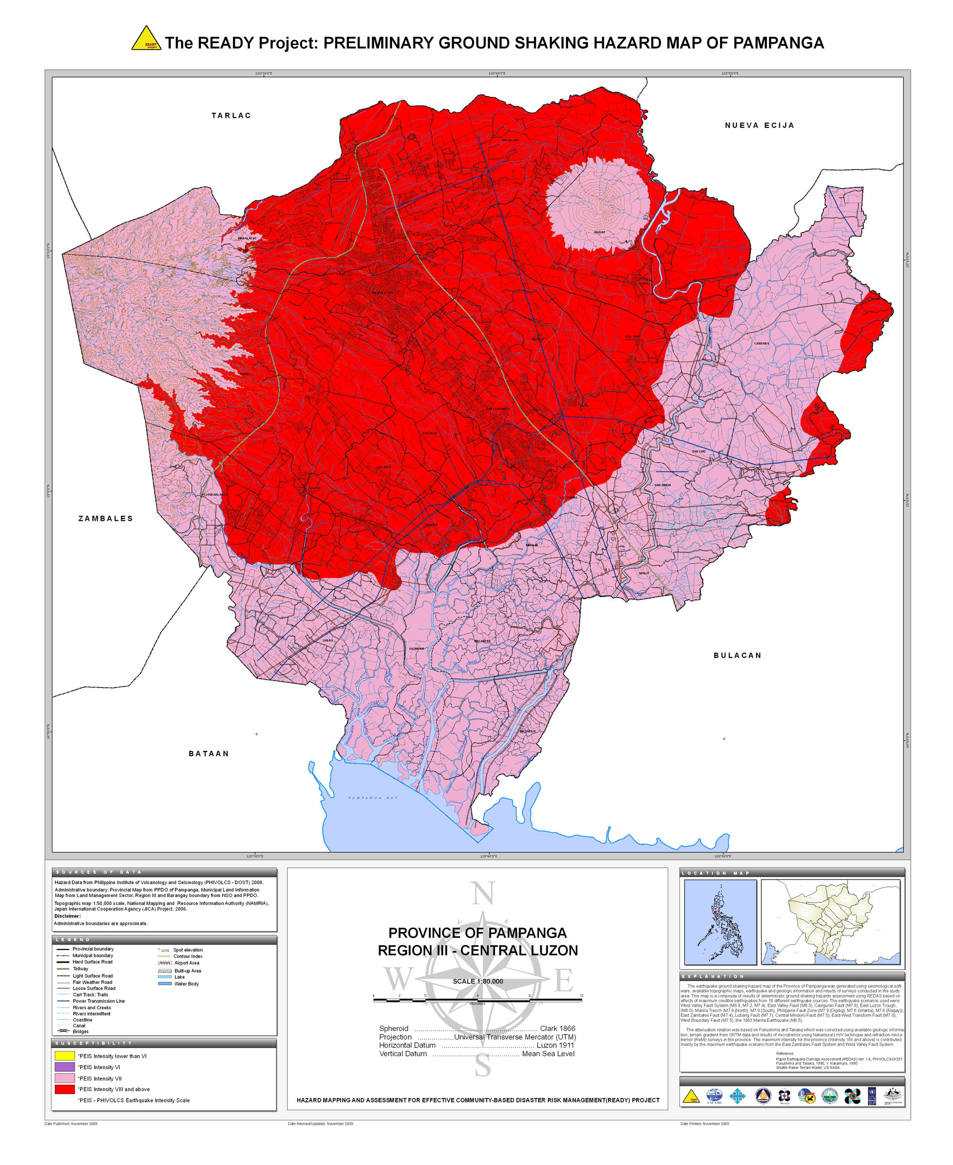
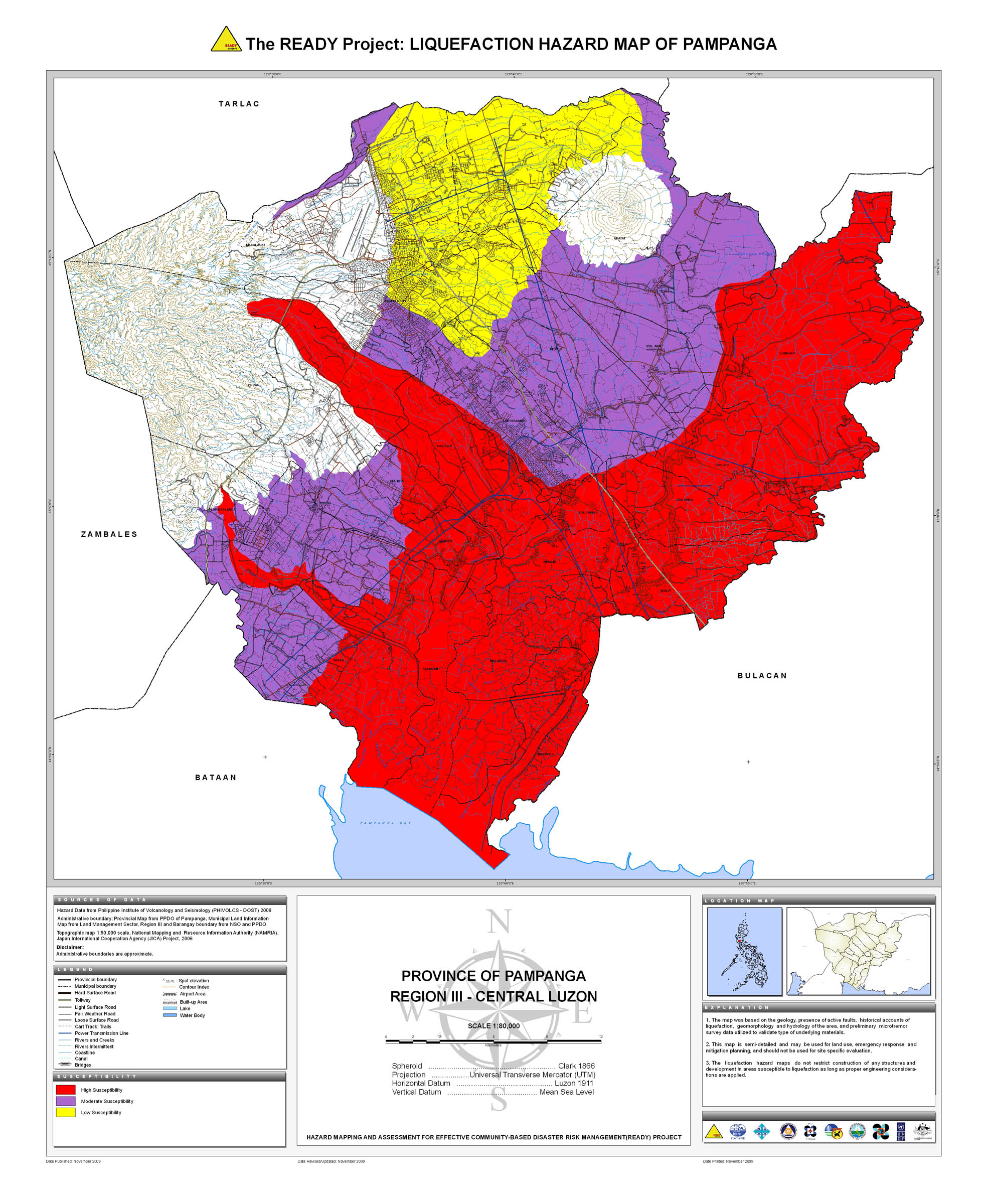
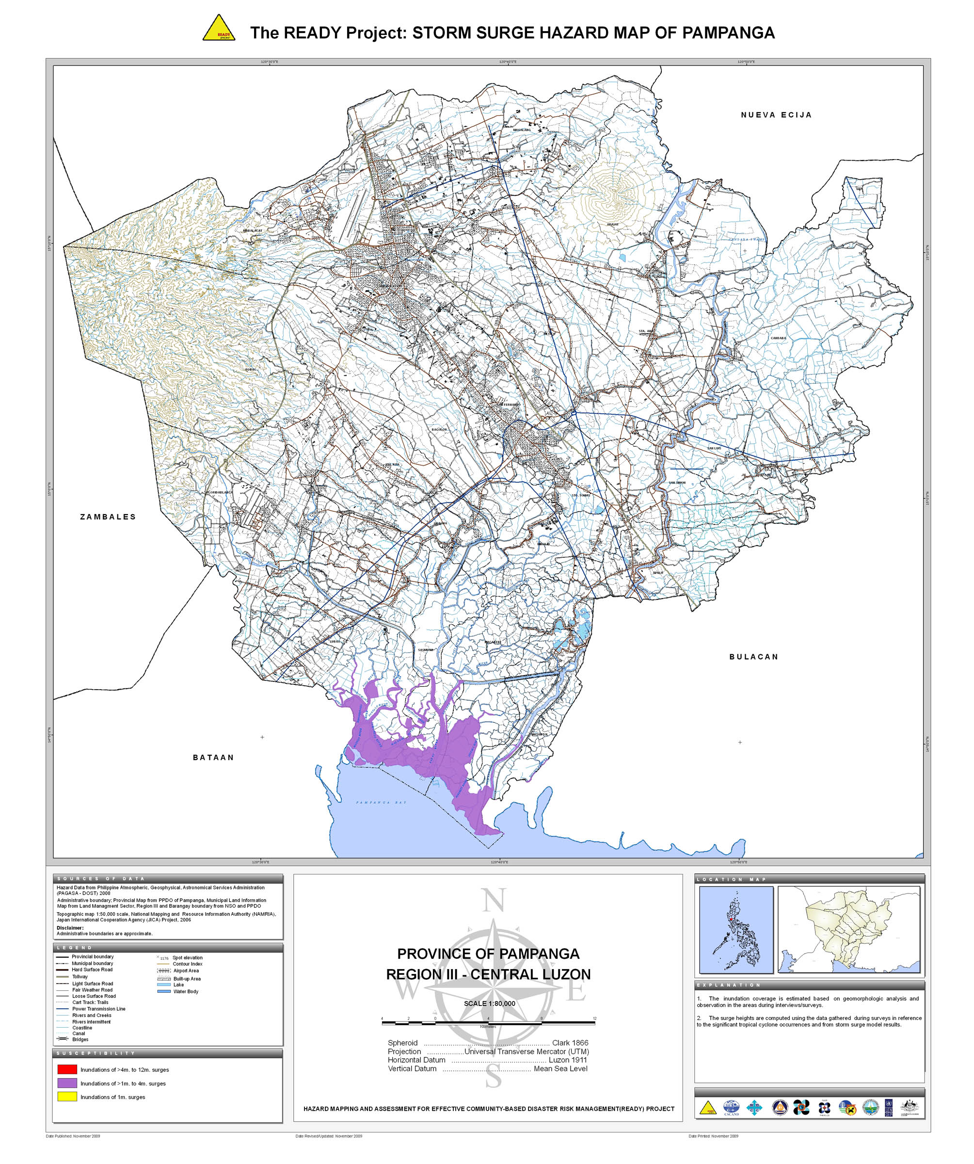
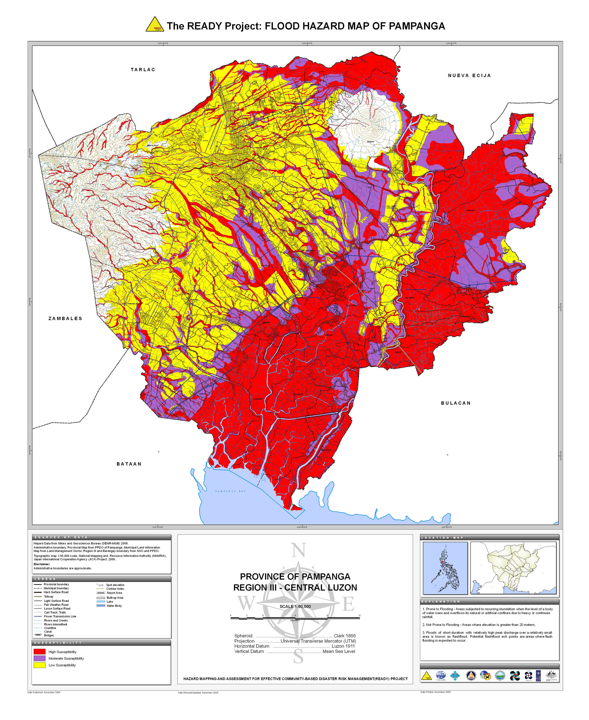
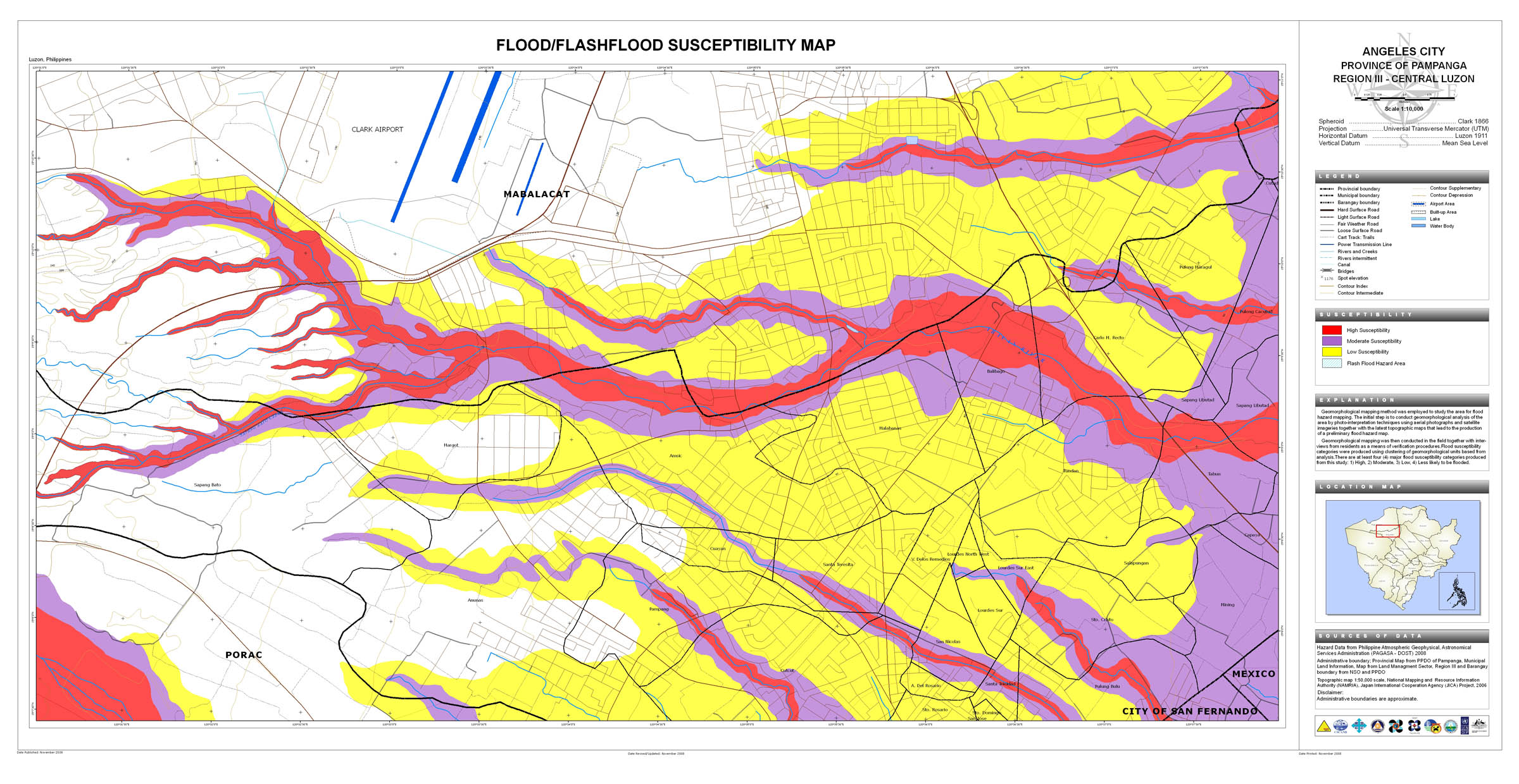
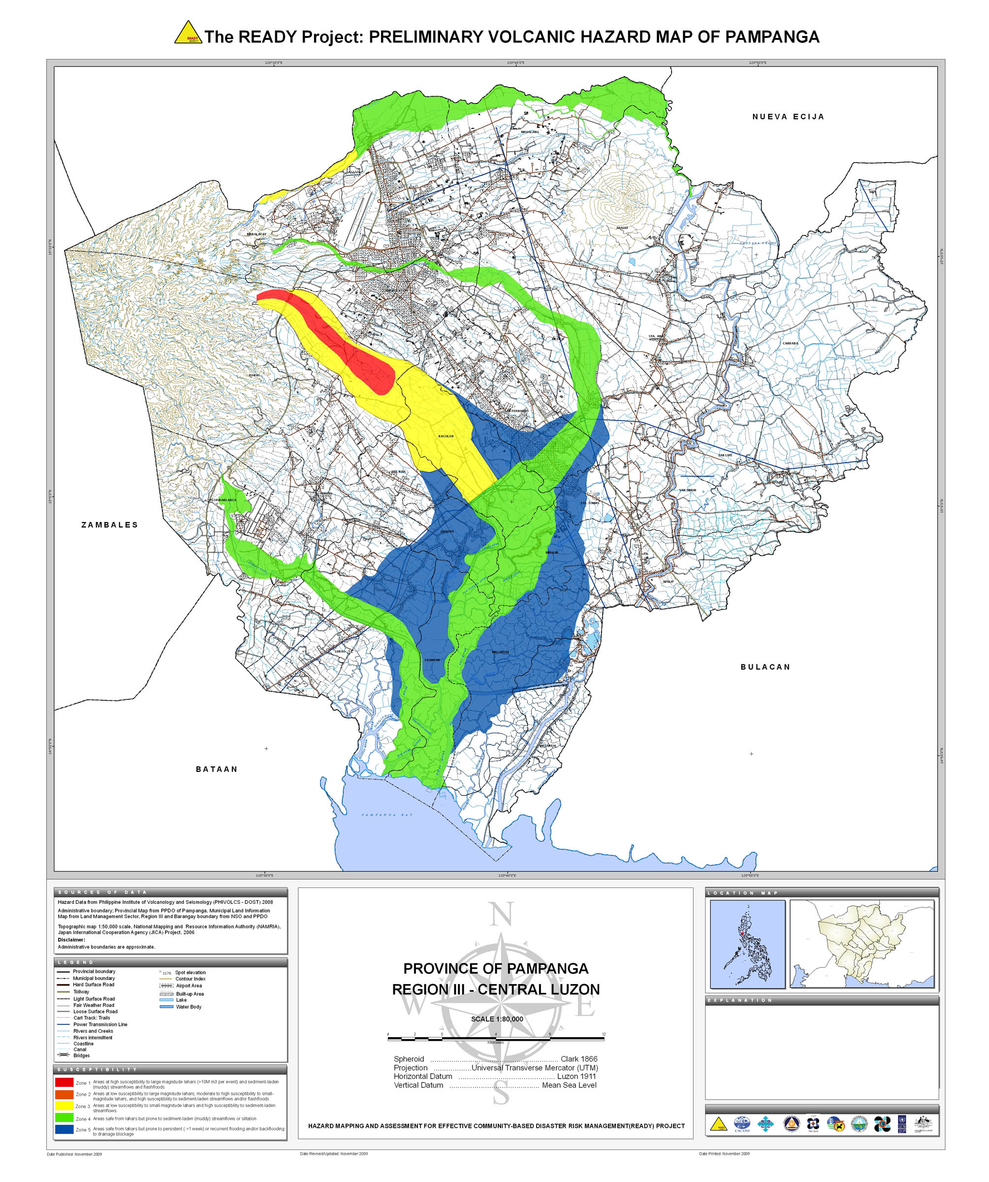
20. Pampanga |
 |
 |
 |
 |
 |
 |
 |
 | ||
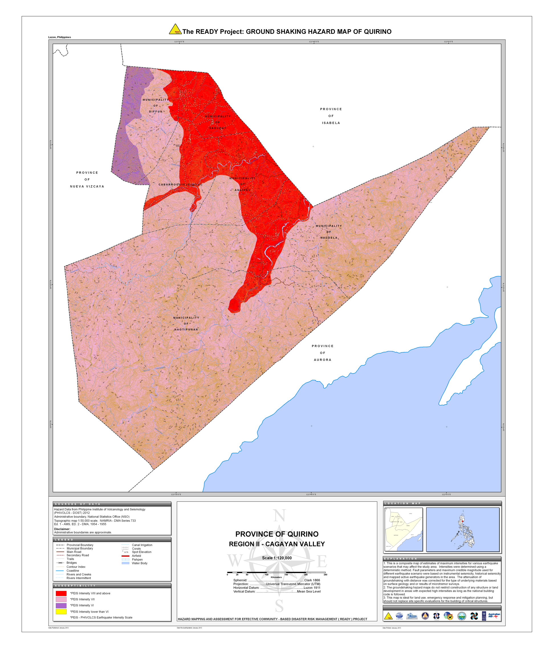
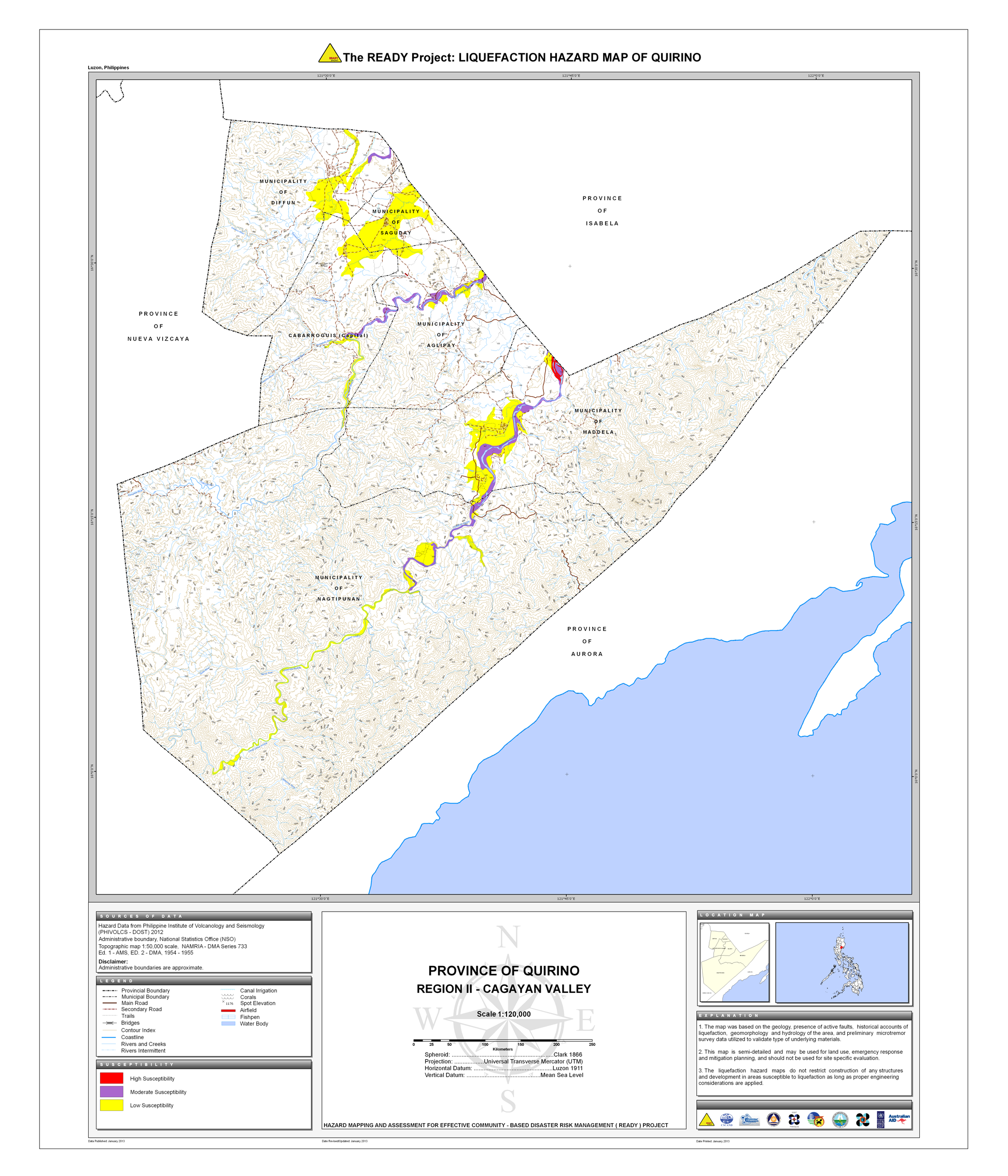
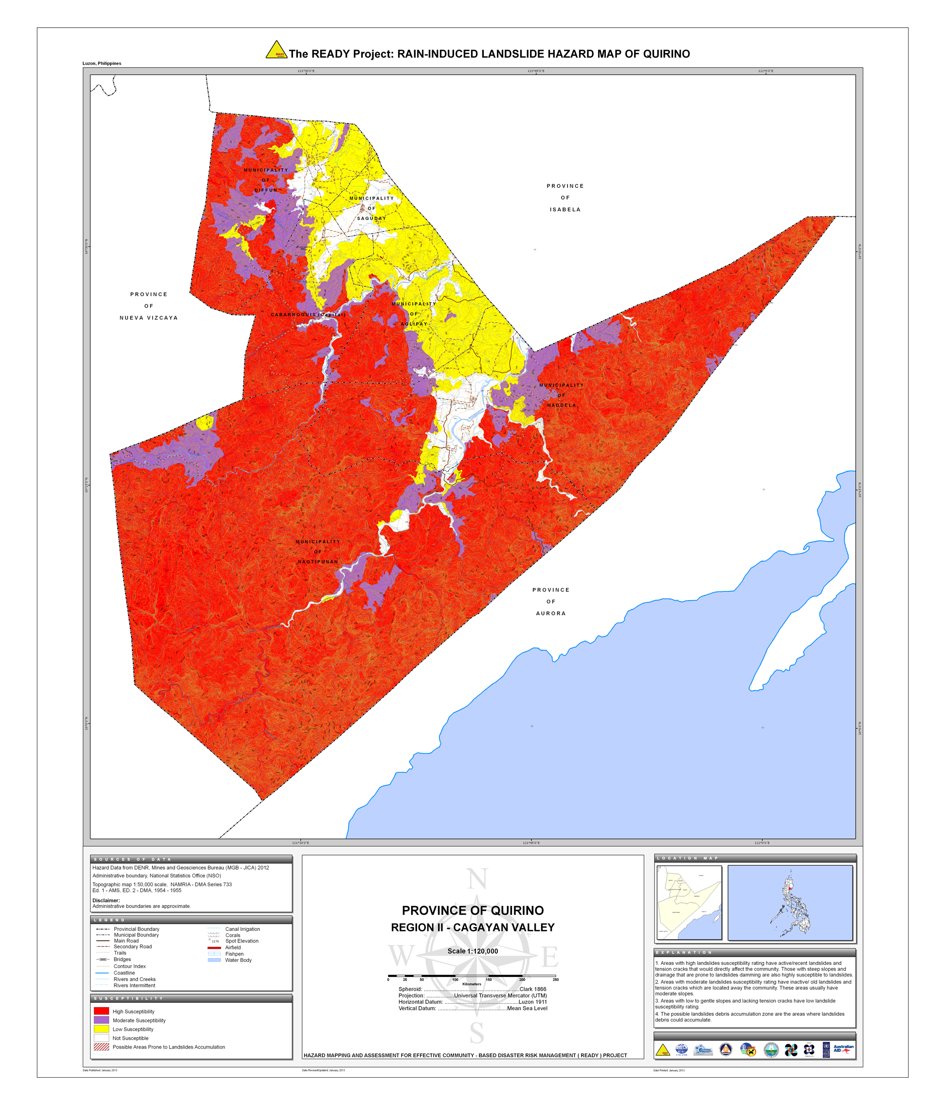
21. Quirino |
 |
 |
 |
 |
 |
|||||
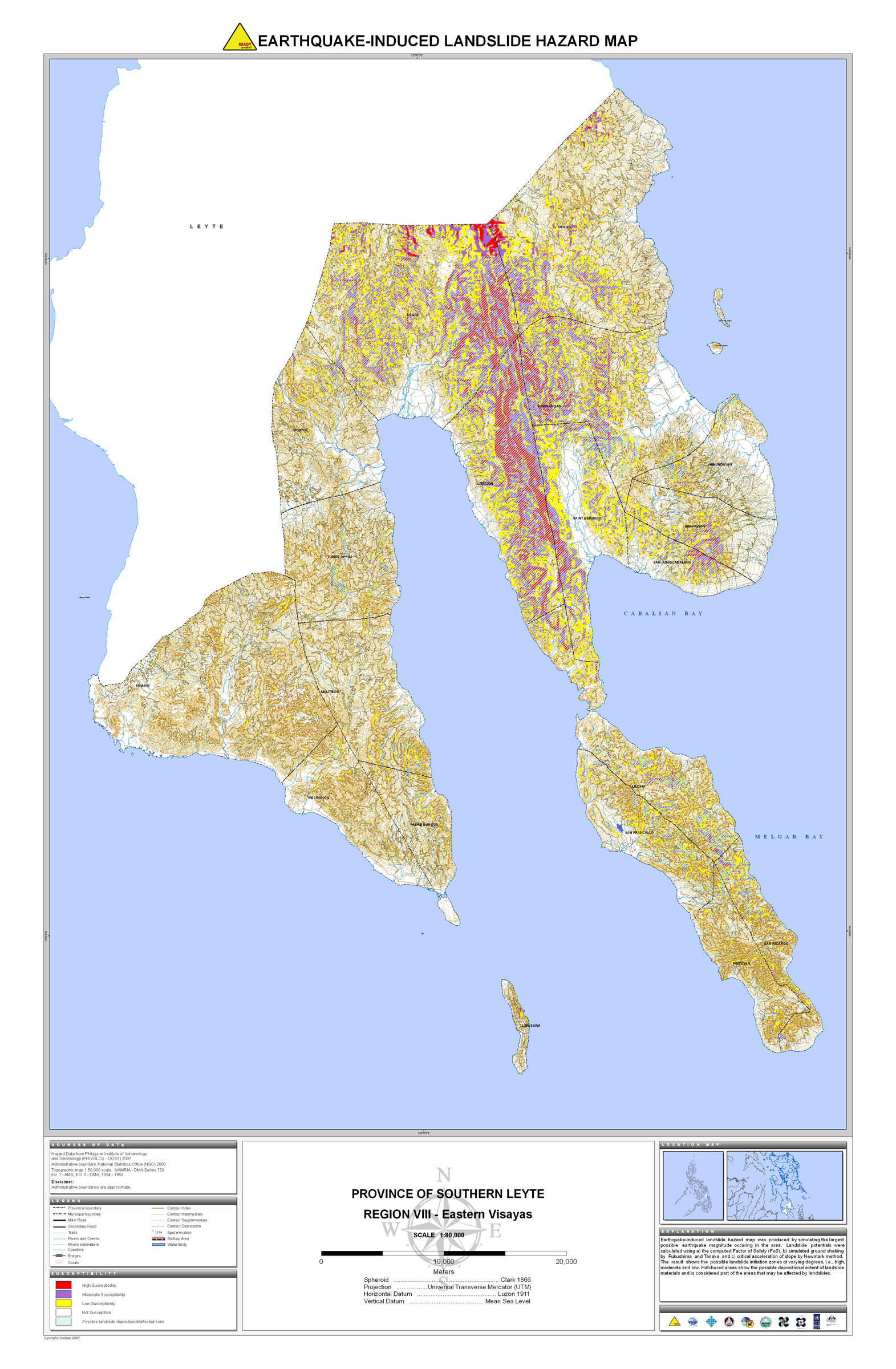
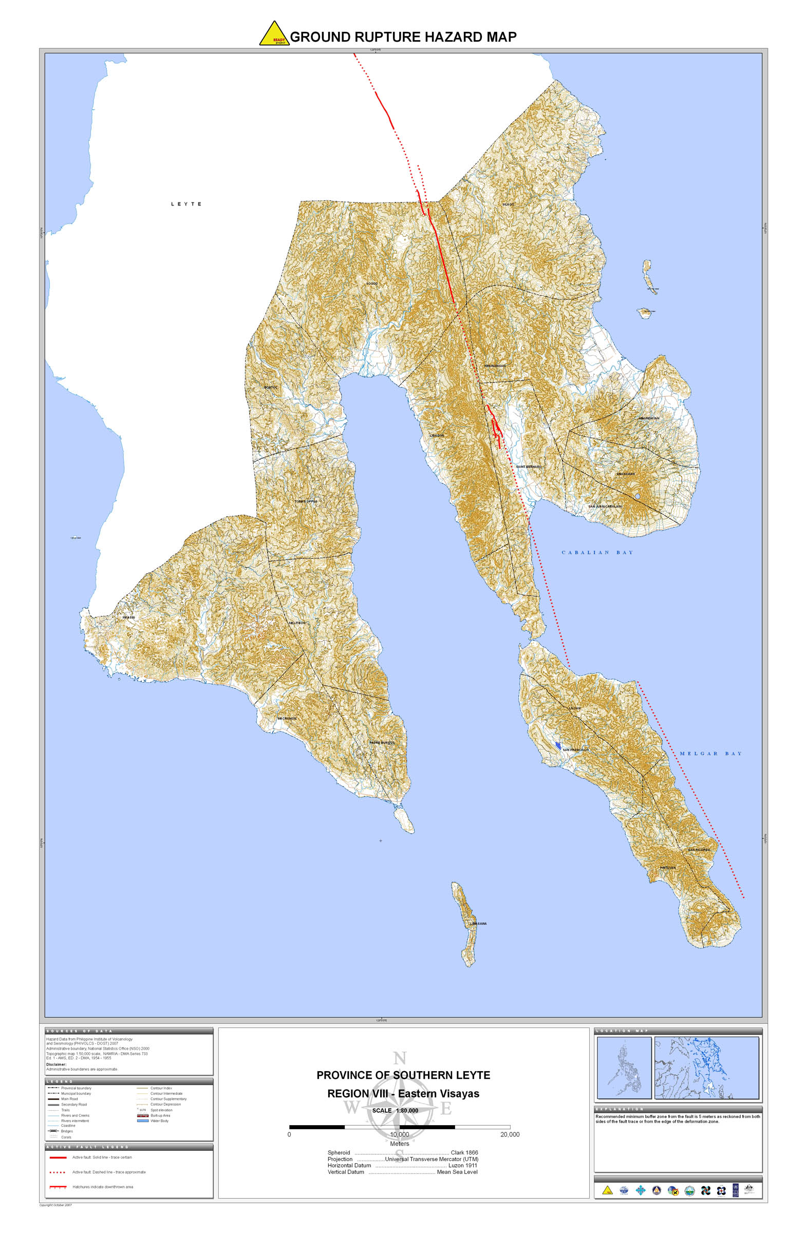
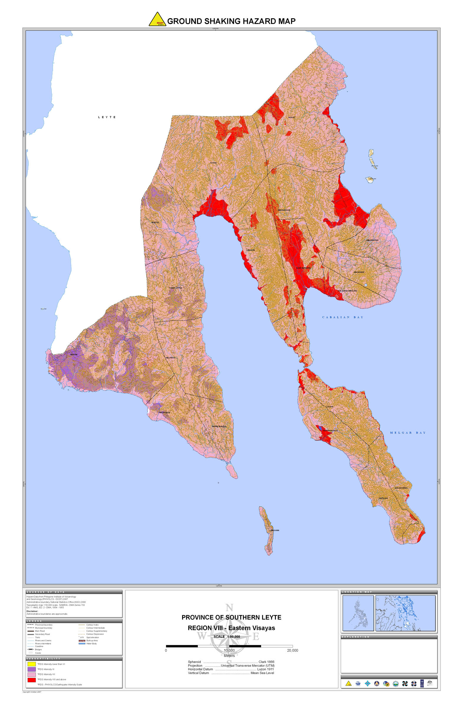
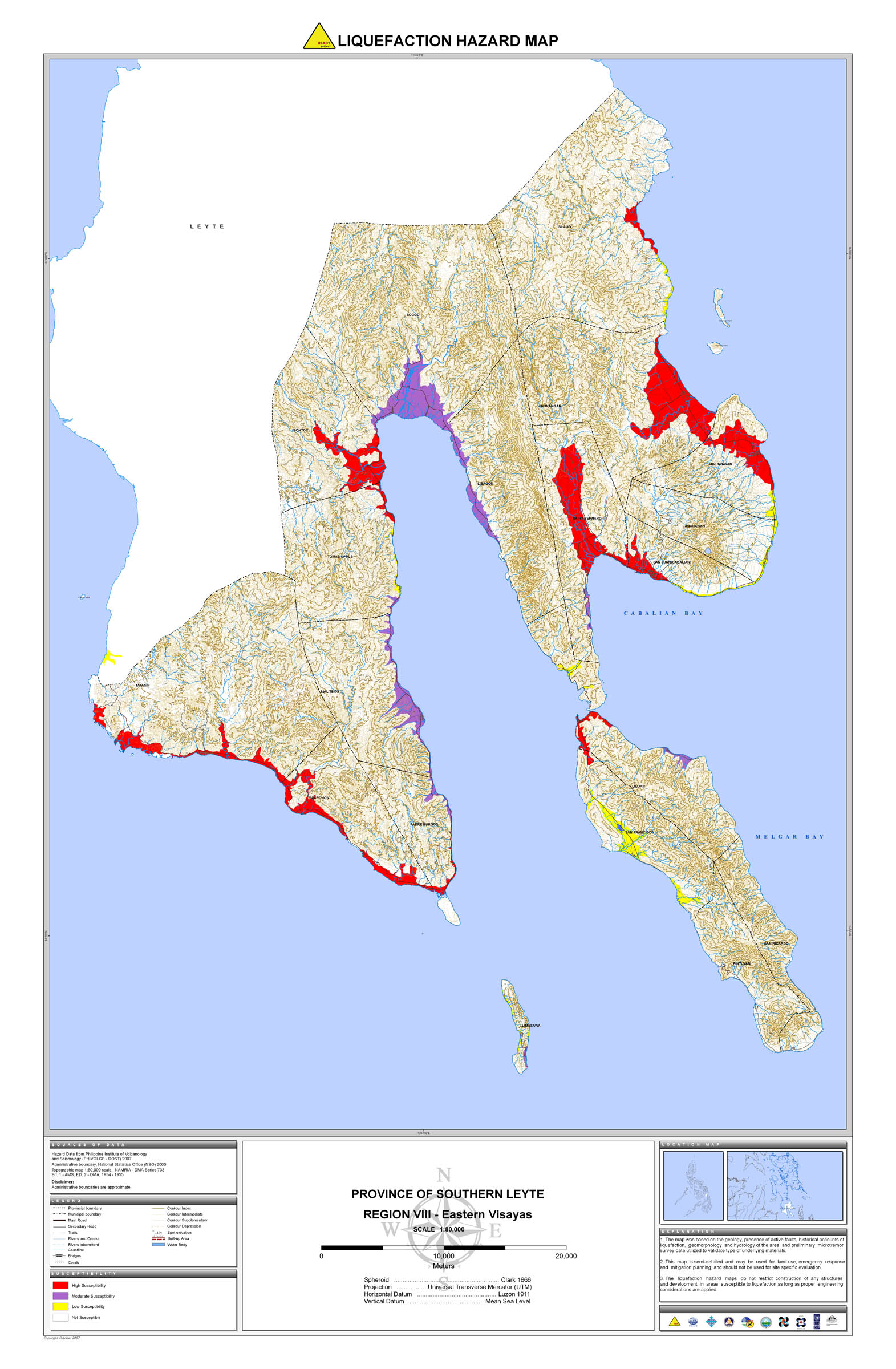
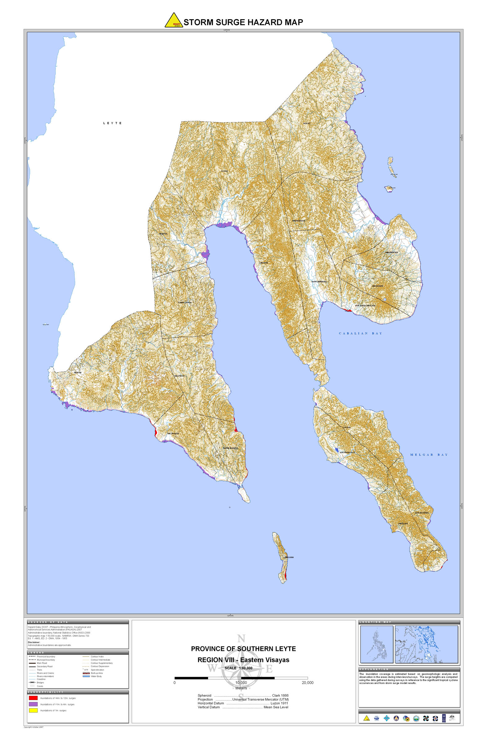
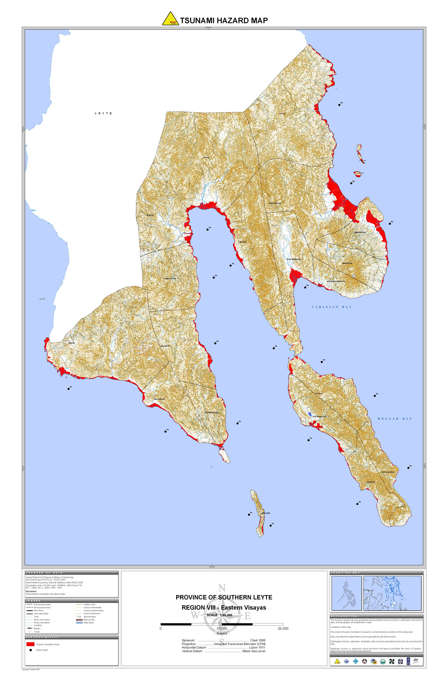
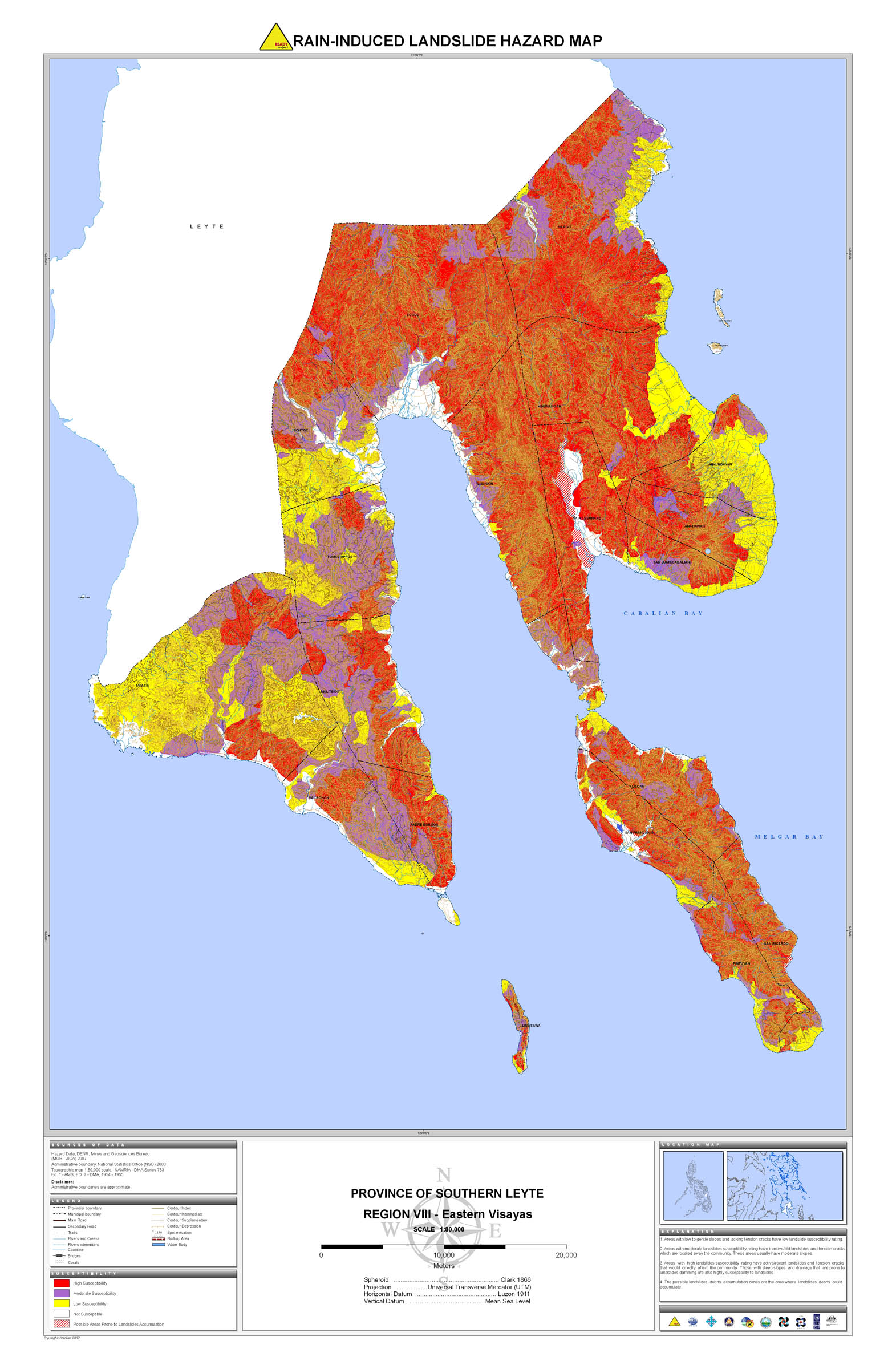
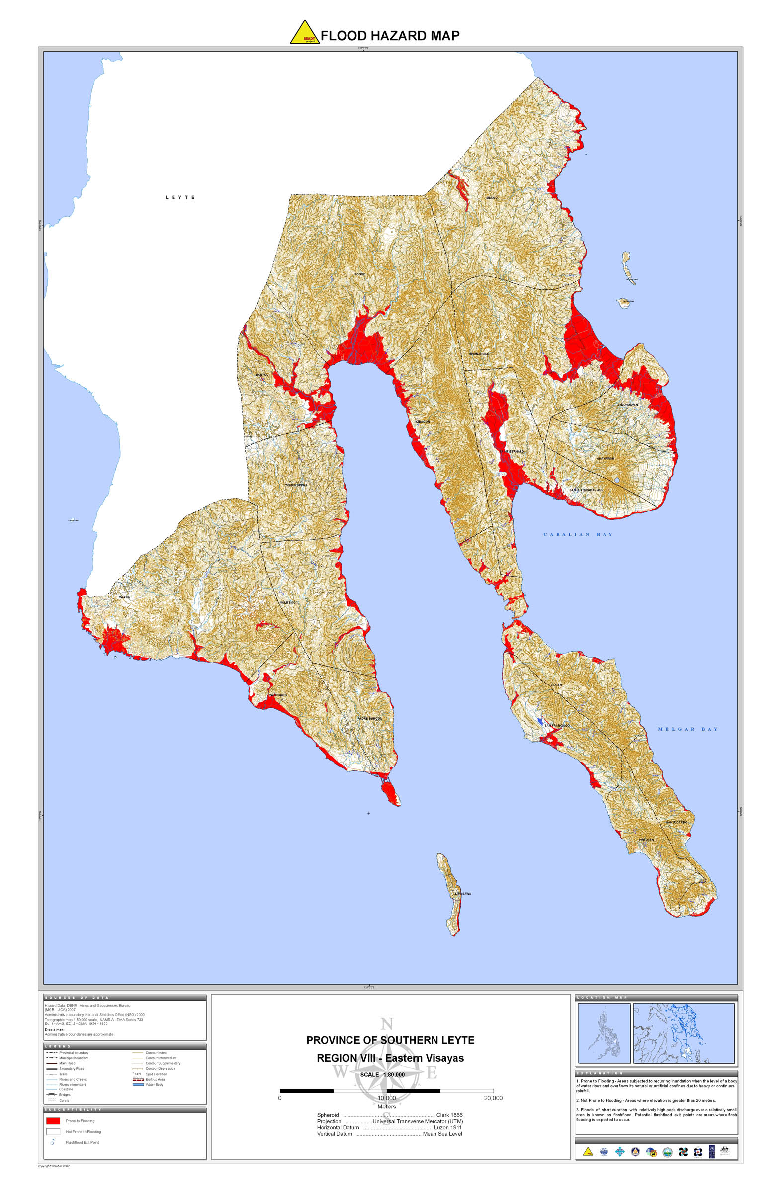
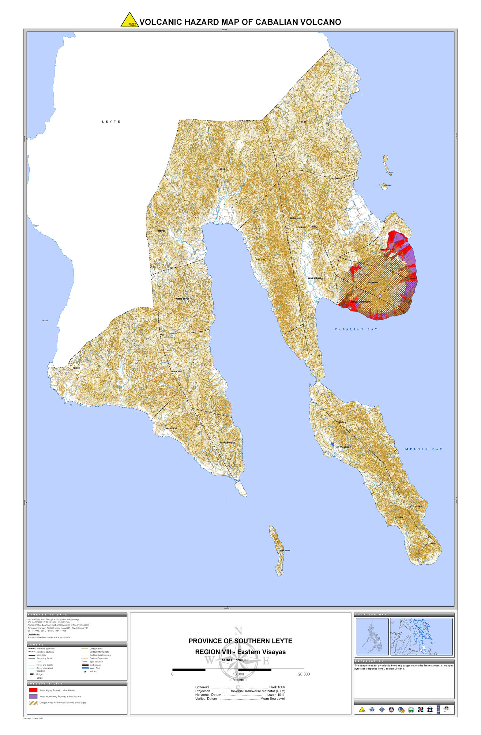
22. Southern Leyte |
 |
 |
 |
 |
 |
 |
 |
 |
 | |
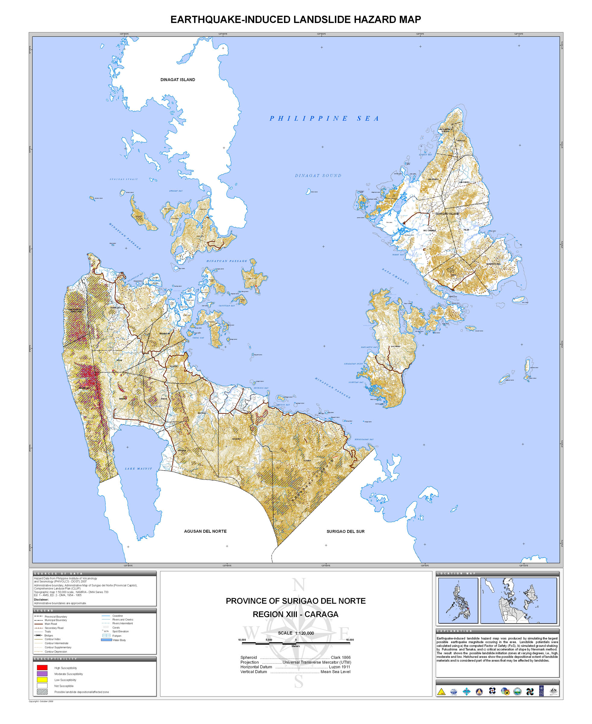
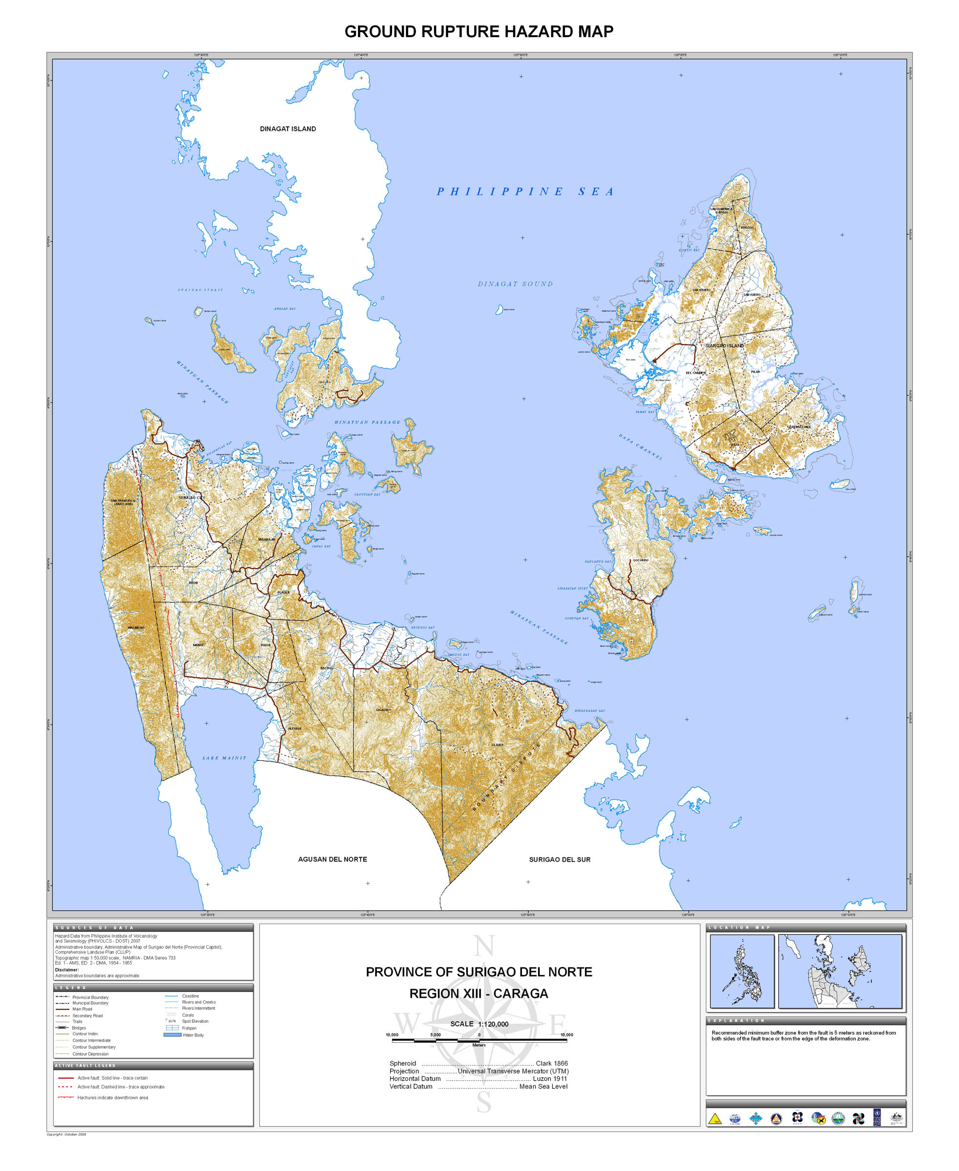
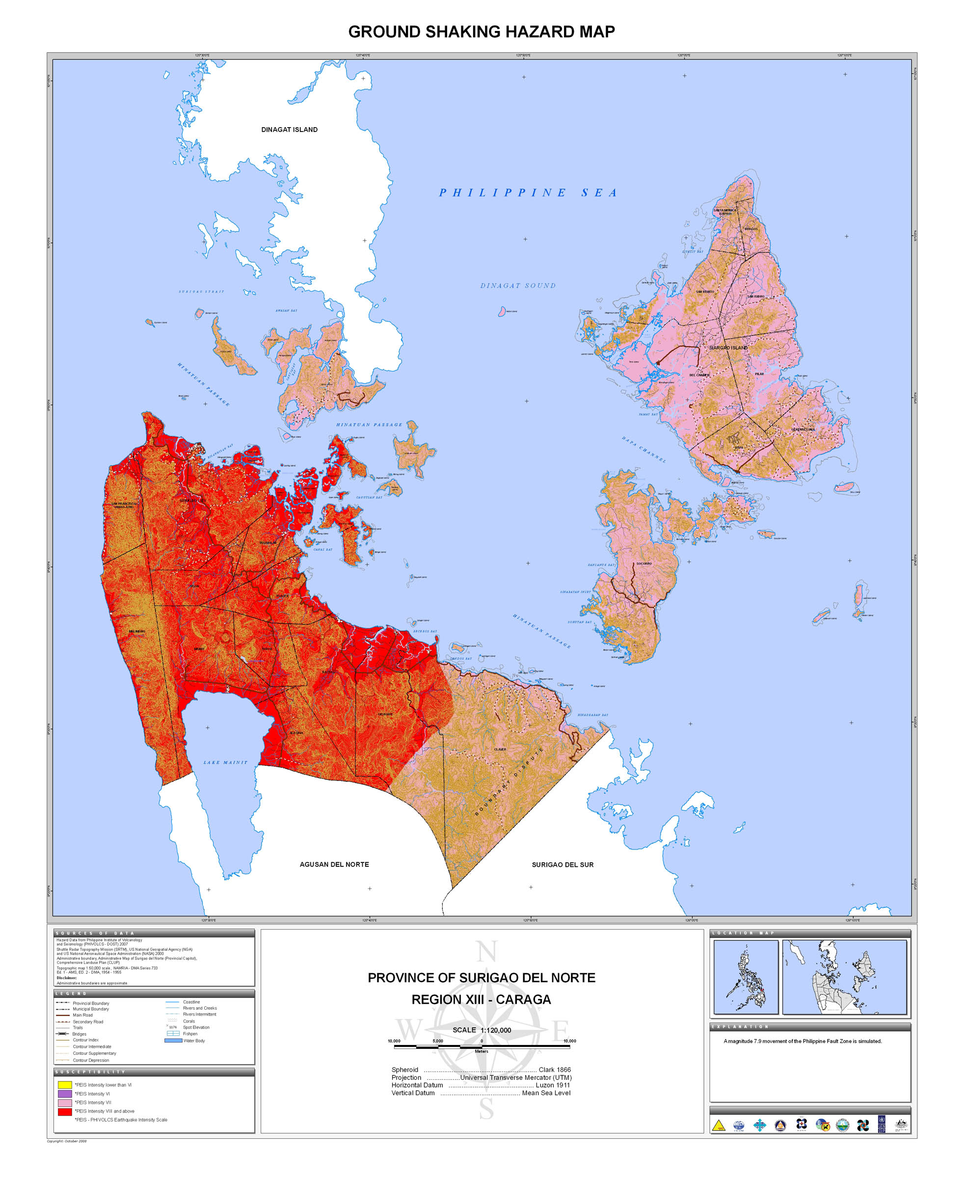
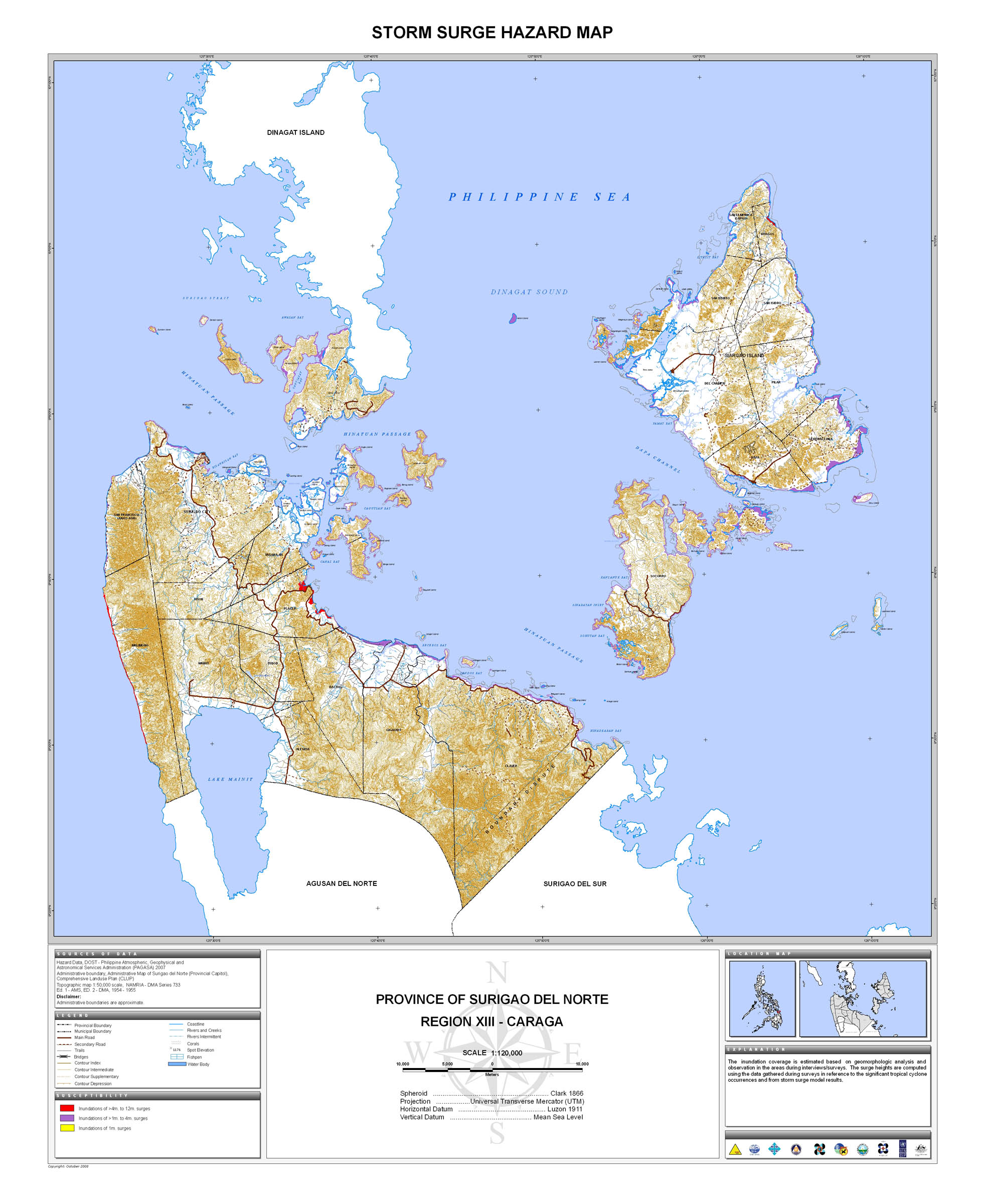
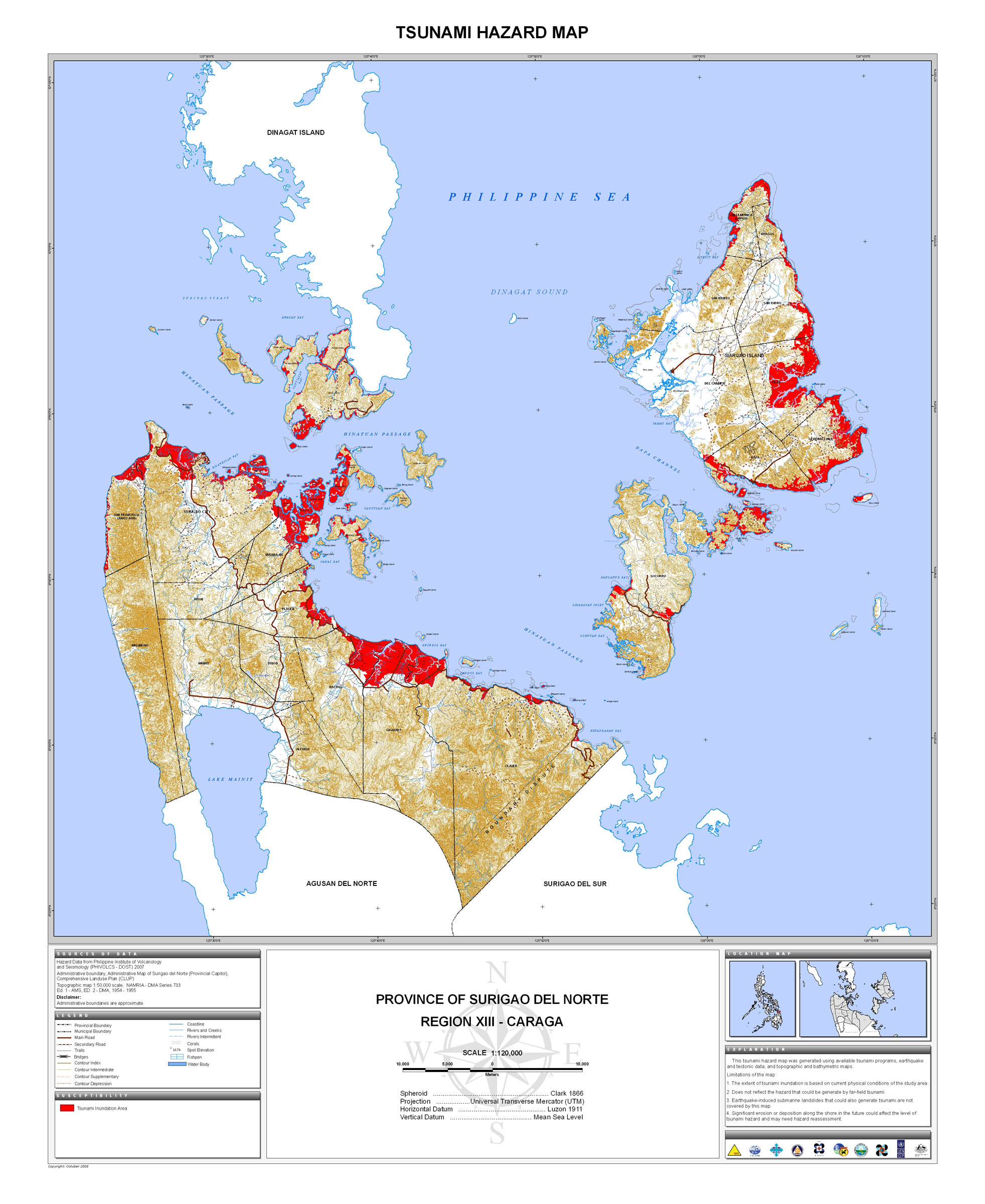
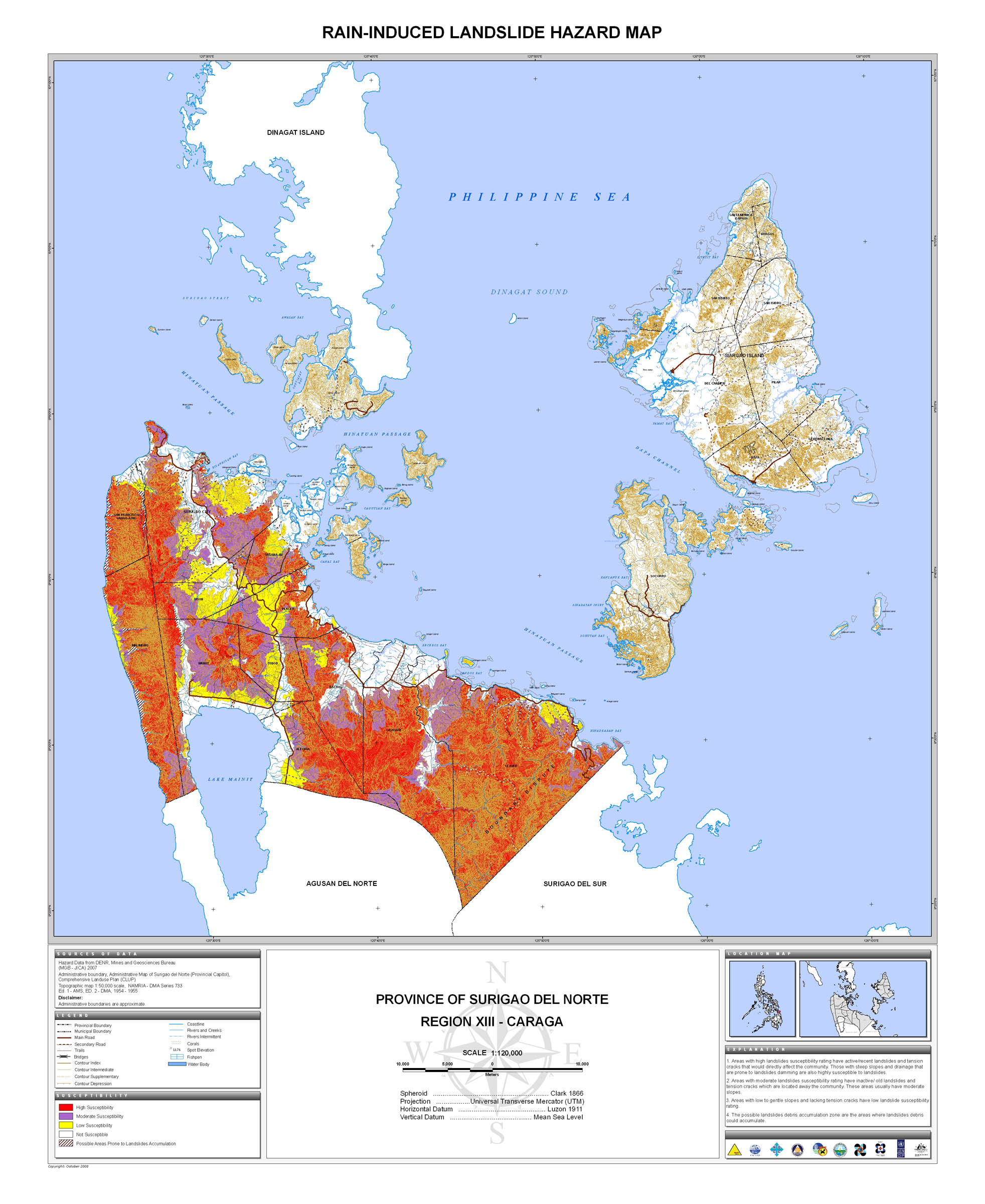
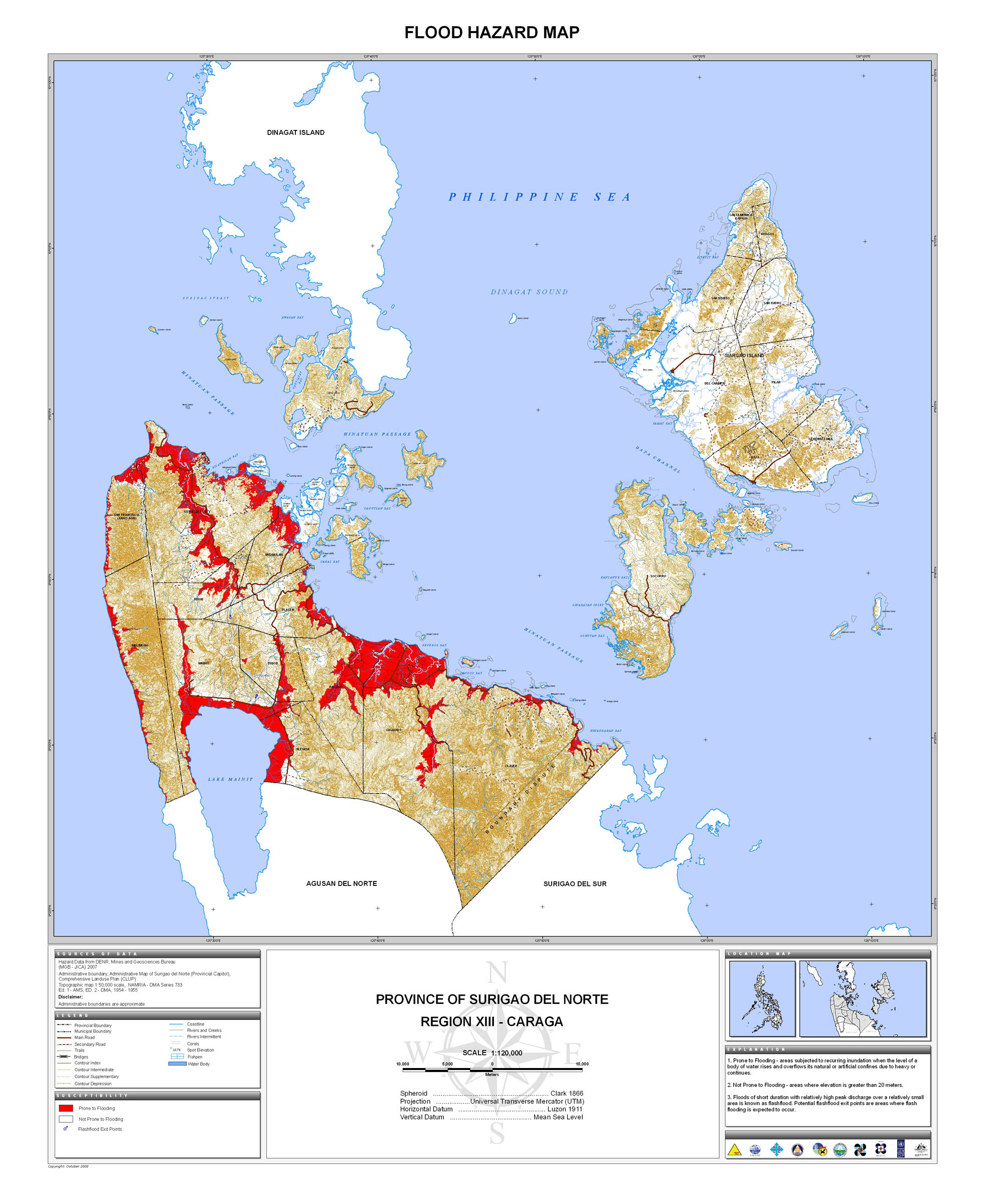
23. Surigao del Norte |
 |
 |
 |
 |
 |
 |
 |
 |
* |
|
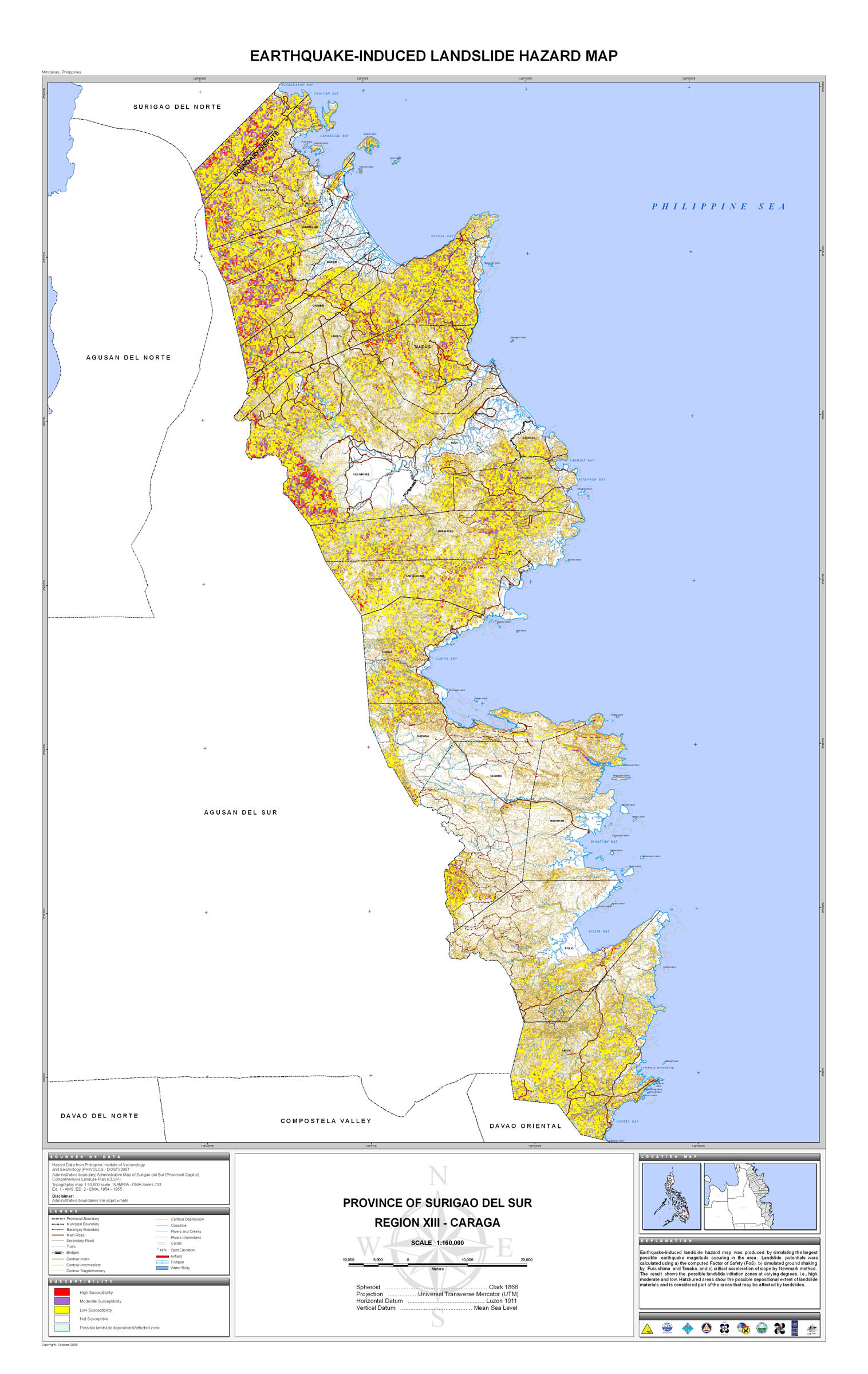
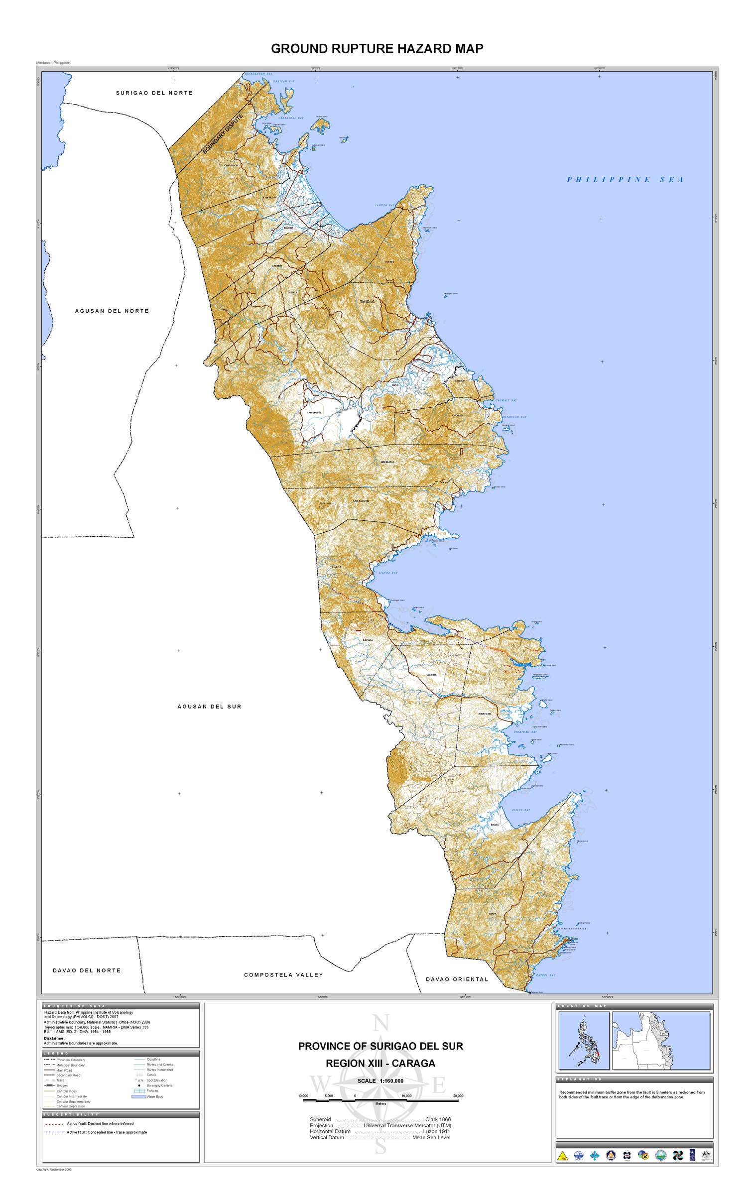
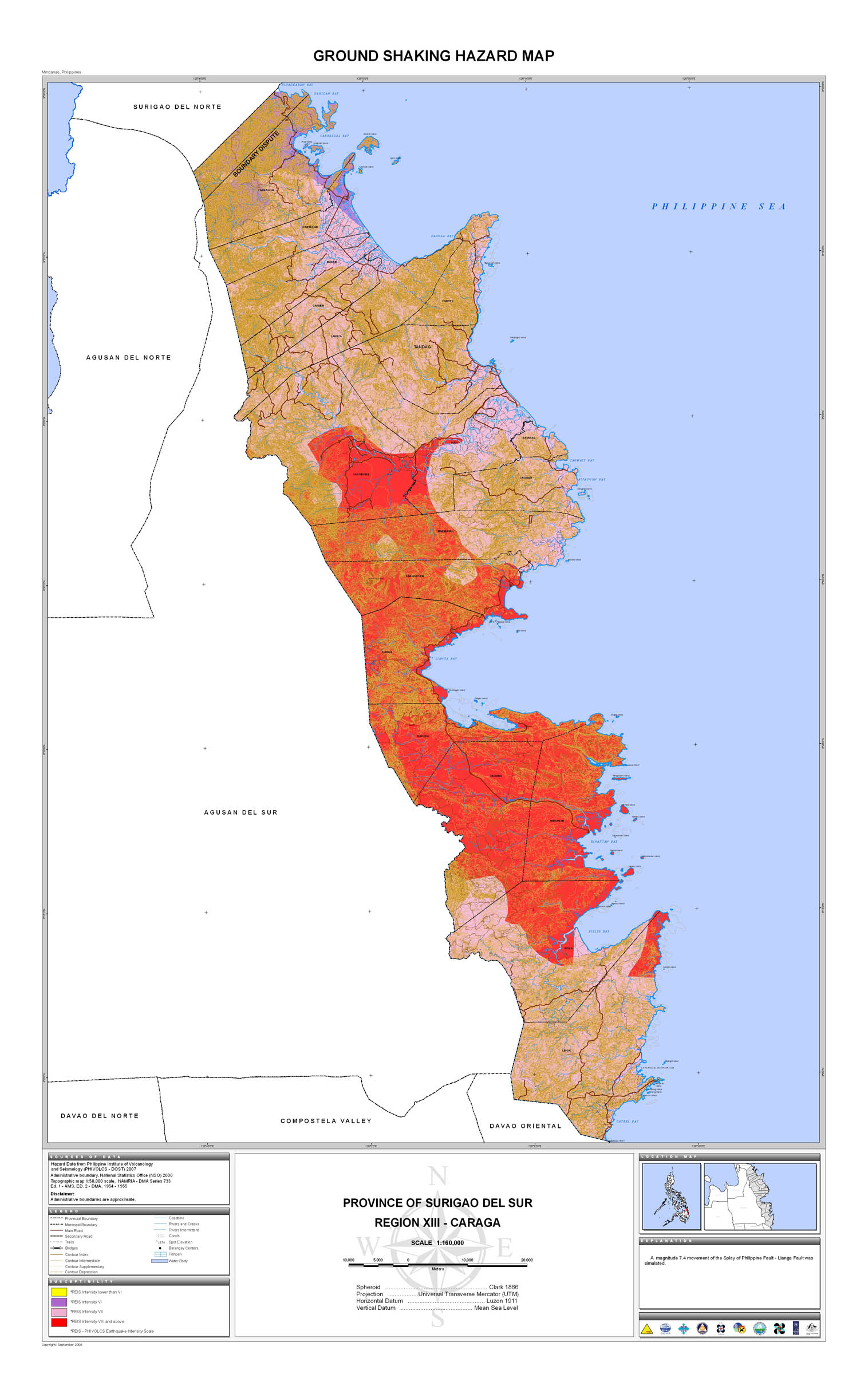
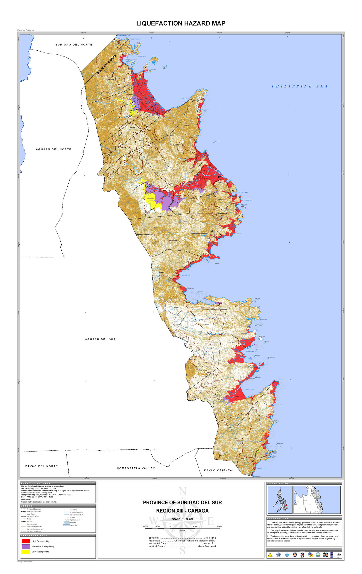
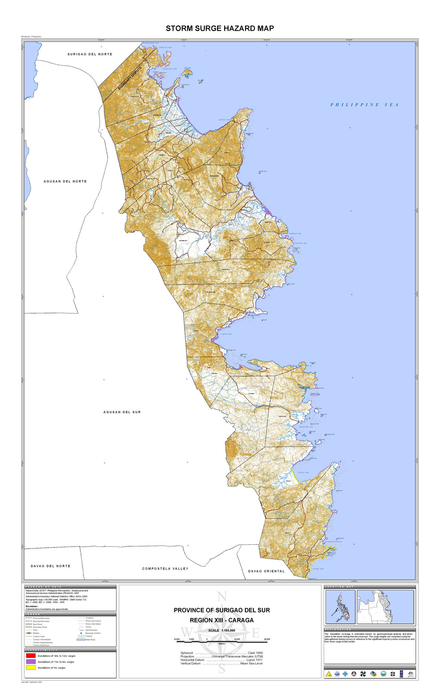
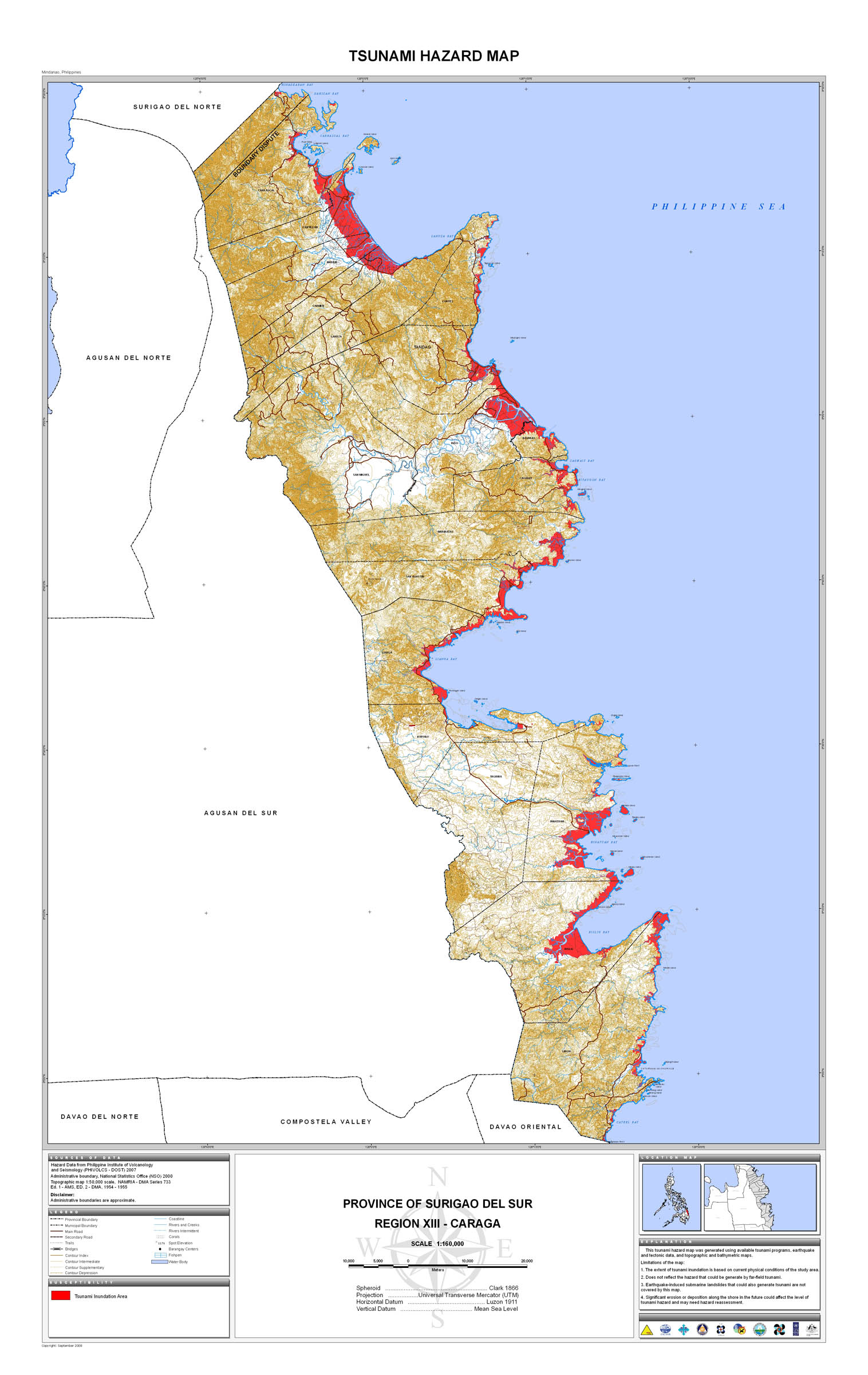
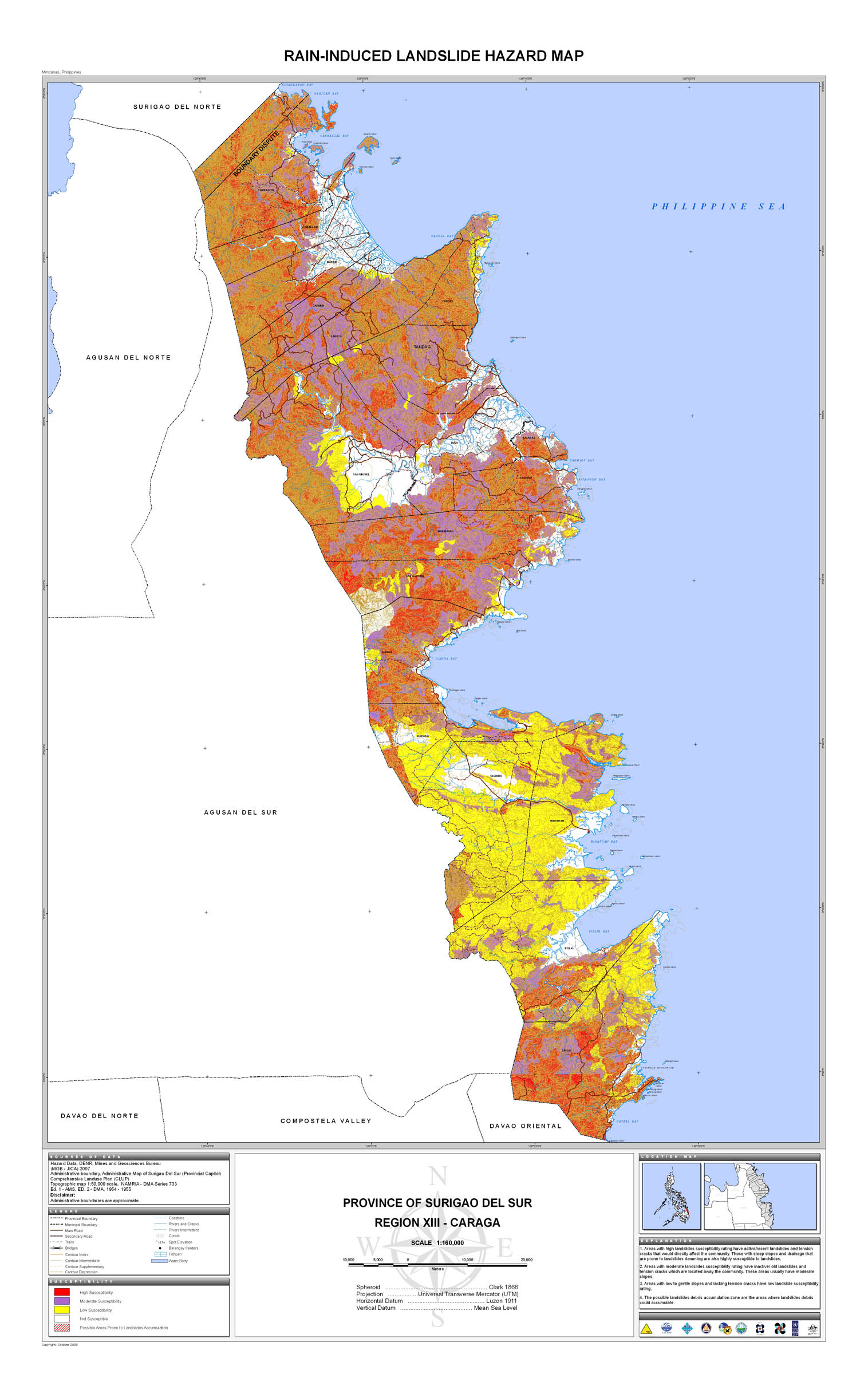
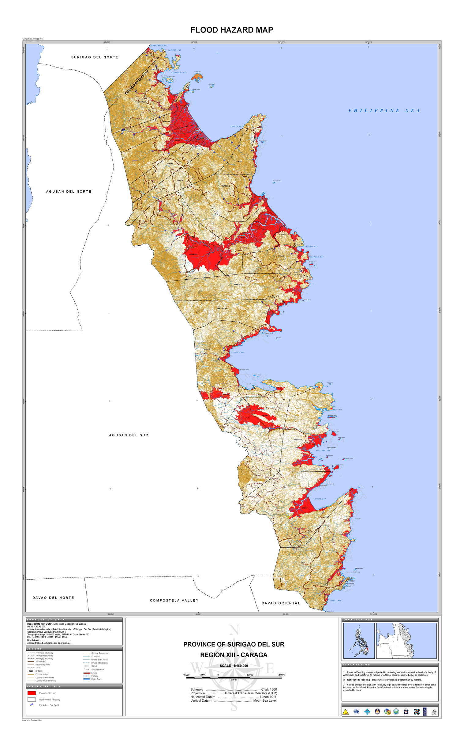
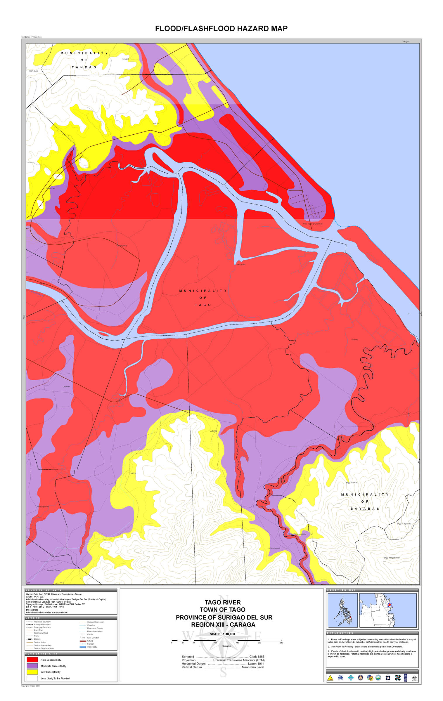
24. Surigao del Sur |
 |
 |
 |
 |
 |
 |
 |
 |
 |
|
25. Zambales |
 |
 |
 |
 |
 |
 |
 |
 |
 |
 |
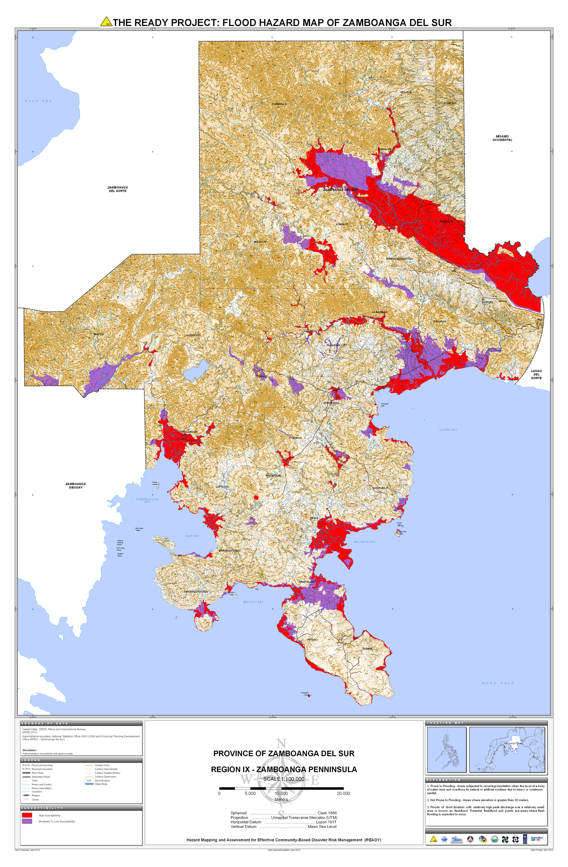
26. Zamboanga Sur |
 |
 |
||||||||
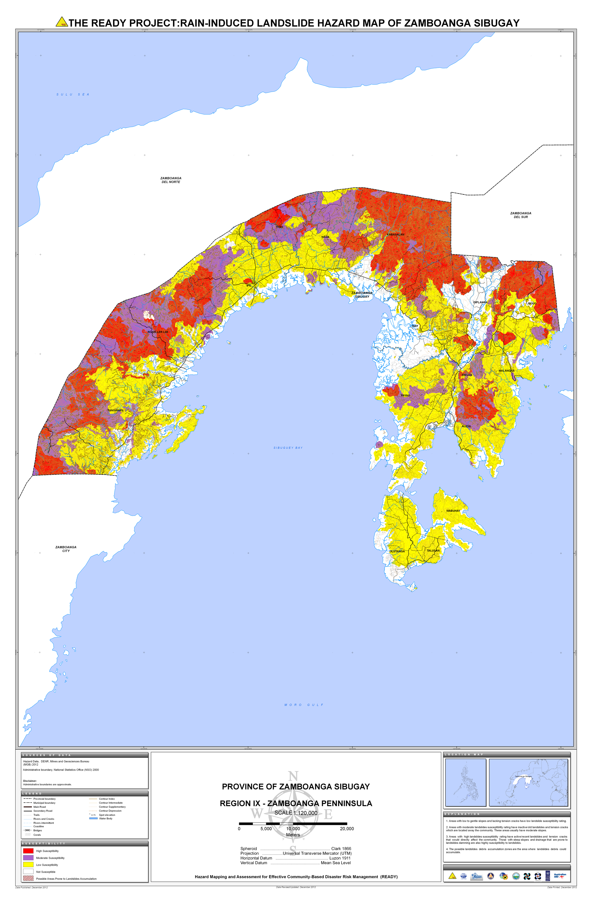
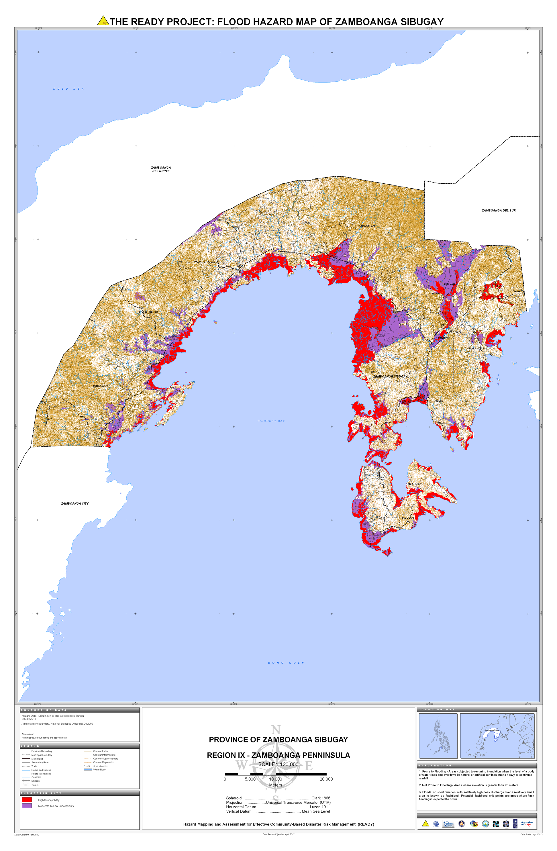
27. Zamboanga Sibugay |
 |
 |
Follow us on


 |
|
Do you produce road maps? NAMRIA produces topographic maps that are used as base maps for other thematic maps like land cover, land condition, land classification, cadastral, etc. In addition, we have digital data of road maps available. This data comes from the Department of Public Works and Highways (DPWH). more FAQs
-------------------- 
 |
|
Contact Us
|
|
|
NAMRIA Main Office Lawton Ave., Fort Andres Bonifacio 1634 Taguig City, Philippines Trunkline: (63-2) 8810-4831 to 34 Local 401,444 | Follow us on
|


 LOCATE
 DOWNLOAD
 LEARN
LEARN