Surveying and Mapping
Hydrographic Surveying. Surveys whose principal purpose is the determination of data relating to bodies of water. A hydrographic survey may consist of the
determination of one or several of the following classes of data: depth water; configuration and nature of the bottom; directions and force of currents; heights and times
of tides and water stages; and location of fixed objects for survey and navigation purposes.
Physical Oceanographic Surveying. Studies or examination of the physical characteristics of ocean water such as salinity, temperature, density, etc., and
dynamics such as tides, currents and waves.
Geodetic Surveying. Surveys being conducted primarily to establish, densify and maintain the Philippine Geodetic Control (horizontal and vertical network).
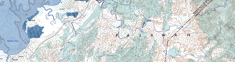
Topographic Mapping. Determination of the horizontal and vertical positions of natural and man-made features of the earth's surface to be presented on
a topographic map. Photogrammetric surveys include the use of aerial photographs.
Land Classification Surveying. These involve the classification of the country's unclassified public forests into alienable or disposable lands, as well
as the evaluation of existing land classification projects and the verification of land classification status.
GIS Development
NAMRIA is a technical agency whose personnel are highly trained not only in surveying and mapping but also in information management. This agency offers
services to both private and government agencies in the development of geographic information systems.
Some of the GIS projects developed by NAMRIA are: Philippine Geoportal System, School Profiling for DepEd, Historical and heritage sites for NHI, Tourism sites and establishments
for DOT-Reg 3, Forestry Statistics for FMB, among others.
Geomatics Training
The NAMRIA Geomatics Training Center or GTC is an accredited training center by the Civil Service Commission (CSC). It offers training courses related to Geographic Information
System (GIS), Remote Sensing (RS), Global Positioning System (GPS), and other surveying, mapping and allied technologies employed by NAMRIA for executives, middle managers
and technical staffs.
The GTC is located at the third floor of the NAMRIA main office building in Taguig City. It has well-equip training facilities and well-trained and experienced GIS
resource persons. It can train up to 25 persons at the same time and can host seminars and training outside NAMRIA.
For further inquiries and confirmation of training schedule you may call the GTC at (63-2) 8887-5466.
The GTC can also accomodate off-site training.
View Training schedule
GTC Training Calendar.
View Training schedule and fill out the NGTC pre-registration form.
Click here
View Geomatics Training Center brochure.
Click here
Certifications
Certification of Nautical Distance. Involves the issuance of certificate of approximate distance in nautical miles, measured along the navigational route
between two specified points according to the scaling made on nautical charts published by NAMRIA.
P 180.00 for the first 25 NM + P 25.00 for the succeeding 5 NM or a fraction thereof.
Certificate for Exploration
Permit Application- P 2,500.00 each
Certificate of Municipal Water Technical Description
P 5,000.00 + P 50.00 per km. of coastline.
Certification of geodetic station data, per station - P 360.00
Geodetic station data for research - Free
For inquiries, information, or certification
please call (+63-2) 8884-2840 or e-mail us (geodesy@namria.gov.ph).
Certification of GPS receivers, per receiver - P1,800.00
Certification of tidal benchmarks - P 360.00
Data Processing
Evaluation of GPS survey data per station - P 500.00
Raw magnetic observation data, per station: P 430.00
Processed magnetic observation data, per station: P 530.00
Processed tidal hourly heights, monthly, per station - P 300.00
Processed mean hourly tidal current velocity including current ellipse, per station - P 300.00
Processed times and heights of high and low waters including lunitidal interval heights, per station, per month - P 300.00
Monthly and annual mean sea level and other tidal datum planes - P 300.00
Tide reducers, per station, per month - P 300.00
Tidal extremes, per station, per year - P 360.00
note: Prices may change without prior notice.
Museum of Surveying and Mapping
The NAMRIA museum is the only museum that traces the history of Philippine surveying and mapping from 1900 to present. It exhibits the 20th Century collections of old survey
instruments and equipment used in surveying the Philippine archipelago. The instruments and equipment were used by the United States Coast and Geodetic Survey (USCGS)
and later by the Bureau of Coast and Geodetic Surveys (BCGS).
The museum showcases three features. First, the
Timeline narrates the history of surveying and mapping in the Philippines, including piece of the country's
geodetic datum origin. Second, the
Equipment Collection that features old surveying and mapping equipment, the centerpieces of which are the tide-predicting
machine and multiplex projector optical system. And third, the
Map Gallery displays maps of various kinds-from early Spanish maps of the Philippines to the
first NAMRIA-produced analog and digital topographic maps, nautical charts, orthophoto maps, and land classification maps.
The museum is open Mondays to Fridays from 9:00 a.m. to 4:00 p.m., except on public holidays.
Admission is free.
For inquiries, information, or booking, please call (+63-2) 8810-4831 local 401 or
e-mail us.
Library and Documentation Services
The NAMRIA Library and Documentation Services (LDS) is a special library that supports information needs of NAMRIA employees and clients.
It consists of a comprehensive collection of published and unpublished materials on mapping, surveying, geodesy, remote sensing, hydrography,
oceanography, environment and natural resources (ENR) and other related subjects.
The LDS is also responsible for acquiring, organizing, maintaining, and disseminating information materials relevant to the Agency's mandate,
programs, projects and activities. Its holdings comprise of topographic maps, nautical charts, books, microfiches, posters, serials, slides,
and other media on ENR and mapping. Special collections of rare books on mapping and surveying, Gender and Development (GAD), Human Resource
and Organizational Development (HROD) are also available.
Operating Hours
The library is open Mondays to Fridays from 8:00 a.m. to 5:00 p.m., except on public holidays. Admission is free.