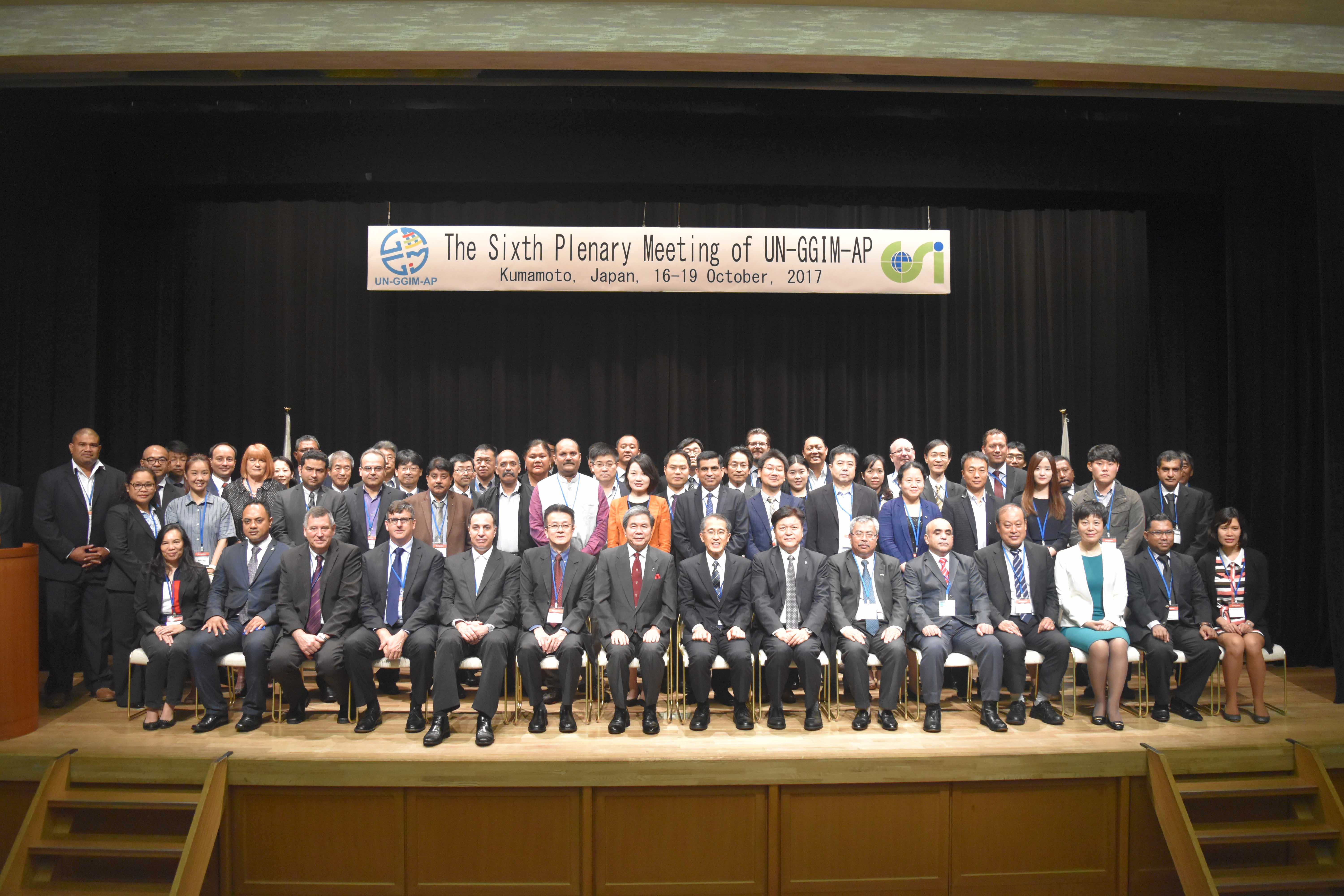
To foster dialogue and exchange among National Mapping Agencies (NMAs) within the Asia Pacific Region, NAMRIA has recently participated at the Sixth Plenary Meeting of the Regional Committee of the United Nations Global Geospatial Information Management for Asia and the Pacific (UN-GGIM-AP) held in Kumamoto Prefecture, Japan on 16-19 October 2017. The Plenary was organized by the UN-GGIM-AP, through the Geospatial Information Authority of Japan (GSI). The event convened government officials and technical experts from the Asia-Pacific Region to discuss trends and innovations on geospatial information and management.
NAMRIA representative Ms. Rosal Dolanas (2nd row, leftmost) at the Sixth Plenary Meeting of the UN-GGIM-AP in Kumamoto City, Japan
Being aware of the increasing impacts of natural disasters in the region, this year’s Plenary Meeting focused on the roles and contributions of NMAs in disaster risk management. Countries and other key stakeholders were encouraged to implement the Sendai Framework for Disaster Risk Reduction 2015-2030 to achieve resiliency at the local and national levels. At the regional level, the UN-GGIM-AP has established a Working Group on Disaster Risk Management (WG2) to explore the potential roles of NMAs in the applications and services of geospatial information, and to develop guidelines on the use of geospatial information for disasters work. The WG2 highlighted the Strategic Framework on Geospatial Information and Services for Disasters as a guiding policy document to attain its goals and objectives. The strategic framework, authored by NAMRIA as Co-chair of UN-GGIM’s Working Group on Disasters with Jamaica, was recently approved by the UN-GGIM Bureau in August 2017.
What were done in Kumamoto Prefecture, the official meeting venue, served as an example on the effective use of geospatial information during disaster occurrences. In April 2016, the prefecture suffered two consecutive earthquakes, causing 211 fatalities and damaging infrastructure and related services amounting to 3.7 trillion yen (1.7 billion pesos). To simulate best practices during the 2016 Kumamoto earthquake, a special session was arranged by GSI to introduce the roles of NMAs and geospatial information in disaster risk management. Aside from data management, NMAs can also invest on enabling infrastructures and build partnerships to better engage, and further improve their mandate as mapping agencies of their respective countries.
While banking on these strategies, NAMRIA has already embarked on a number of initiatives. The agency has been proactive in implementing RA 10121 (Philippine Disaster Risk Reduction and Management Act of 2010), particularly in information sharing and capacity building initiatives. NAMRIA has also been actively participating in the Information Management – Technical Working Group (IM-TWG) of the National Disaster Risk Reduction and Management Council (NDRRMC). The IM-TWG has been established “to serve as a venue for NDRRMC member agencies and key partners involved in DRRM to address disaster-related data and information availability, quality and accessibility, as well as system interoperability issues across the emergency cycle; and provide the guidelines in establishing, managing and sharing Common and Fundamental Operational Datasets.” (IM-TWG website, 2017)
The Plenary Meeting also covered other conventional agenda items which included the report on the major outcomes of the Seventh Session of the UN-GGIM held in August 2017, review of the considerations and subsequent decisions on the further modalities of UN-GGIM, summary of the various activities and progress of the Committee and its four Working Groups (WG1-Geodetic Reference Frame, WG2-Disaster Risk Management, WG3- Regional Spatial Data Infrastructure, WG4 – Cadastre and Land Management) during the past year, and the roles and contributions of the Regional Committee to the further development of UN-GGIM. A forum on geodetic data sharing jointly organized by UN-GGIM-AP WG1 and the International Federation of Surveyors (FIG) was also conducted to examine the regional challenges, benefits and opportunities of exchanging geodetic data.
NAMRIA was represented by Information Systems Analyst Rosal Dolanas from the Geospatial Information Systems Management Branch (GISMB).
Readers can email
newscoop@namria.gov.ph or fax letters to +63-2 8884-2855 for their comments and suggestions.
 SHOP
SHOP


 LOCATE
 DOWNLOAD
 LEARN
LEARN